


Cloud still cover the MS/AL/FL Gulf coasts, but we have nothing but clear skies to our west. As the upper low drifts farther to the NE, clearing skies will prevail all the way over to the beaches.


By far the worst weather today has been from the Mississippi River eastward. Clouds and showers, couple with temps in the 40s & 50s are making for a miserable Saturday.

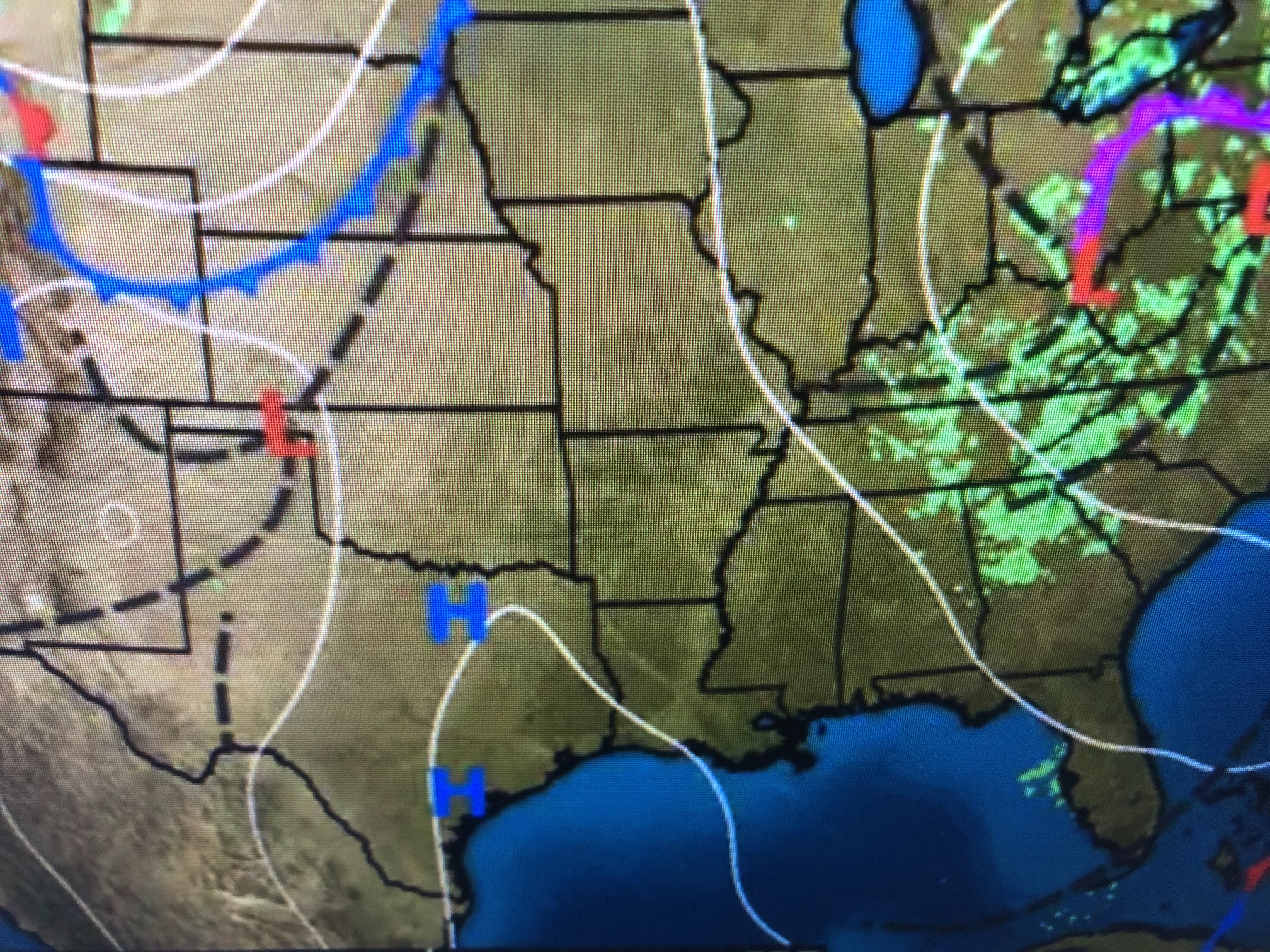


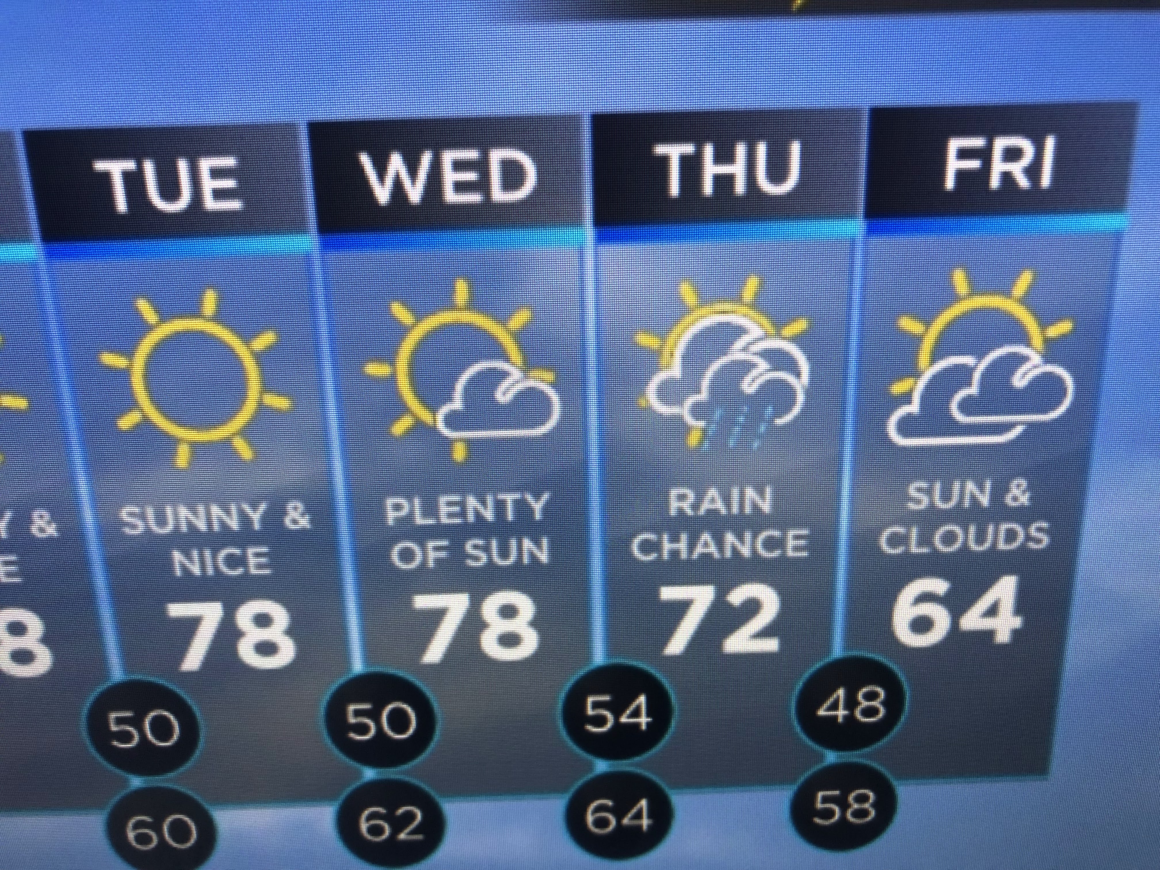
Note the warm up across Texas that will be coming our way. However, dew points remain in the 30s & 40s with no signs of return flow off the Gulf. Our next cold front arrives on Thursday bringing with it our next chance for rain.


No comments:
Post a Comment