


As the cooler air pushes farther down over the Gulf. water temperatures will slowly go down, but it takes several strong cold fronts to do that. Note, while the Gulf waters are generally in the lower 80s, Lake Pontchartrain and area lakes have cooled into the 70s


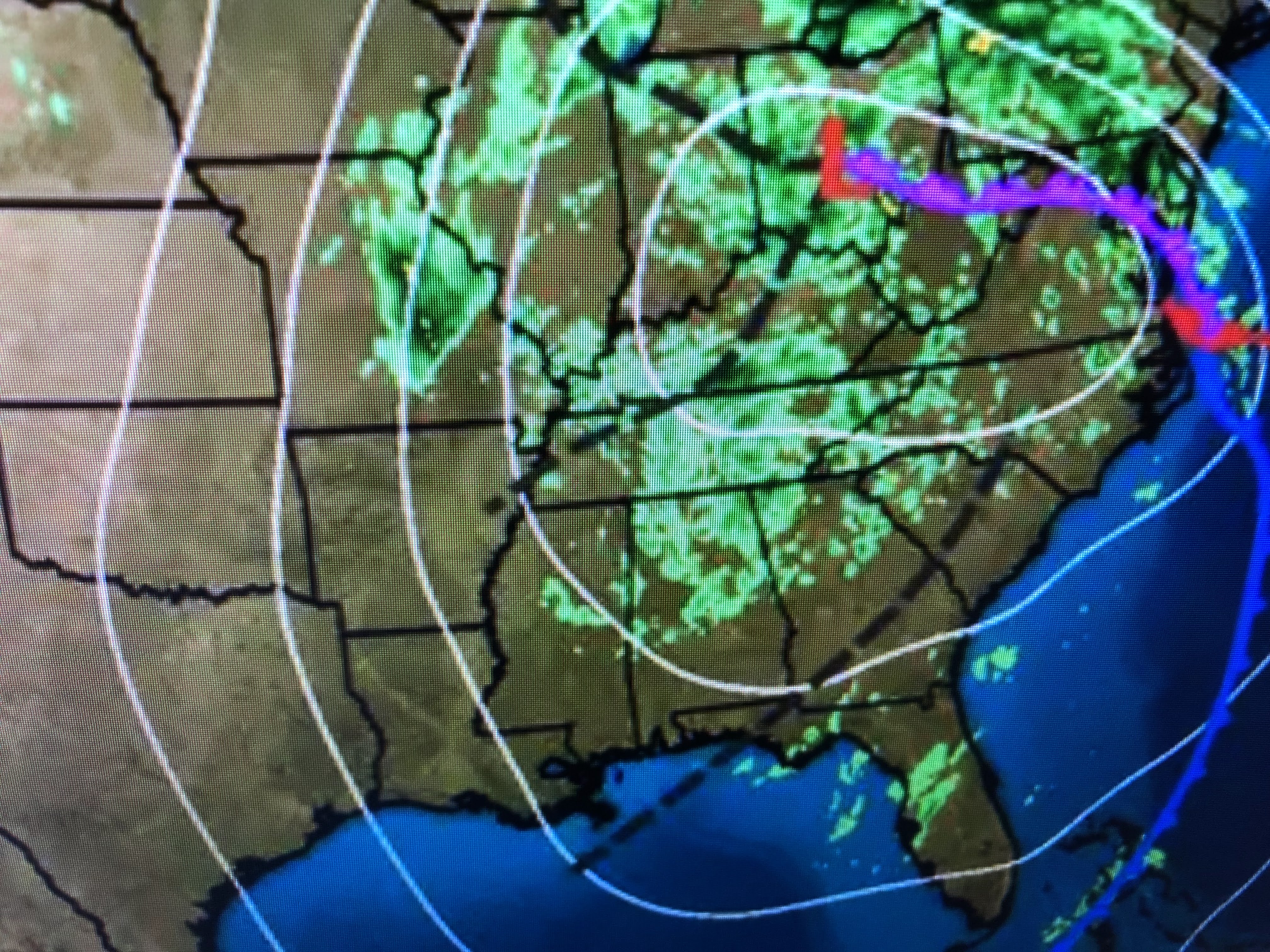
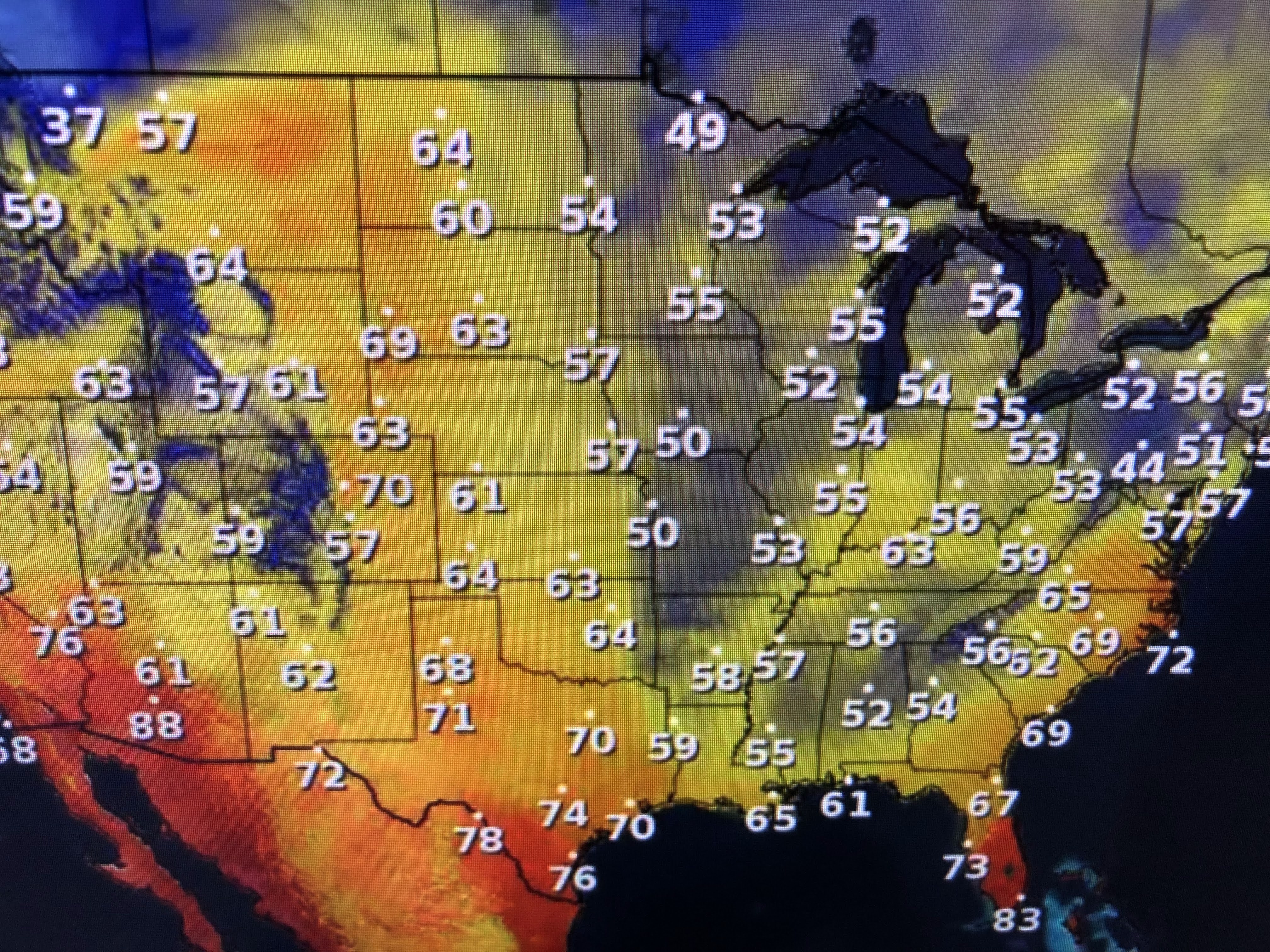


Clouds are wrapping around the upper and surface lows and without sunshine, it's rather chilly. Temps. climb back to 70+ in the sunshine to our west and that will be us for this weekend. There are no signs of return flow off the Gulf and dew points in Texas are in the 20s & 30s indicating very dry, but good feeling air.


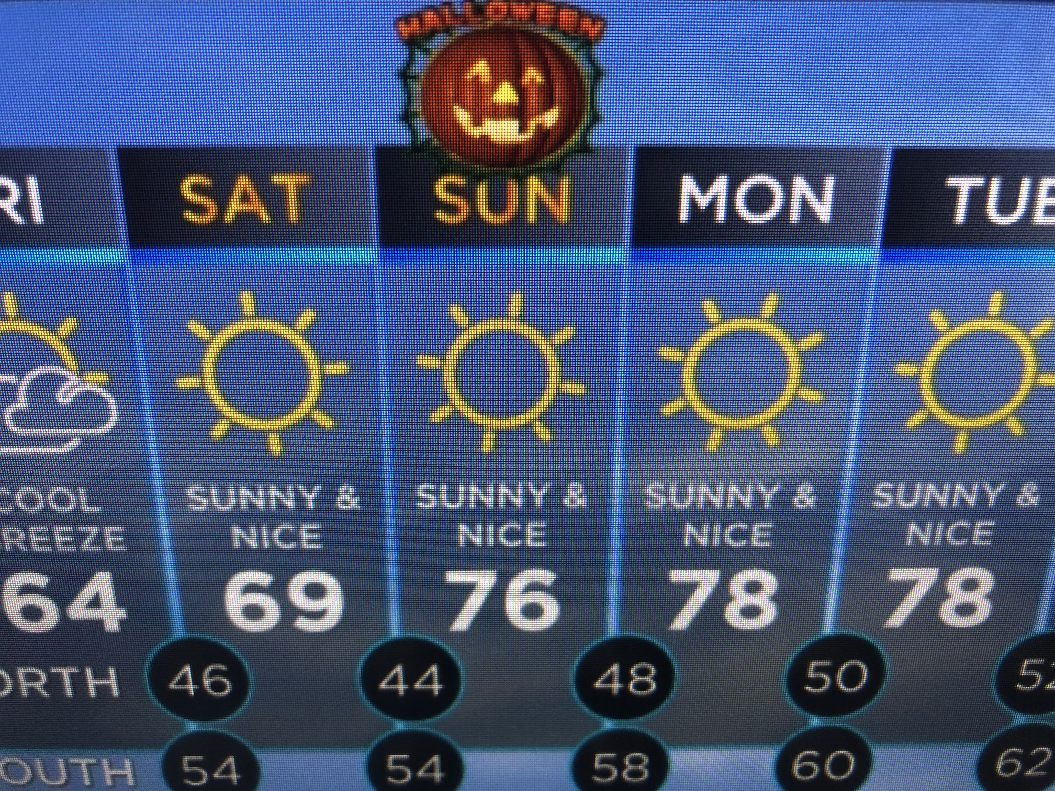
As the clouds leave and the winds diminish, this weekend will be as good as it gets. Nights will be comfy cool with days sunny and mild to warm. Finally,


NHC keeps wishing for Wanda as they just have to get through all the names on the 2021 hurricane list. In my time, these storms way out at high latitudes would never be named. With the improved satellite technology, any swirl cannot escape being seen. Let's enjoy our weather and root for Da Saints. Saints 33 Tom Brady 31. Who Dat! Stay tuned!

No comments:
Post a Comment