It will be much drier behind the front as dew points fall into the 30s & 40s. The main question regards the cloud cover. Typically skies will clear behind a front UNLESS there is a disturbance coming along in the sub-tropical upper jet stream.
Regardless, the core of the current cold (and it's pretty cold!) will stay well to our north and east.
The reason for that is the upper trough is not digging down into the south but will shear our to the east coast.
The top graphic is valid for Friday morning showing the trough pulling eastward. Now compare that to the bottom pic that is valid for Dec. 6th. Note how sharper the trough is with the flow diving down out of Canada. As I mentioned yesterday, that's a 2 week forecast subject to many changes. But if it becomes reality, expect near freezing temperatures here for that first week in December.
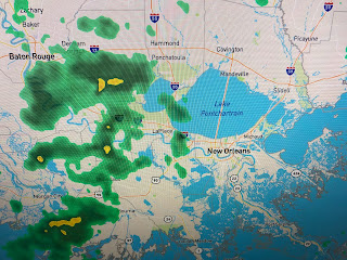
Radar has been following diminishing rainfall along the front and we may see enough to wet the ground. Rain chances will stay low for the next 5-7 days.
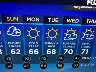
You can see there will be a warm up as we head towards December. Like many of you, I'll be watching the Saints tonight and we don't expect miracles with so many of our starters not playing. What we do expect is they play their hearts out, and with the help from our 12th man, maybe, perhaps miracles can happen. I'm keeping it 24-20 Saints. Who Dat! Stay tuned!


No comments:
Post a Comment