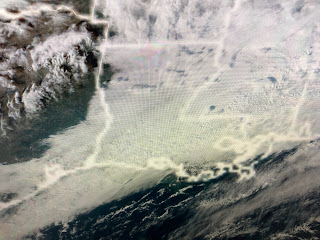
The reason we can't get and stay in the colder air can be seen on the upper steering flow. There is a trough along the West coast bringing rain to southern California while the flow over us is mainly west to east. The real cold flowing out of Canada is steered eastward over the Great Lakes into the Northeast. We'll have to wait until Sunday to bring out the heavy coats.
The core of the cold is already shifting away from us. The stalled front to our south will surge back to the north by Wednesday afternoon keeping us in the warm air sector through Saturday.
You can tell by the dew point (60 degrees) at MSY that the really drier air has not made it to the South Shore. Yesterday's rain totals generally were in the .50" to less than an inch range. My yard & garden quickly soaked up the moisture. We could see some more showers early Wednesday as the frontal boundary lifts back to the north. The next real rain threat will be Saturday PM ahead of the next stronger cold front.
Finally, the super cold air (45-50 below) over Canada has moderated and shifted to the east. I still see a colder pattern developing for the last 10 days (Dec. 20-30) of this month. Not exactly cold enough for snow for Santa, but we still have time for that to change. In the short term it's back to Spring-time warmth this week. Stay tuned!


No comments:
Post a Comment