Water temps are now below 80 except down over the "Loop Current " coming through the Yucatan Channel. The bottom graphic is the oceanic heat content that has all of the Gulf too cold for tropical development, except over the loop current. So what the heck is going on?
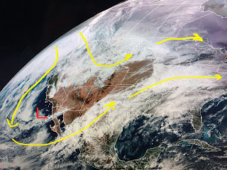
The upper trough remains anchored over the West keeping them cold while the East stays mild to warm. The northern tier is seasonally cold while the southern states remain very warm. Until the upper trough shifts over the eastern states, we'll continue with above normal/average temps into the New Year.
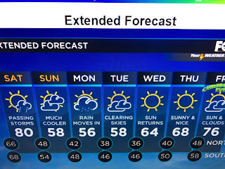
Fortunately, the severe weather threat 2 days ago was far less impactful and we are not expecting any severe storms with a cold front plowing through here Saturday night.
Saturday may see near record warmth before it's back to sweaters and jackets Sunday through Tuesday.
There are strong storms along the front in Oklahoma tonight, but those are expected to weaken before they reach us. The cool down will not last through Christmas as we'll be back 70+ by Christmas Eve. Stay tuned!


No comments:
Post a Comment