


NHC's outlook is calling for no development for the next 5 days. What we are seeing is a huge dust surge coming off of Africa that is typical for early in the season. There appears to be a weak tropical wave approaching the islands east of Barbados. Only one computer model (GFS) continues to develop something in the southern Gulf for late NEXT weekend.

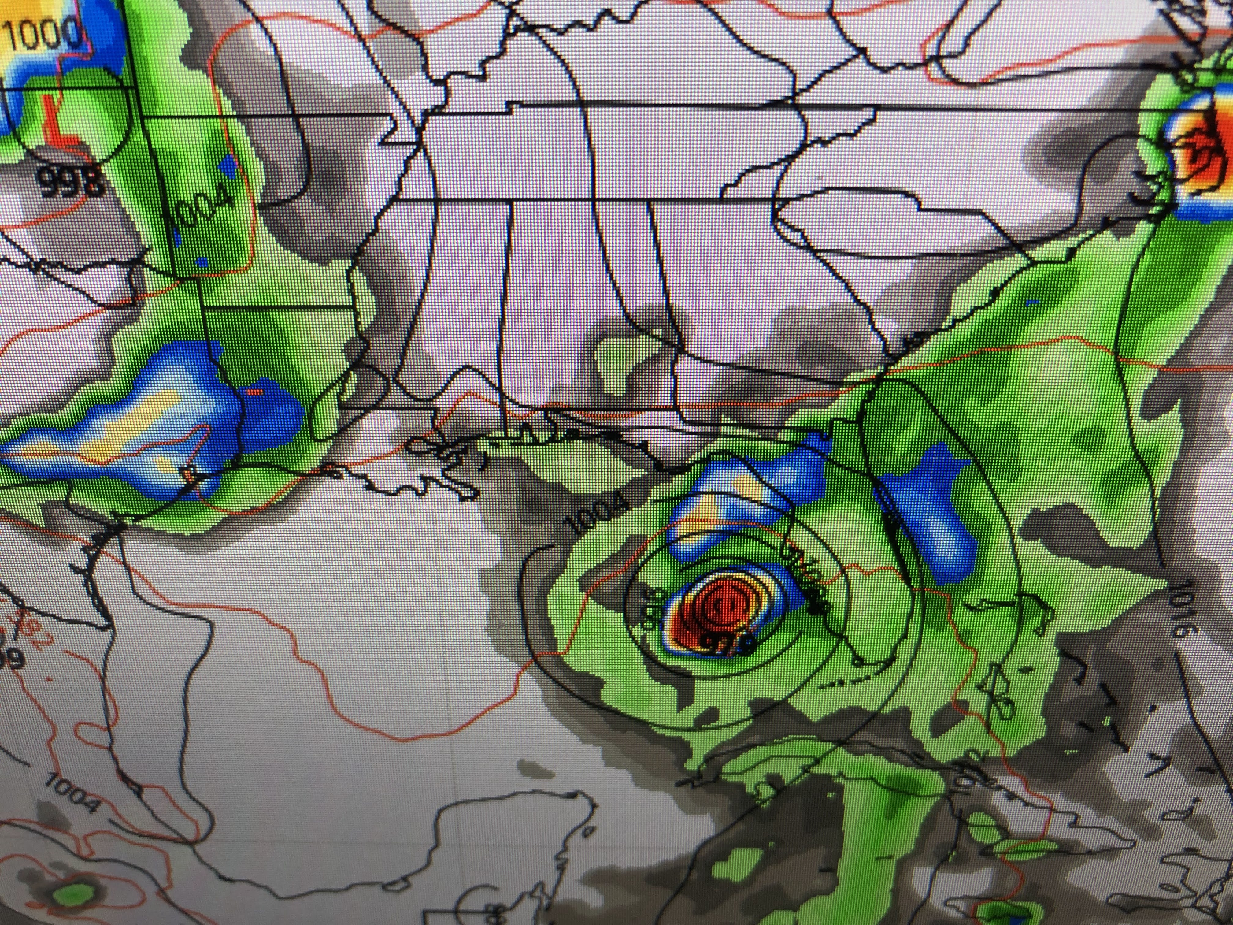

yesterday it took the disturbance over south Florida, but today they bring it west of Tampa. None of the other models even see anything developing so I wouldn't get too excited that the GFS is going to be correct. Closer to home, we have an upper low over the Gulf that is firing off some storms.


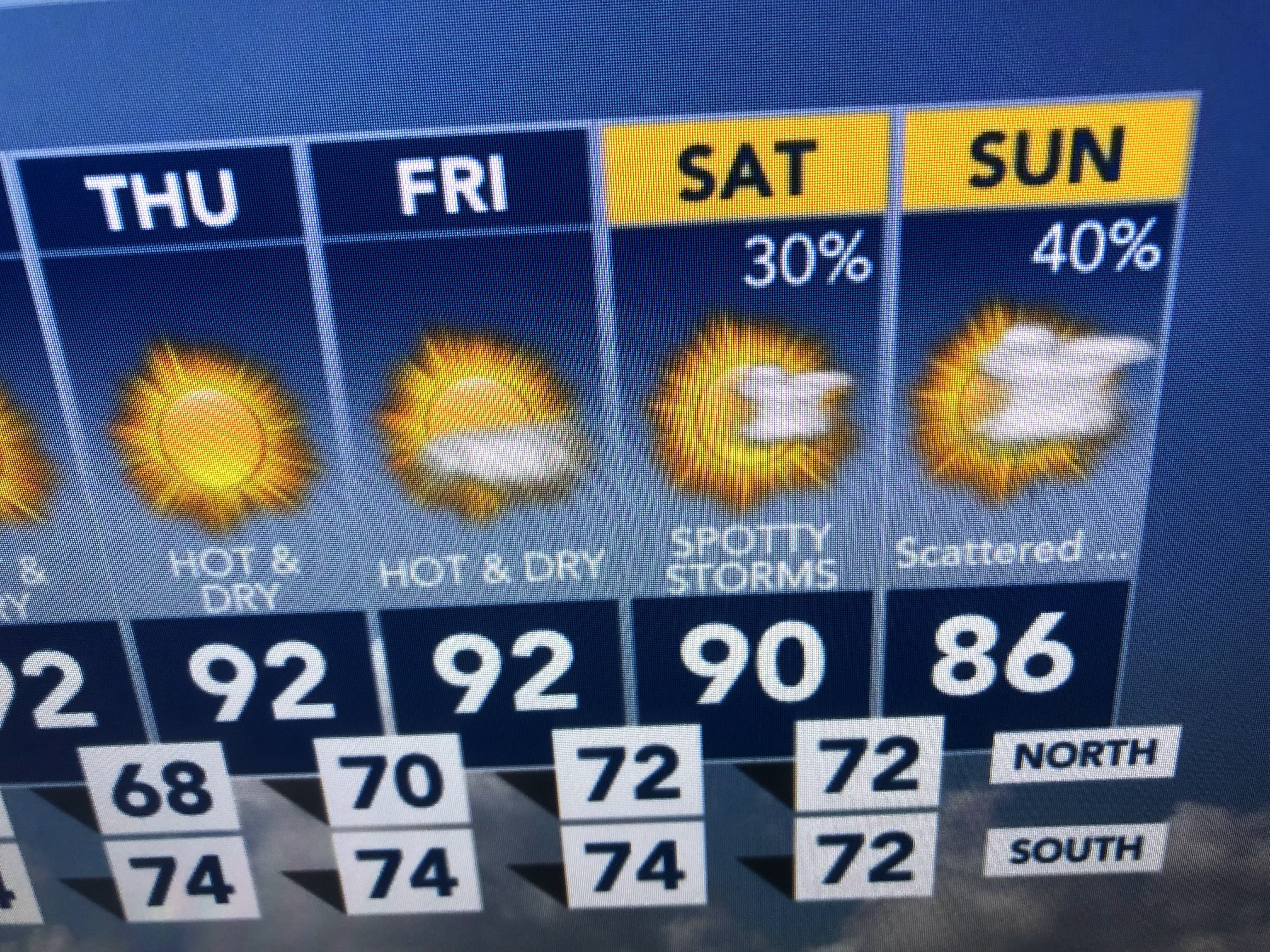
The upper air flow has the signs of an "omega block" setting up with a trough off both coasts and a heat ridge in between. That should mean daytime heating storms will fire from us eastward tomorrow with the ridge shifting over us for the rest of the week.


Finally, today's paper has an article indicating Louisiana has been "a magnet for major hurricanes" since 2005. They are correct, but so what? Are they aware of what happened back in the 40s, 50s & 60s?


During the 40s, south Florida was the focus for landfalling major storms. that shifted during the 50s to the east coast and then back to the Gulf coast during the 60s. My take is, I'm hoping this recent trend will shift back away from us beginning this season. We need time to recover. It's not that we want others to suffer, but let's shift the burden so that Louisiana can get back on our feet. Stay tuned!

No comments:
Post a Comment