


Hopefully the dust layer lingers for several weeks as one long range model (GFS) continues to bring tropical development into the Gulf. The Weather Channel & many others have been talking about the Central American Gyre (CAG) that forms low pressure across Central America & northern South America. You can kind of see that in this afternoon's satellite picture (circled).


There is NOTHING there yet, but the GFS tries to form something NEXT Tuesday as the following graphics indicate.


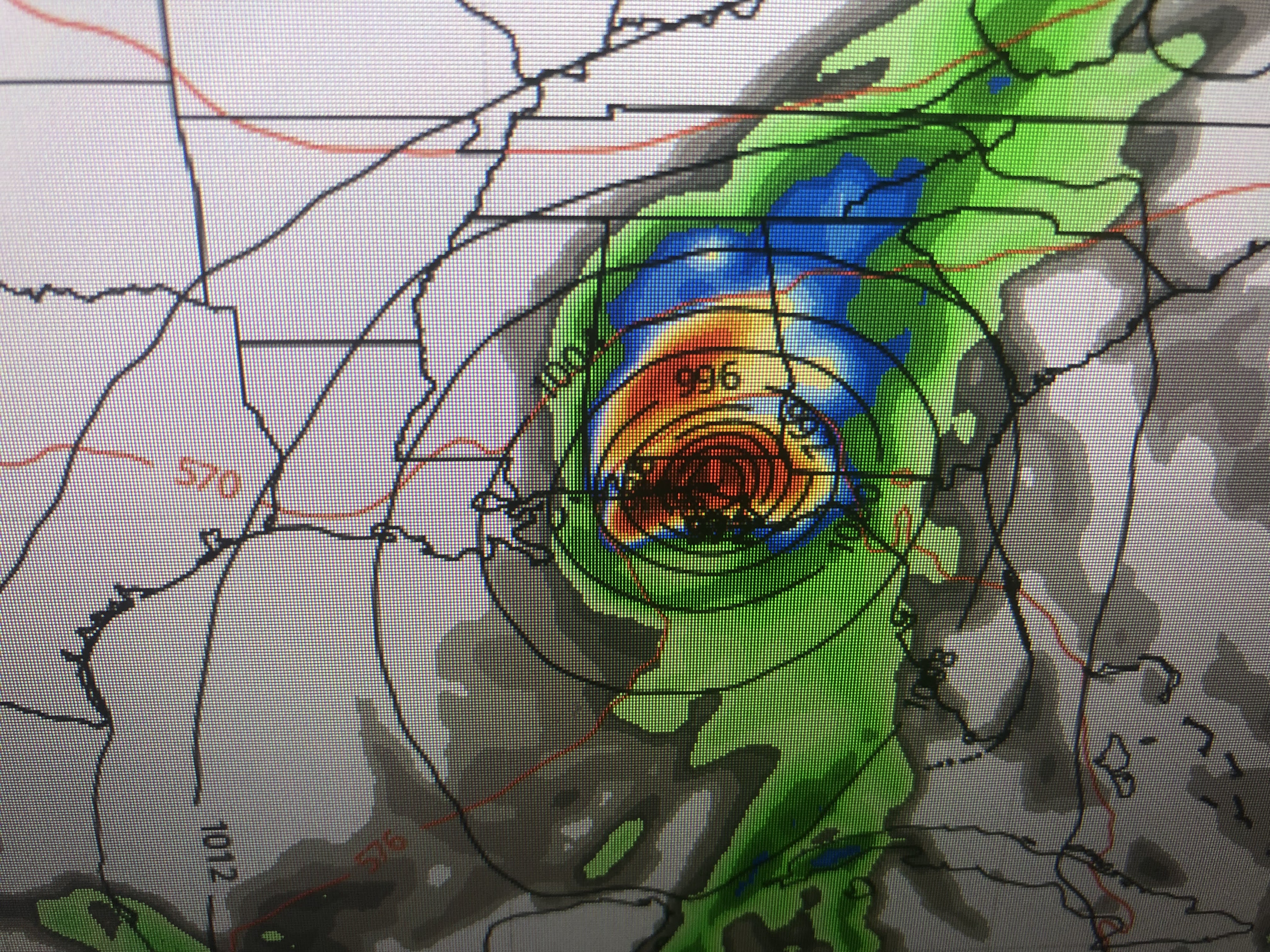
Before you freak out, remember the GFS is the only model seeing this feature. Look at the European during the same NEXT Thursday through Saturday timeframe.
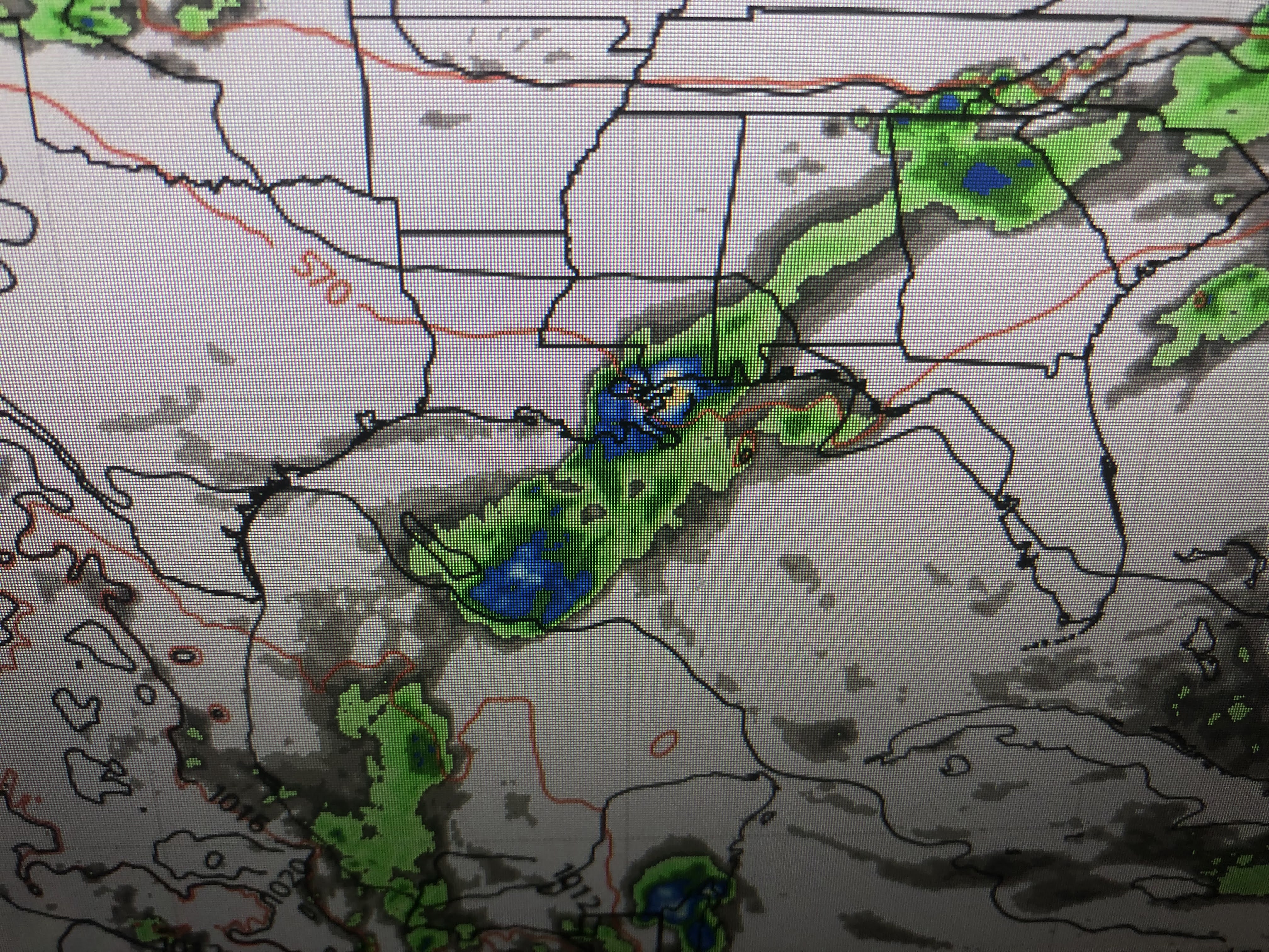


The Euro has NOTHING. How could the two major models be so different? This will be a true test of which model we place more faith in during the upcoming season. Even if the GFS is semi-correct, whatever might form stays to our east leaving us on the dry side. Obviously I'll be focusing on this feature daily as I know many of you have beach plans coming up.


In the short term, the upper flow is mainly West/SW to East/SE across the northern states with several disturbances triggering clusters of storms. An upper ridge is keeping the southern states hot & mostly dry. That should continues for another 2-3 days.


You can see the clouds and storms passing well north of LA/MS with temperatures well into the 90s.


Not only are we hot, but dew points have bounced back into the 70s making it feel like it's near 100 degrees. Showers have been few but very strong with some hail around Slidell. They are more numerous along the beaches & the sea breeze front.


Sure it's been warm/almost hot and Zack Fradella had a graphic this morning that showed the first 16 days of May have been above normal. Add in today and it's the first 17 days.


If you want to keep your lawns and gardens green, get those sprinklers going as Mother Nature offers little relief until the weekend.


Is the chance for a May Tropical system making landfall in Louisiana zero? No, but looking back at history, we have had only one and that was Tropical Storm Arlene in 1959. I like our chances of staying safe in May. Stay tuned!

No comments:
Post a Comment