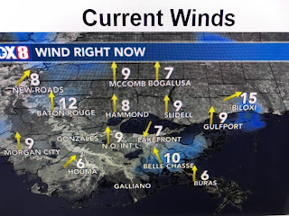
Back over the states. not much is happening, although it appears a weak cold front will get close by the weekend.
The chill is lingering over the Great Lakes and northeast with slightly above normal heat across Texas and the Gulf South.
Today is day 18 above normal/average for May. The usual way we get "cooler/less hot" at this time of the year is to have daily daytime heating storms develop. Sometimes a weak frontal boundary will come close enhancing our shower chances. That might happen this weekend.
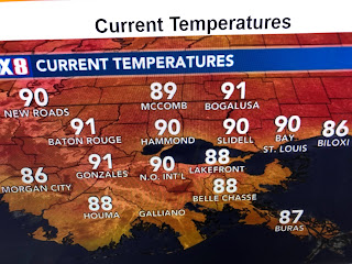
Plenty of sunshine allowed temps to top 90+ again today. Expect the same tomorrow.
Finally, the bottom 2 graphics show how the Mississippi at the Carrollton gage is cresting today with a slow fall for the rest of this month. Why is that important? As we enter the hurricane season, we don't want high river levels. Typically they peak in May and reach their lowest levels by August & September. That allows our levees to contain any storm surge caused by a hurricane from backing up the River and overtopping levees. As I mentioned weeks ago, there will be no need to open the Spillway this year. Stay tuned!


No comments:
Post a Comment