


You don't actually have to get under the rain shield to get cooler. Just being under the clouds help. The top pic shows big storms (note cloud shadow) east of Dallas at 8 AM with the next view at noon while the following is at 3 PM. Locally it's the same here.


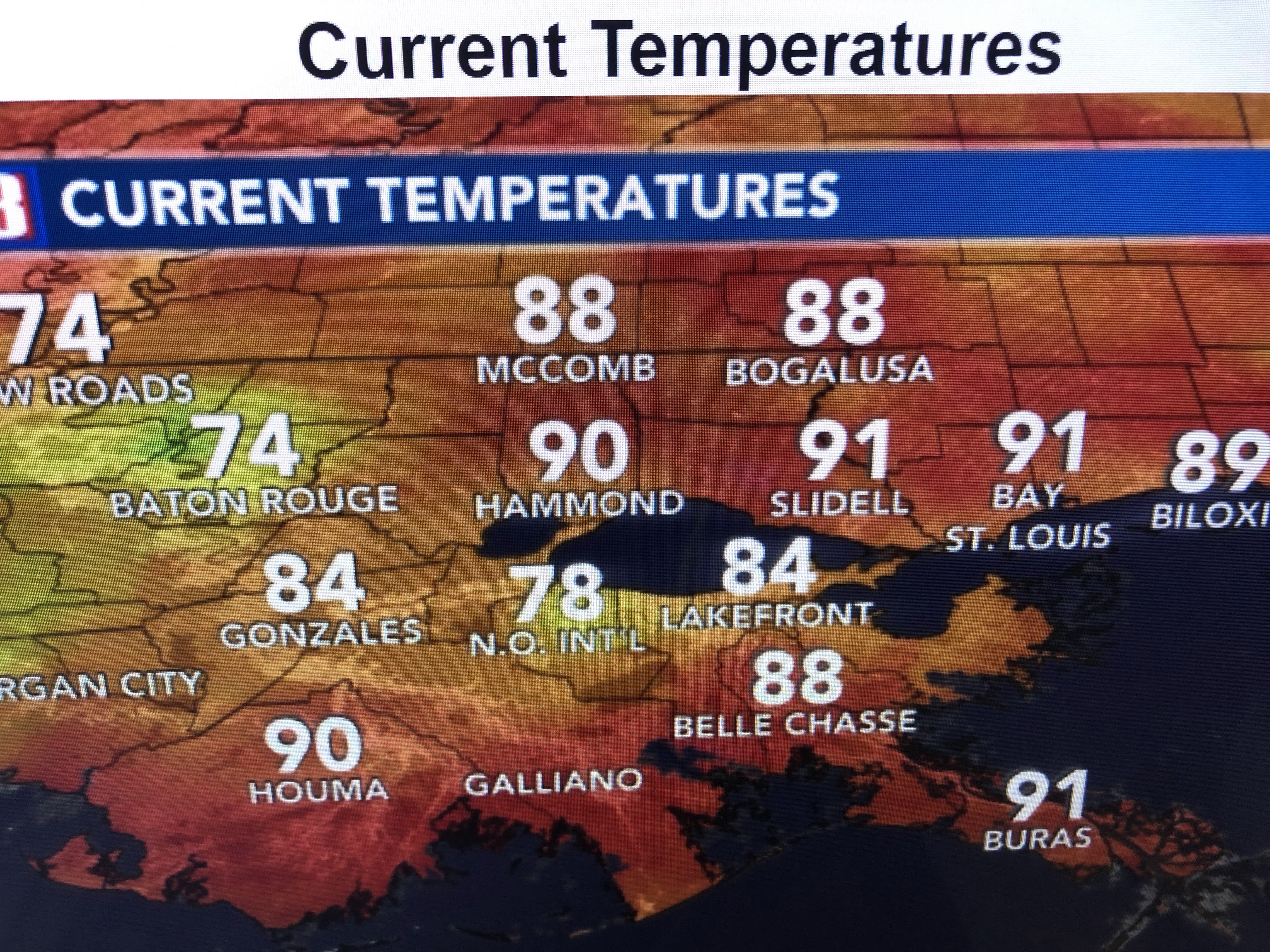
Those sites 90+ are in the sunshine while those in the 70s have nearby rain.


I don't see any major changes coming as fronts are stalled to our north while upper lows dominate the Tropics.


None of the computer models develop any storms for the next 10-14 days and that almost takes us to the end of July. The longer we go without any development, the closer we get to Fall cold fronts. We all know August & September are our "Prime Time". Let's relax for now since we know (climatology tells us) that the active time is still ahead.


I've said it before... the 7 day forecast is basically useless in the summertime. Our "normal/average" daily rain probability is 30-40%. It will rain every day somewhere, unless we have an upper heat dome that caps any storms. Right now that dome is over the central plains. Keep the rain gear handy, but remember there will also be many dry hours. Grand Isle International Tarpon Rodeo begins in 2 weeks. Stay tuned!

No comments:
Post a Comment