


Ahh, to be young again! Weather-wise, it's been fairly quiet with a few spotty storms. But that's about to change. Look at these upper air charts for the next several days.


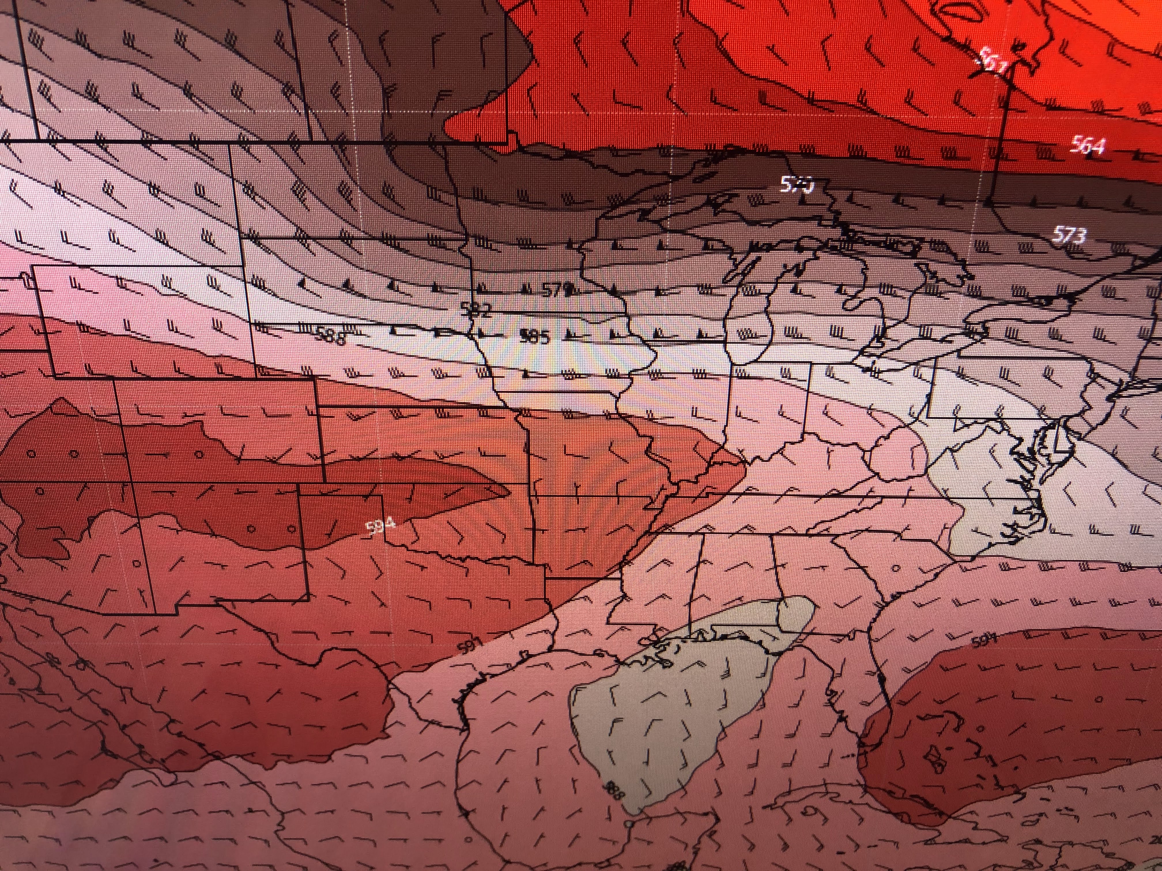

The top view is from this morning with the upper high centered over Colorado. The next view is valid Sunday PM showing an east coast trough giving us a northerly. The final views are valid Tuesday & Wednesday showing the upper trough over us. That should enhance our daily rain threat resulting in the potential for 5-8" for next week.


The rainfall prediction map broad-brushes those amounts. Not everyone will see that much. but some could have even more.


You can see the bright band of clouds to our north that will be sinking our way for tomorrow. Dew points are in the obnoxious range approaching 80 so there is plenty of low level moisture to work with.


Increased rain chances should mean less hot temps. Many are already 90+ before noon. The Tropics...


The Inter-Tropical Convergence Zone (ITCZ) is apparent from Africa westward into the Pacific where I've circled the disturbances. The Atlantic Basin remains shut down. I've grabbed a graphic from Bay9news out of Tampa Bay.


Another plume of Saharan dust will keep things quiet for another 1-2 weeks. Models are hinting things will begin to get active during the last 10 days of July. Until then relax and enjoy your weekend. Stay tuned!

No comments:
Post a Comment