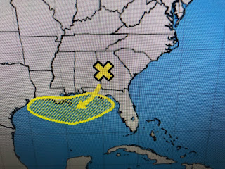
The first 5 weeks of the hurricane season across the northern Gulf have been quiet, but that might change late this week. A weak frontal boundary is staggering down near us and NHC has hatched in an area across the northern Gulf for POTETIAL development. They're giving slim (20%) chances for something to form, but past history has several storms forming from cold frontal boundaries.
There is nothing there yet, but even if nothing forms, there will be some heavy rains along and offshore the LA/MS coasts. While the GFS sees nothin forming, the Euro does just east of the River moving northward into Mobile Bay.


The top views are the Euro valid for Friday & Sunday mornings while the bottom are the GFS for the same time periods. Certainly 2 different solutions. The real unknown is where will the heavy rain bands form? The forecast is mainly along the coasts and offshore with amounts 10"+.
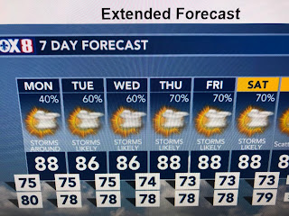
Is it any wonder the 7 day increases rain chances above normal(60-70%) for much of this week? That should keep highs below 90 all week.
I'm not concerned about any rapid tropical development since the MJO is in the unfavorable (sinking) phase. I'm more concerned about slow moving tropical rain storms that could cause street flooding for days.
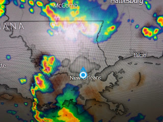
Some big storms are sinking south this afternoon. Note how less hot folks are where it's been raining or cloudy. Plan for a wet week here and all along the northern Gulf coast. Stay tuned!
There is nothing there yet


No comments:
Post a Comment