


The remains of Darby passed well south of hawaii while Hurricane Estelle is expected to reach a Cat. 3 Monday or Tuesday. Models predict another system will form behind it. But look at the Atlantic.


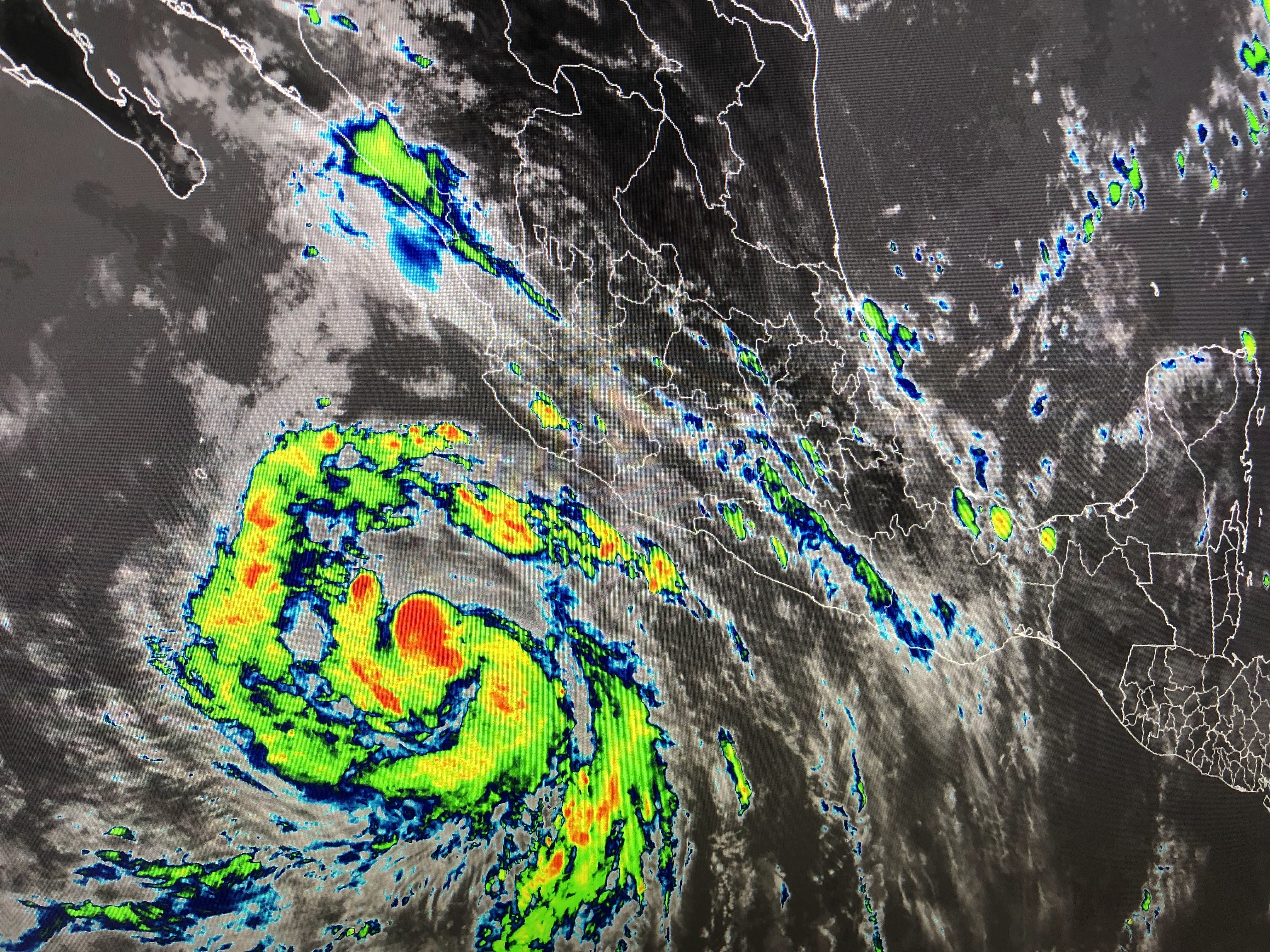
Nothing is happening & models do not develop anything for at least 7-10 days. The biggest clusters of storms are over the Gulf stream off the Carolinas Look at the Gulf. All of the disturbed weather has dissipated as the heat dome continues over the Plains.


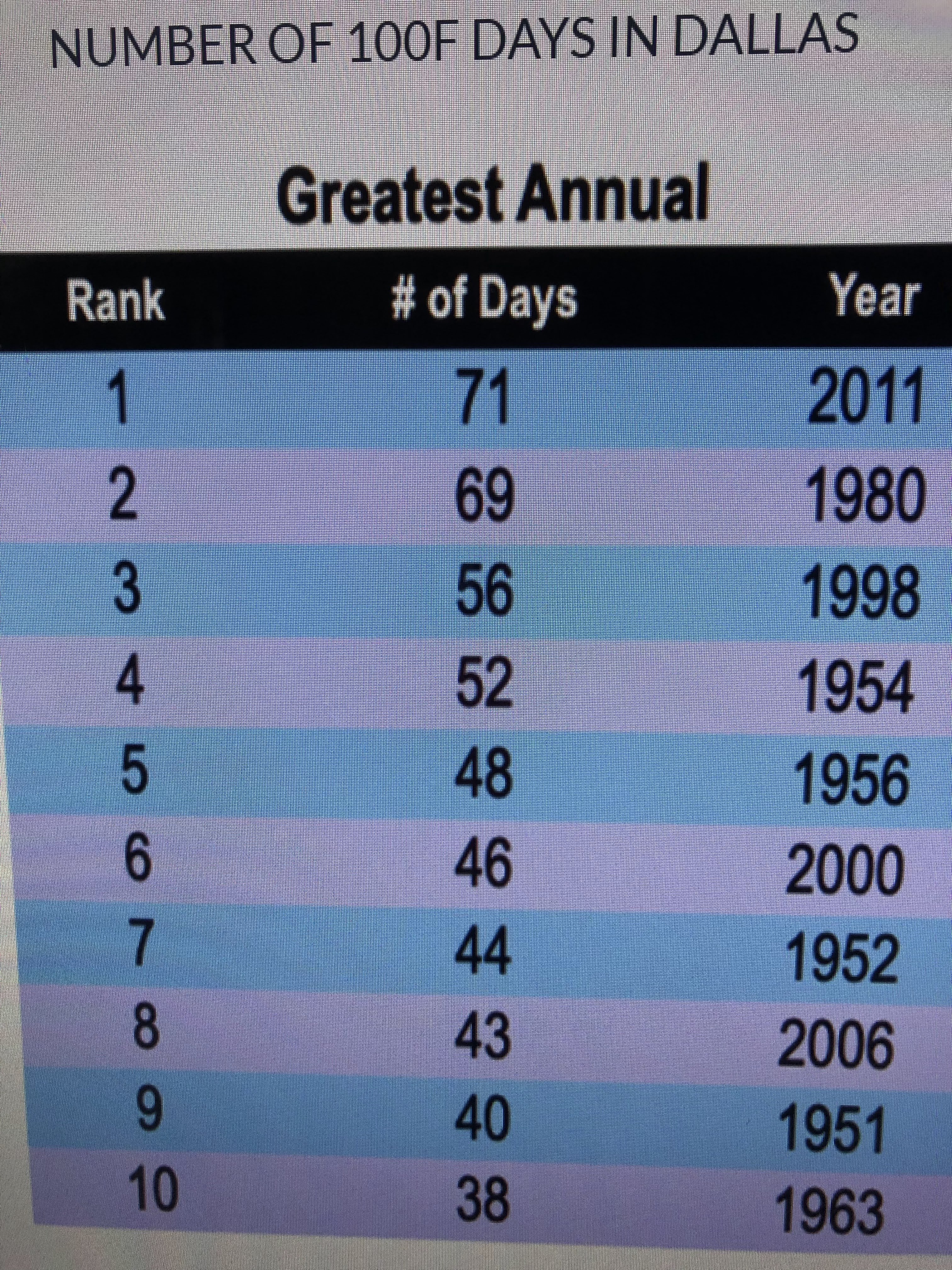
Before you global warming alarmists go nuts, today is the 23rd day 100+ for Dallas. They have a long way to go just to break into the top 10 hottest years. How about us? We did have our hottest June since record began at MSY.

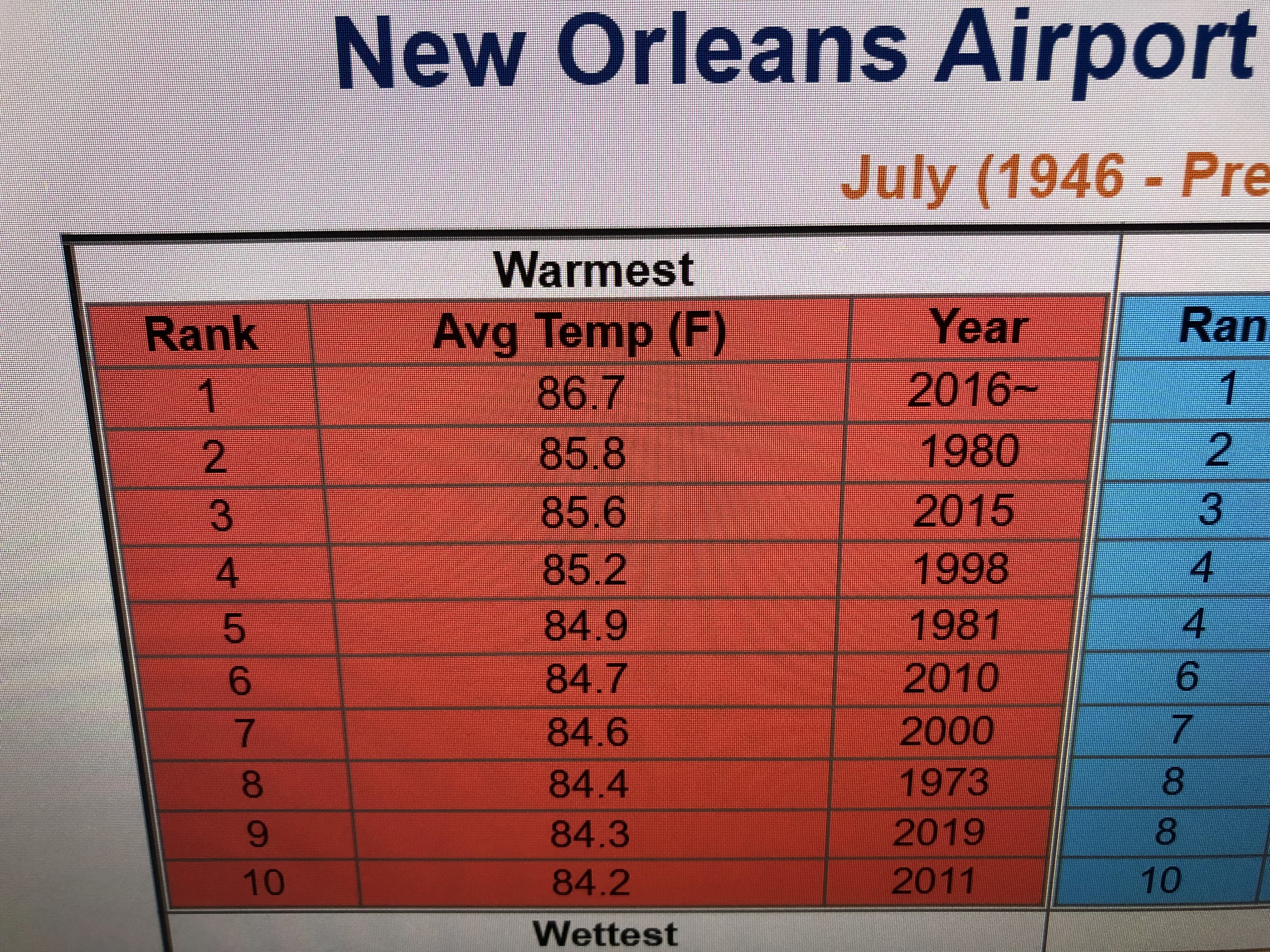
Even though it seems we've been really hot, compared to past history, our average temps so far in July is 84.0, barely above the 83,8 long term normal/average. If we have the next 2 weeks get really hot, we could break into the top ten hottest Julys.


As you can see, the surface weather map has no fronts around us so the only triggers for storms will be daytime heating & land/sea breeze fronts. It is cooler under the clouds and showers across the Great Lakes & Ohio Valley. Florida is getting the bulk of the storms today.


Here's the 7 day forecast, but as I've said many times before, during the summer it's useless.


Or you can always stick your head in the fridge! Stay tuned!

No comments:
Post a Comment