


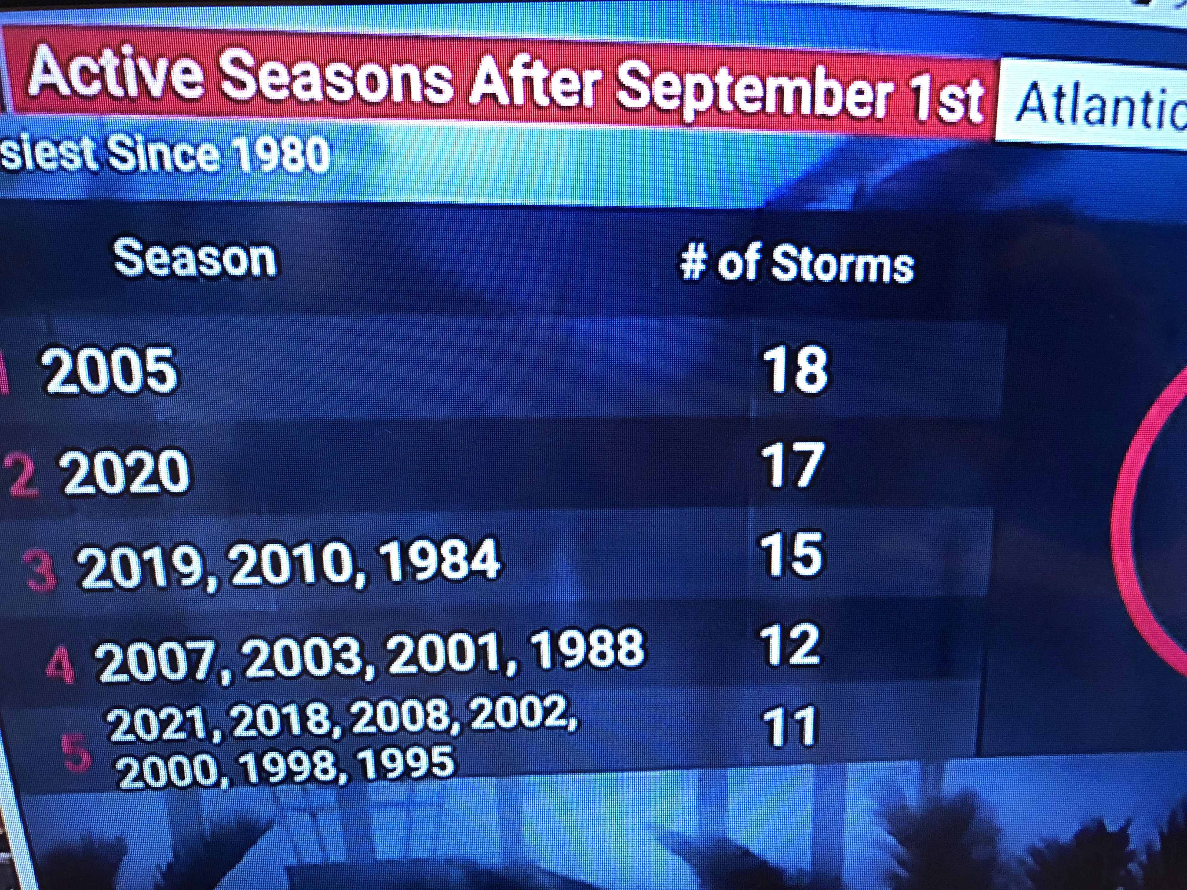
You can see the dust pouring off of Africa north of 90 L that should limit development. The bottom graphic I grabbed from Jim Cantore on TWC this morning just to point out how active past season's were AFTER September 1st. I think the main difference during those seasons was we had many named storms before Sept. 1st versus how quiet this year has been. But satellite views are showing lots of potential spots for development.


NHC is not talking about any of them since models aren't showing anything forming. My gut tells me we need to pay attention to these closer in systems. I like seeing the Gulf as clear as it is. Of course the main weather story has been the flooding rains to our north & west.


This boundary is predicted to stay to our north, but we don't want it sinking to the south and stalling. Dallas went 67 days without rain but received 8-12 " during this morning's rush hour creating widespread flooding. The problem is an old frontal boundary is stuck to our north with upper disturbances move along it while it's Fall-like to the north.


Of course, lots of clouds and showers means temperatures less hot.


Until this boundary moves away, look for the rest of this week staying with above normal rain chances and below normal temperatures.


And finally...

The clock is ticking and since we have never had a November storm cross the Louisiana coast, we have just another 6-8 weeks to worry. Stay tuned!

No comments:
Post a Comment