


All the clouds kept our highs in the 80s with the top radar view taken at 8:30 AM The next was at 11:30 with the bottom at 3:30. The cause of all this above normal clouds & storms is a stalled boundary to our north. Low pressure is moving slowly along the boundary and that will enhance rain chances again tomorrow. Like today, the North Shore will have the higher rain chances.


North of this boundary, much of the nation is enjoying an early Fall preview with dew points in the 40s & 50s.


Unfortunately, I don't see any fronts coming down out of Canada so we'll have to wait for the upper pattern to change later this week to get back into more sunshine. At least we're not dealing with brutal late August heat. Now for the Tropics.


The Weather Channel (TWC) has followed the lead of the other experts and lowered their early season hurricane predictions from 21 named storms down to 17. That's still a high amount to me and it will have to get real active real soon.
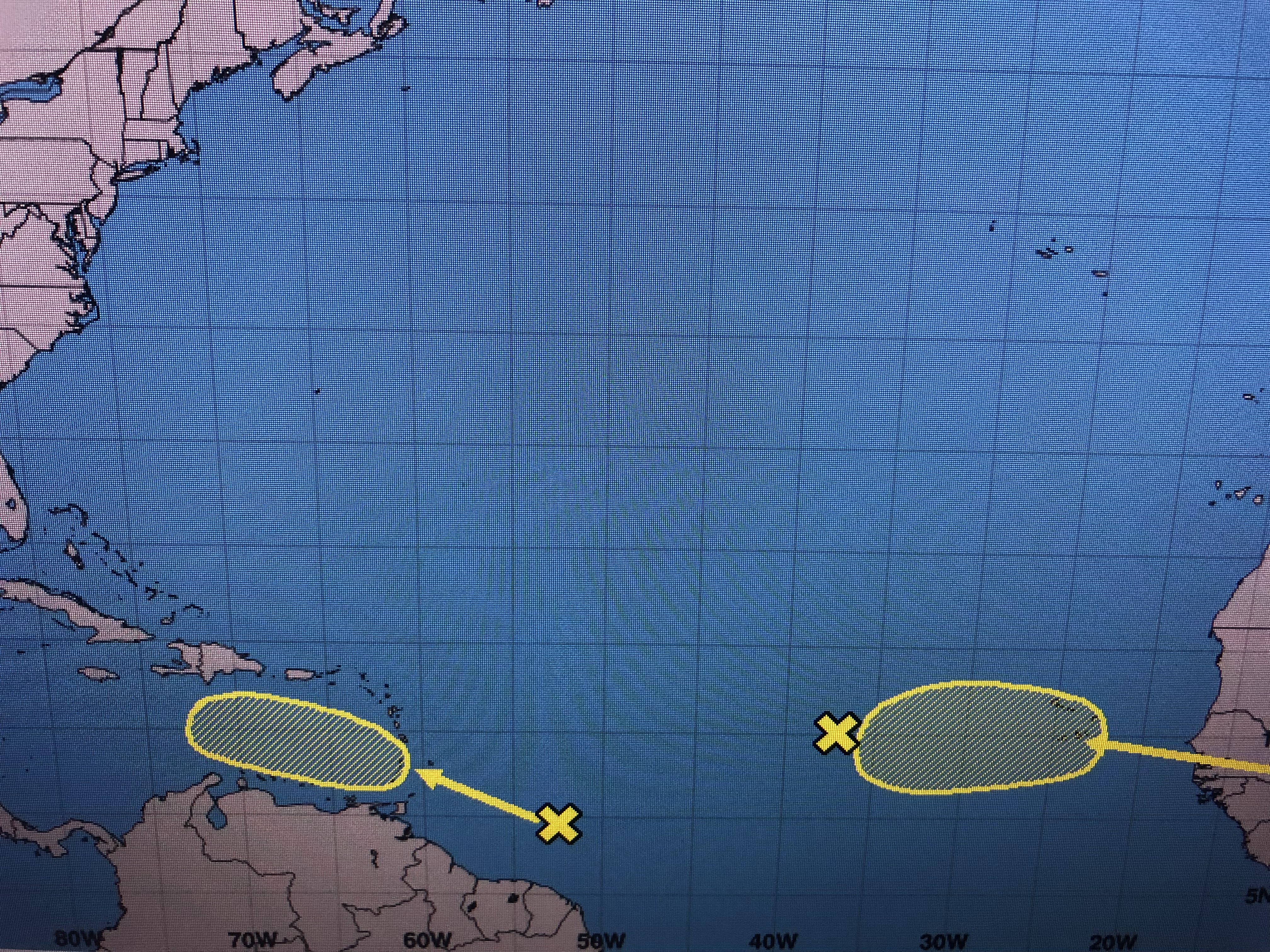


Invest 90 L has not developed and NHC believes the wave still over Africa might have a better chance. Of greater interest to us is the outlined area SE of Barbados. Models are taking that into the Caribbean over the weekend.


The top graphic is the GFS valid for NEXT Friday indicating a well defined tropical system in the eastern Gulf. The next graphic is valid for the next day with the center heading for the Florida beaches. The bottom view is the Euro valid for Friday morning and it sees NOTHING. The GFS has done this before beyond 10 days so I will not get concerned until 1) something forms for us to track and 2) we get within 5-7 days before impact. Let's hope whatever has been inhibiting storms this year continues.


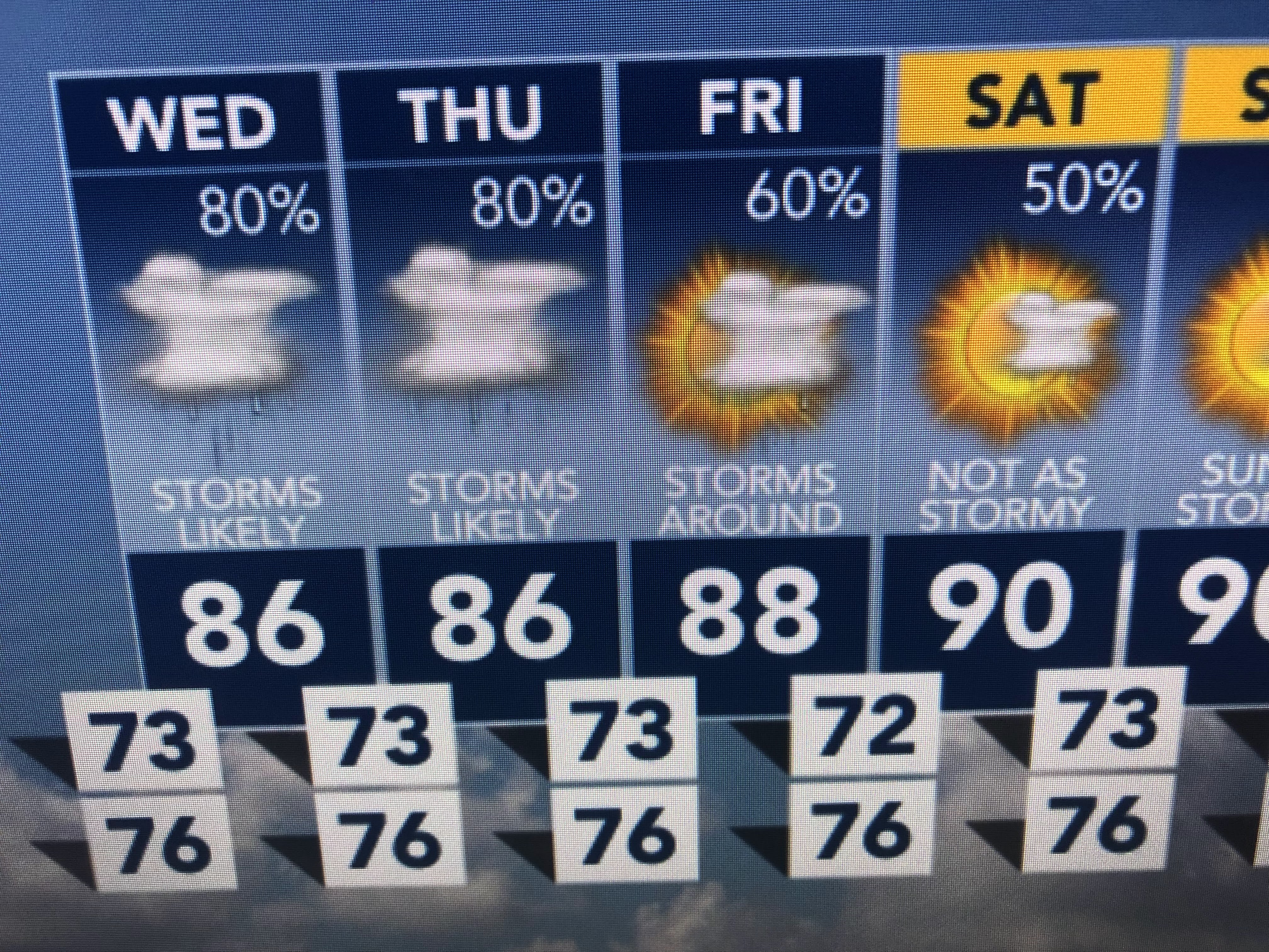

I'm enjoying these less hot temperatures and they are likely to continue for several more days. Later this week, we should start to see a drying trend that will allow us to get back to 90+. The last week in August is usually a bummer. Fortunately, it doesn't appear we have any tropical worries in the next 5-7 days. Stay tuned!

No comments:
Post a Comment