

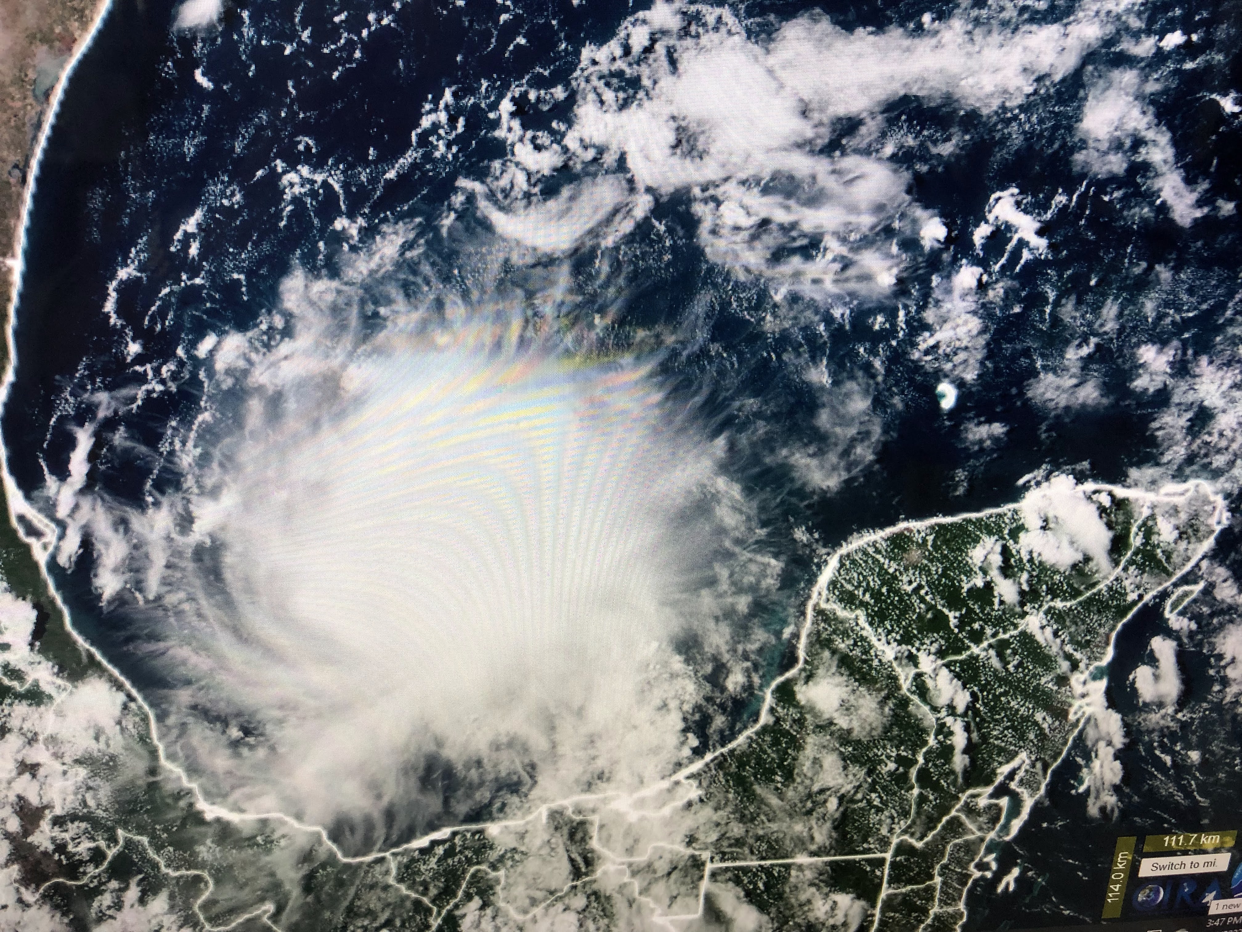

The NHC track quickly brings PTC # 4 into Mexico as a weak (green line) Tropical Storm (Danielle) south of Brownsville. This would bring more needed rainfall to south Texas that will spread northward and then eastward into next week.


If Danielle is named tonight or tomorrow, the gap between storms will end at either 47 or 48 days. The bottom graphic I grabbed two days ago. At 47 days, this would place 2022 as # 3 as longest gap between storms. The rest of the Tropics still show no signs of life.


A frontal boundary will stall out near us this weekend and, couple with tropical moisture from PTC # 4 could mean a rainy start intoi next week.


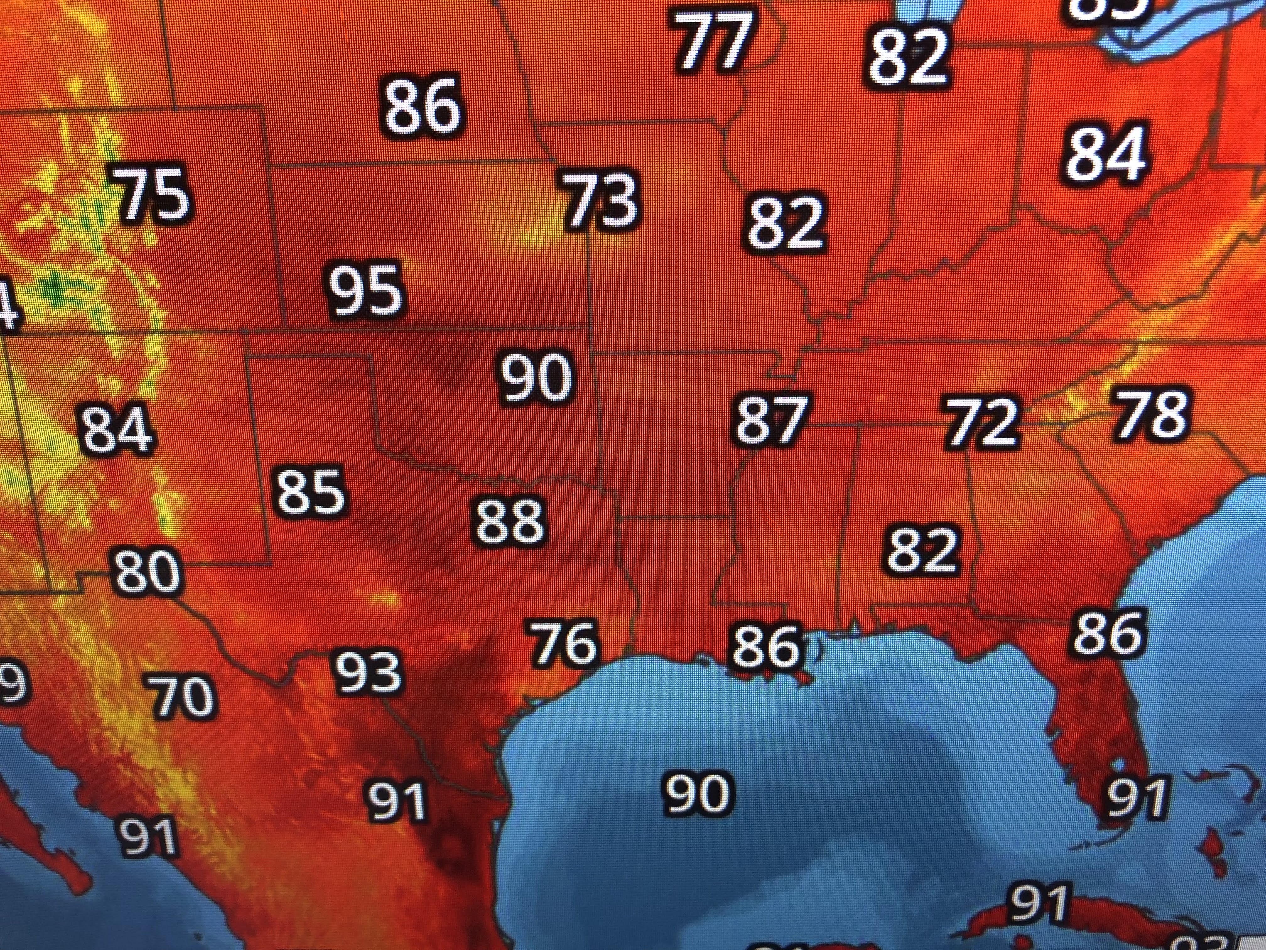
The increased clouds and rainfall has crushed the heat dome over Texas and Oklahoma. Of course, the other big concern is the weather in Green Bay tonight?


There is a swirl of clouds (low pressure) to their west that could bring a few showers, but temperature are quite comfortable in the 70s. Live coverage begins on FOX 8 at 7 PM.


As long as this rainy pattern continues over the South, I see nothing indicating a long heat wave is coming for the last 2 weeks in August. Now if only we could start seeing some cold fronts! Stay tuned!

No comments:
Post a Comment