


The bottom graphic is from Dr. Rick Knabb on TWC showing all the previous Augusts without storms happened in El Nino or Neutral year. We have never had no storms in August during a La Nina year. There must be more to it than just wind shear & warm waters?


NHC still is tracking 3 systems that they could name over the next couple of days. One is way out off Africa and will bother no one. The other is in the far northern Atlantic and will not last long. The third is 91 L east of the Islands that is trying to get better organized, but it continues to fight dry air all around it.


Tomorrow begins "Meteorological Fall", but the only Fall feeling weather is up over eastern Canada. It's still warm over most of the U.S, but the weak front just to our north has brought some drier air/lower dew points as close as Memphis to Atlanta. Models have backed off on any early September fronts and we may have to wait until after the 20ths before a REAL cold front arrives.


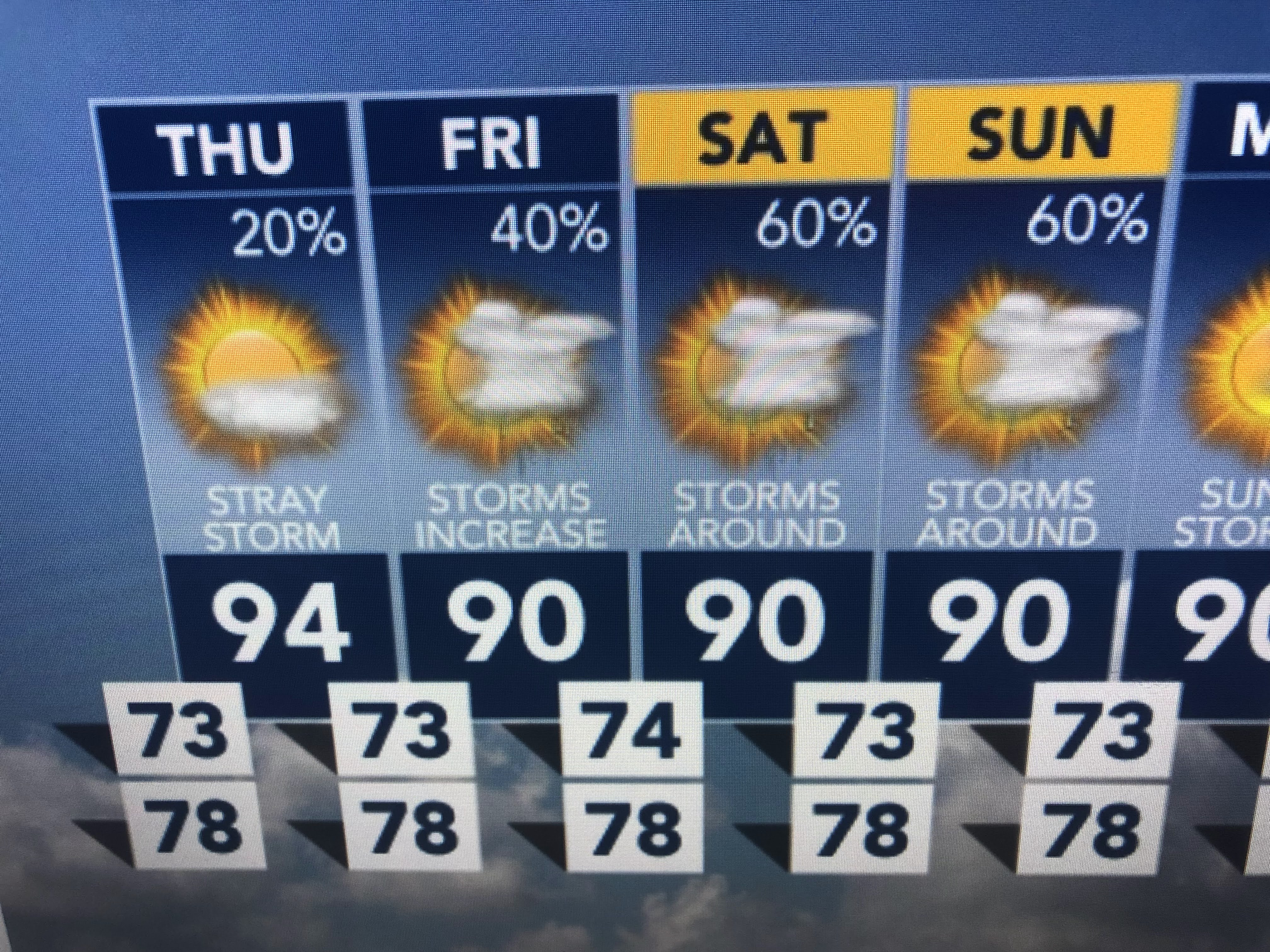
Without clouds and any rain, we're back up well into the 90s. That will slowly change as rain chances increase over the weekend.


An finally, despite having a record hot June, Summer 2022 will end up fairly average/normal as this graphic from Zack shows.

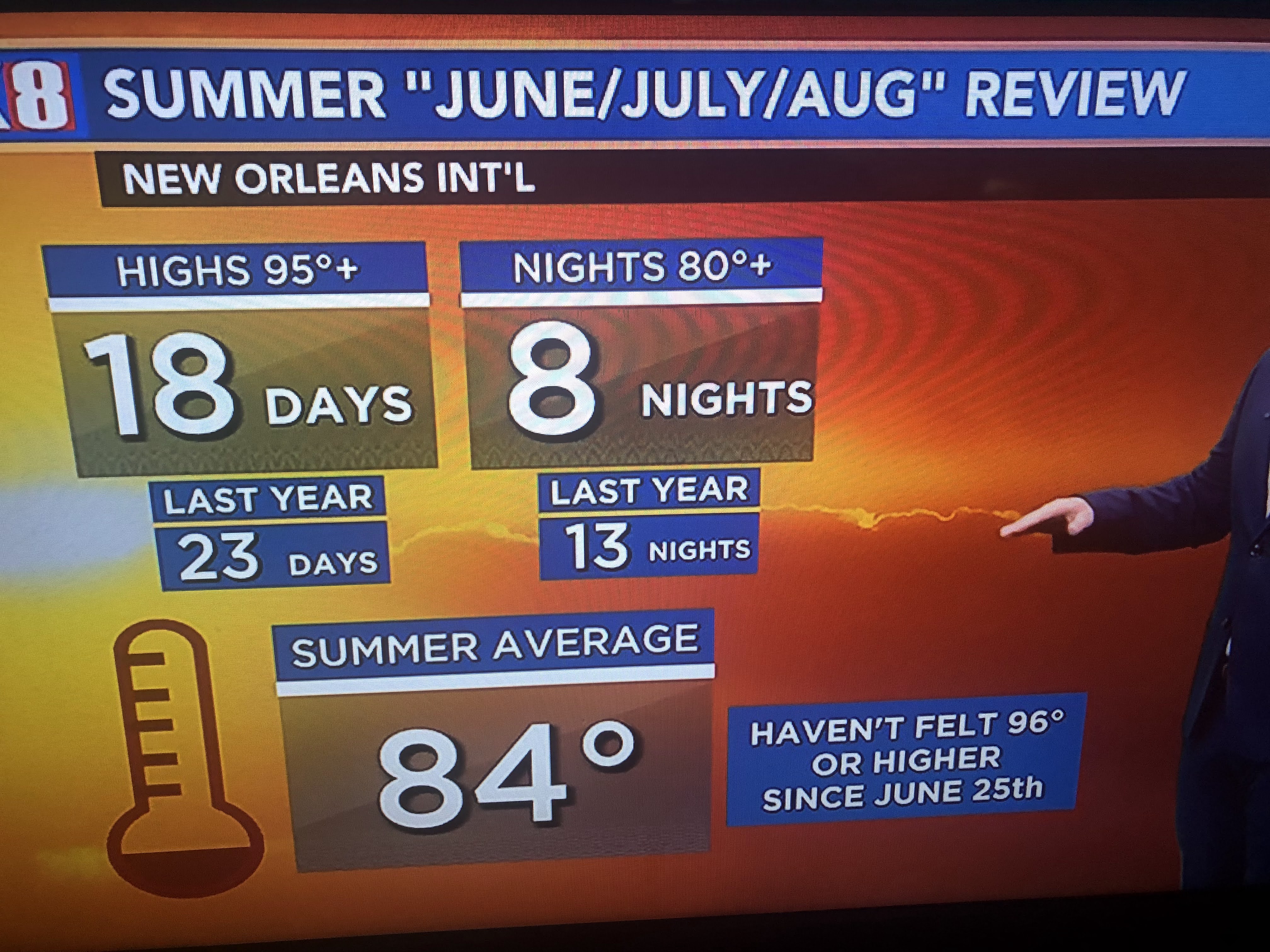
Compared to 2021, this Summer has been less hot. Now if we can only get through the hurricane season saying it's been less active! Stay tuned!

No comments:
Post a Comment