

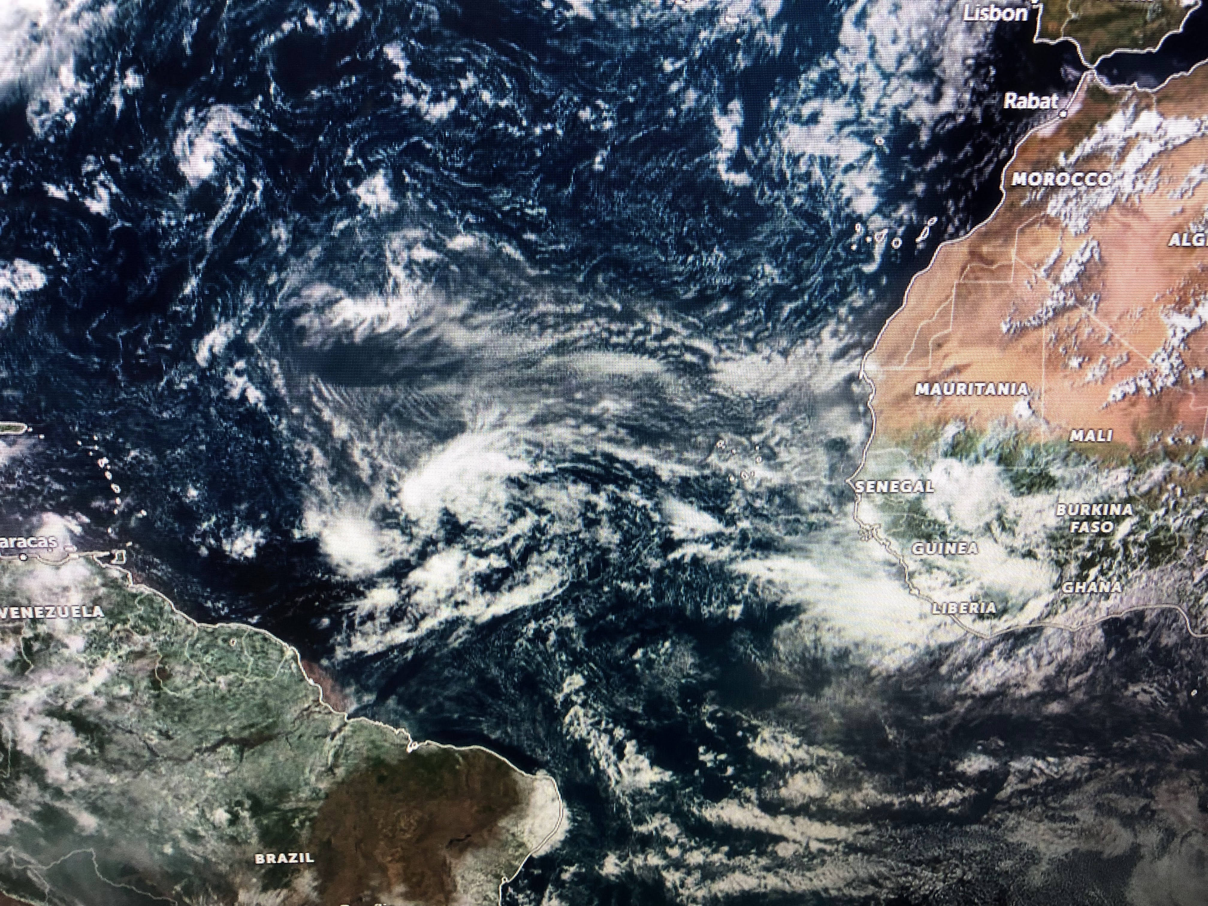


There clearly is a low level circulation but it lacks any storms around it. NHC has increased the chances for development up to 40%.


The orange area is the low I pointed out while the yellow area coming off of Africa is the next wave. But, as Lee Zurik would say, there is more.


NHC is highlighting an area over the Caribbean where a tropical wave could become better organized early next week. That is the feature the GFS model continues to develop into a named storm. But look at all the little swirl/lows off the East coast. Could any of them form? Or how about the cluster of storms that has fired off in the central Gulf south of us? NHC doesn't seem to be concerned at this time. So where & when will our next named ( Danielle) storm. Here's what our 2 main models think.


The top 2 views are from the GFS with the 1st valid off of the Yucatan next Friday and then a hurricane heading into Mexico NEXT Sunday. The bottom view is the Euro model that sees nothing forming. Now look at what the Euro is seeing for the Atlantic system.


It see a named storm for NEXT Friday that becomes a Hurricane by Monday Sept. 5th. Will it make the turn away from the East coast? Right now, the Euro says yes it will turn. Bottom line, somethings gotta give with all these opportunities to develop. If none of them do, then all the experts/researchers need to figure out what is limiting formation in 2022.


The boundary that has been along the northern Gulf all week finally dissipated. That allows for daytime heating storms to bubble up more typical of summer. No rain you're 90+. If you're under a shower, temps are less hot.


There are no signs of an early Fall cold front for the next 7-10 days. There are a number of frontal boundaries leftover, but no signs of cooling relief in sight. Typically it's the 2nd or third week in September when we see a "real" front.

As we hope for those fronts, we watch and wait on the Tropics. Will Something finally give? Stay tuned!

No comments:
Post a Comment