


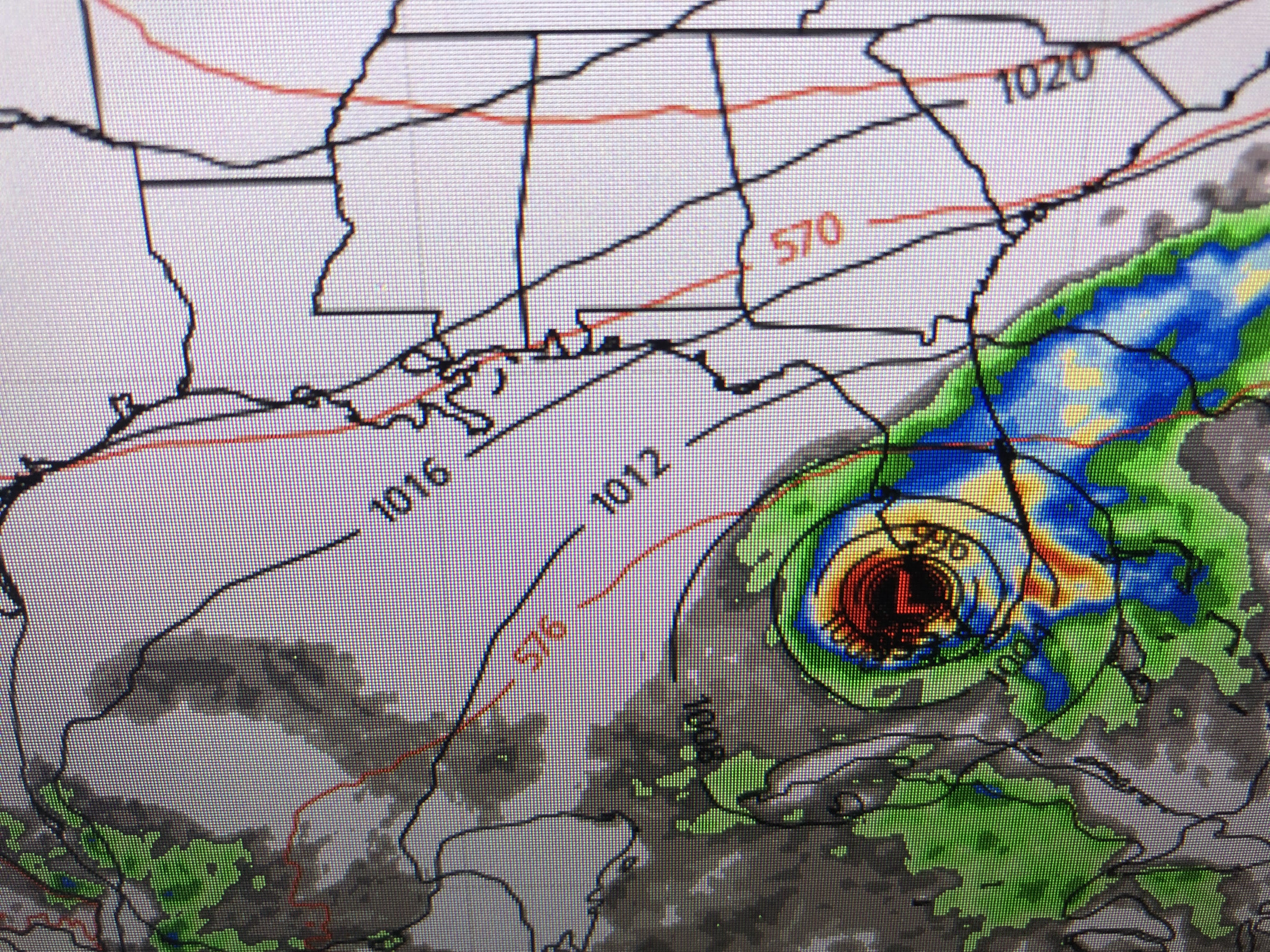
TD 10 is struggling to get better organized due to the strong NE shear created by the outflow from major Hurricane Fiona. Currently the center is exposed, but that should change as we head into the weekend when Fiona will be gone and shear weakens. Yesterday there was a large spread in the model solutions since the starting point was unknown. Not so today.


The spaghetti models are clustered across central and south Florida with the Euro (middle pic) just west of Fort Myers next Wednesday morning. The GFS (bottom pic) is farther to the west at the same time heading the system into the Big Bend area of north Florida. Certainly, it appears this is a Florida storm. Here's the latest NHC track.


It looks like NHC has split the difference between the GFS & the Euro, but they definitely shifted the center line track farther to the west. Take a look at the 10 AM advisory compared to the 4 PM.


The top pic is from 10 AM with the center making landfall over Captiva island west of Ft. Myers. The bottom is shifted 25-30 miles farther to the west now aiming for Sarasota. What I will be looking for is, will this westward trend continue? I'd rather TD 10 (soon to be Ian) stay out of the Gulf and go east of Florida. Could that still happen? Yes, if we see a rapid intensification tomorrow as a stronger storm will turn to the right quicker. So if you have reservations for Disney World next week, don't cancel just yet. If your flight is not until Sunday, wait one more day to allow future model runs to confirm this Florida storm hit. If you're going to the beaches this weekend, you look OK since the storm won't come until later next week. But play attention as any storm that enters the Gulf bears close watching.


In case you're wondering why TD 10 won't become Hermine, look where NHC just named a new Tropical Storm! Not worth mentioning. Back over the U.S., the cool down is coming next week as the circulation around Ian will help drag down the colder air. it's really starting to get chilly over Canada.


We did have a weak front push through over night with lower dew points making today feel a little better. We still topped 90, but the breeze didn't make it feel as hot as yesterday. Look at next week.
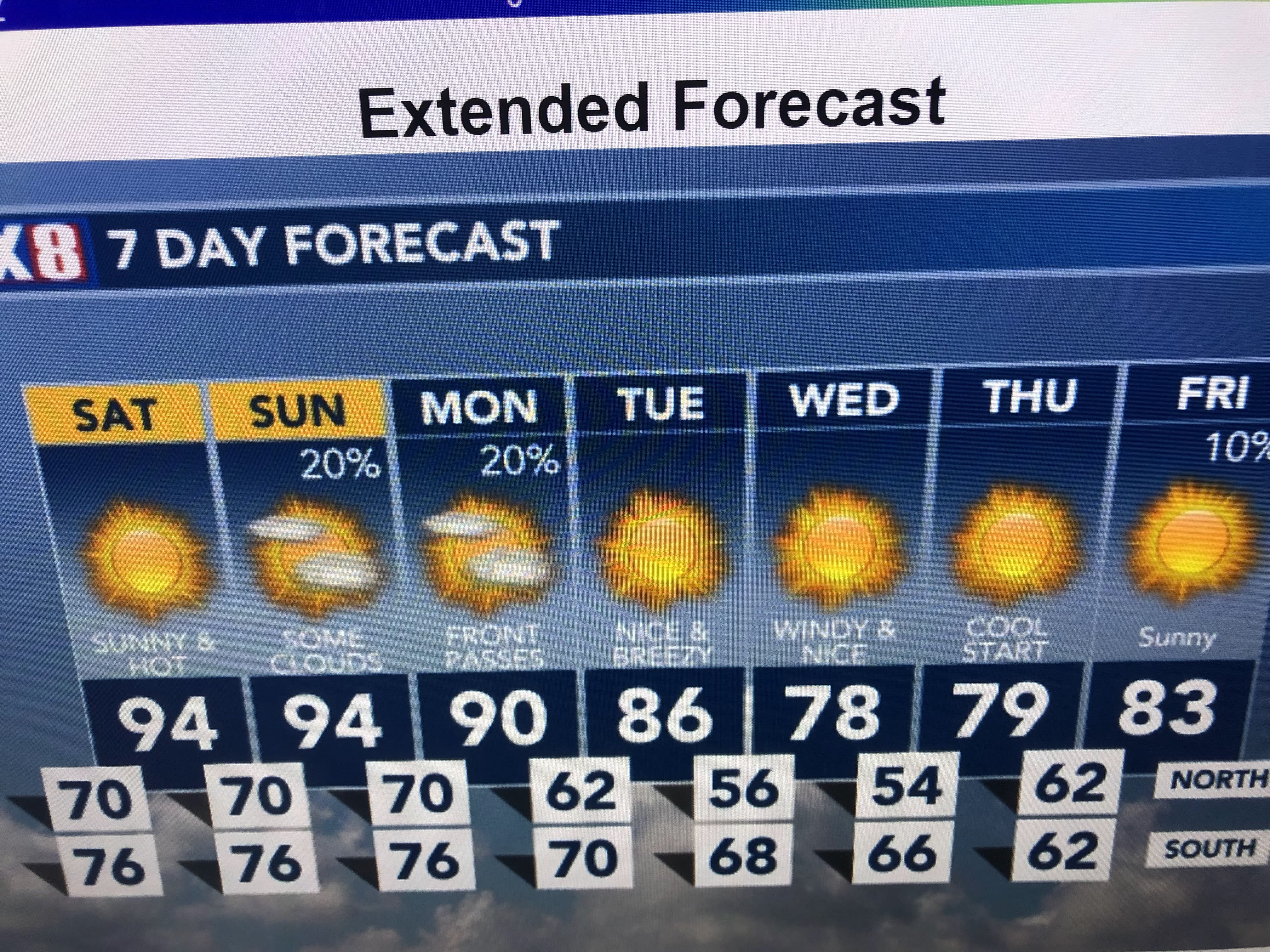


Wow! Dare I say sweater weather at night on the North Shore?!!! Whatever it takes to push the hurricanes away. Come on October. Stay tuned!

No comments:
Post a Comment