


IF you believe in model runs, despite not having a starting point, most are turning 98 L to the east towards Florida. That would be great for Louisiana. However, there is a huge different in solutions between the Euro & the GFS. Let's begin with the Euro.


The top frame is valid for Monday morning with the next Tuesday afternoon clearly bringing the system into south Florida. But now look at the GFS.
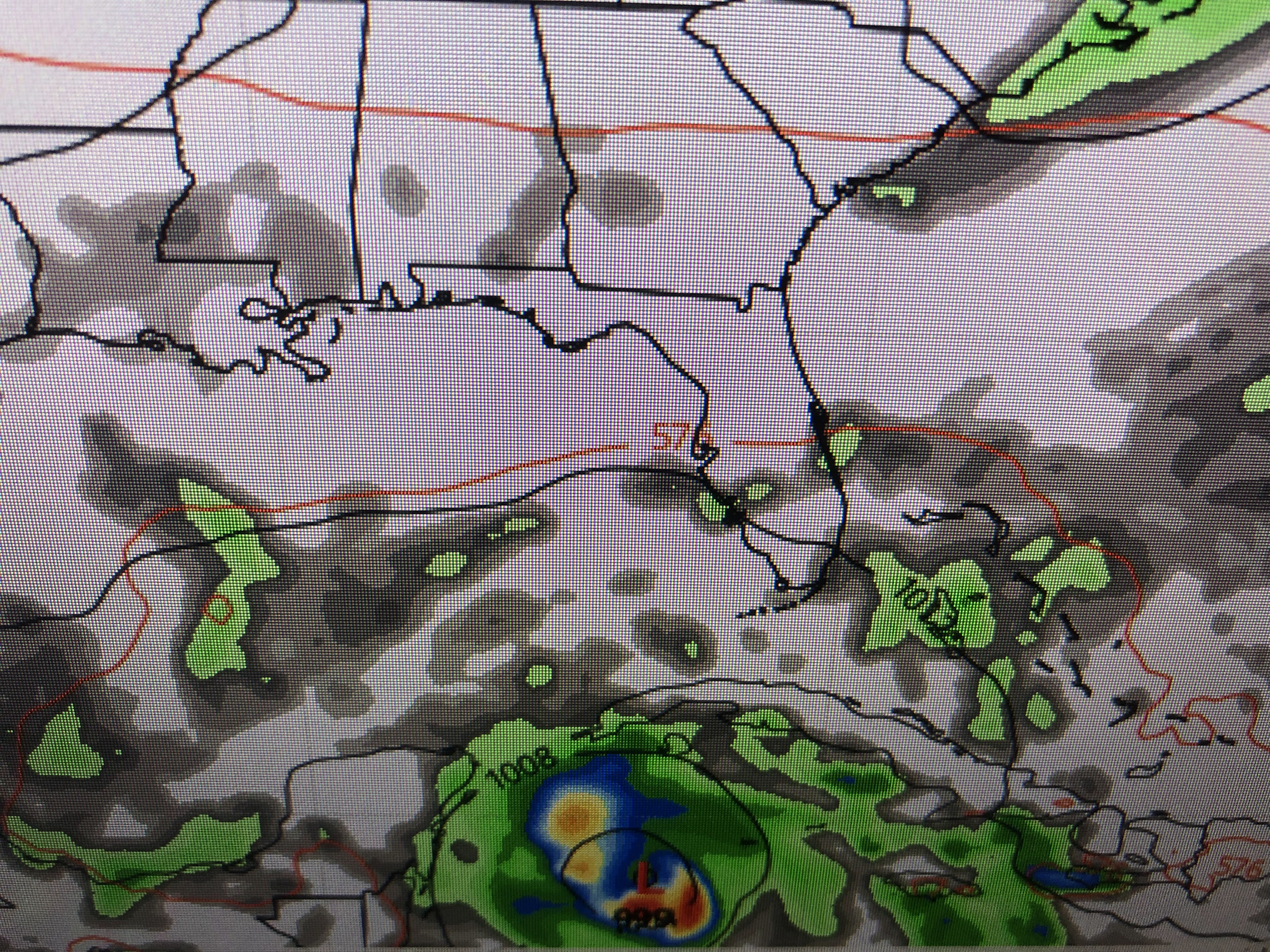


Whoa, what a difference! The top graphic is valid for Monday morning with the next for Tuesday afternoon. While the Euro has the system making landfall in south Florida, the GFS is way farther to the west north of the Yucatan. Take is NOT good for us as it means this storm will come a lots closer. In fact, the next 2 images clearly show a strengthening hurricane over the loop current NEXT Wednesday making landfall early Friday near Pensacola. We would be on the west/weaker side of the storm, but that's way too close for comfort. So what should we watch for and hope for?


Tonight & tomorrow, we want T-Storms to start developing around the center. Why? because a stronger storm/hurricane will turn to the north following the weakness of the upper trough along the East coast. A weaker system will continue to go farther to the west, and the farther to the west before making the turn puts us in greater danger. Zack Fradella had excellent graphics on his morning programs.


The Xs are the possible locations NEXT Wednesday. If the 2 eastern most Xs are correct, it's Florida's storm.. However, if the location north of the Yucatan proves correct (GFS solution), then we will have some impacts late next week. A cold front should push through us Sunday night and tropical systems don't like cold air. So for now we watch & wait. Perhaps you can stock up on some supplies this weekend, but we have many days to get ready IF we need to get ready.


I'm encouraged to see such cold air push down into the lower 48. The heat dome is being squashed down and we should enjoy noticeably cooler air for next week.


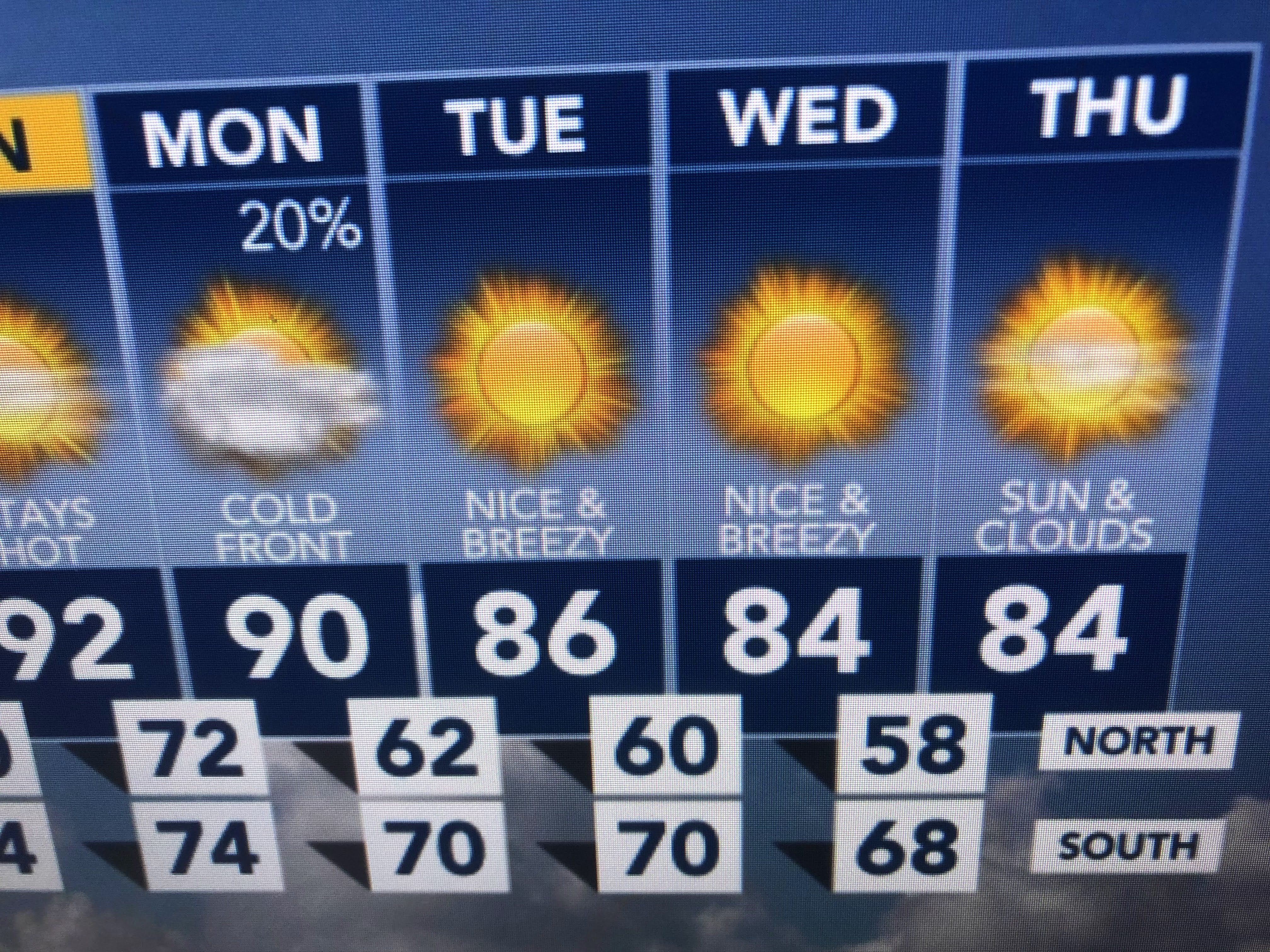
We might have tied the record high of 96, but the cooler air arrives for Monday-Wednesday of next week. Not sure if it will be strong enough to block 98-L from us, but I think it might be enough to deflect it farther to our east. Those of you with travel plans to Florida, keep up with the weather as travel plans may need to be changed. Stay tuned!

2 comments:
Thank you for being there for us. Since I am the first commenter, I must be worrying WAY too early..... Just the thought of a storm gives me a "panic attack" of a lifetime of storms.
Thank you!
Post a Comment