


You can see the areas highlighted with Tropical storm Gaston churning the shipping lanes of the north Atlantic, a small swill in the central south Atlantic, Major Hurricane Fiona leaving the Bahamas & a disorganized cluster of storms along the coast of South America, not to mention an area still on the western African coast. let's focus on the system heading into the Caribbean.


Satellite views sure look innocent enough, so why is everyone getting over hyped about this disturbance? In the words of James Carville, it's the models stupid!


We begin with the European which develops a low on Sunday south of Cuba, brings it across Cuba by Tuesday and into Florida's west coast NEXT Thursday. IF this solution proves reality, we would see little to no impacts. However, the GFS is not as encouraging.


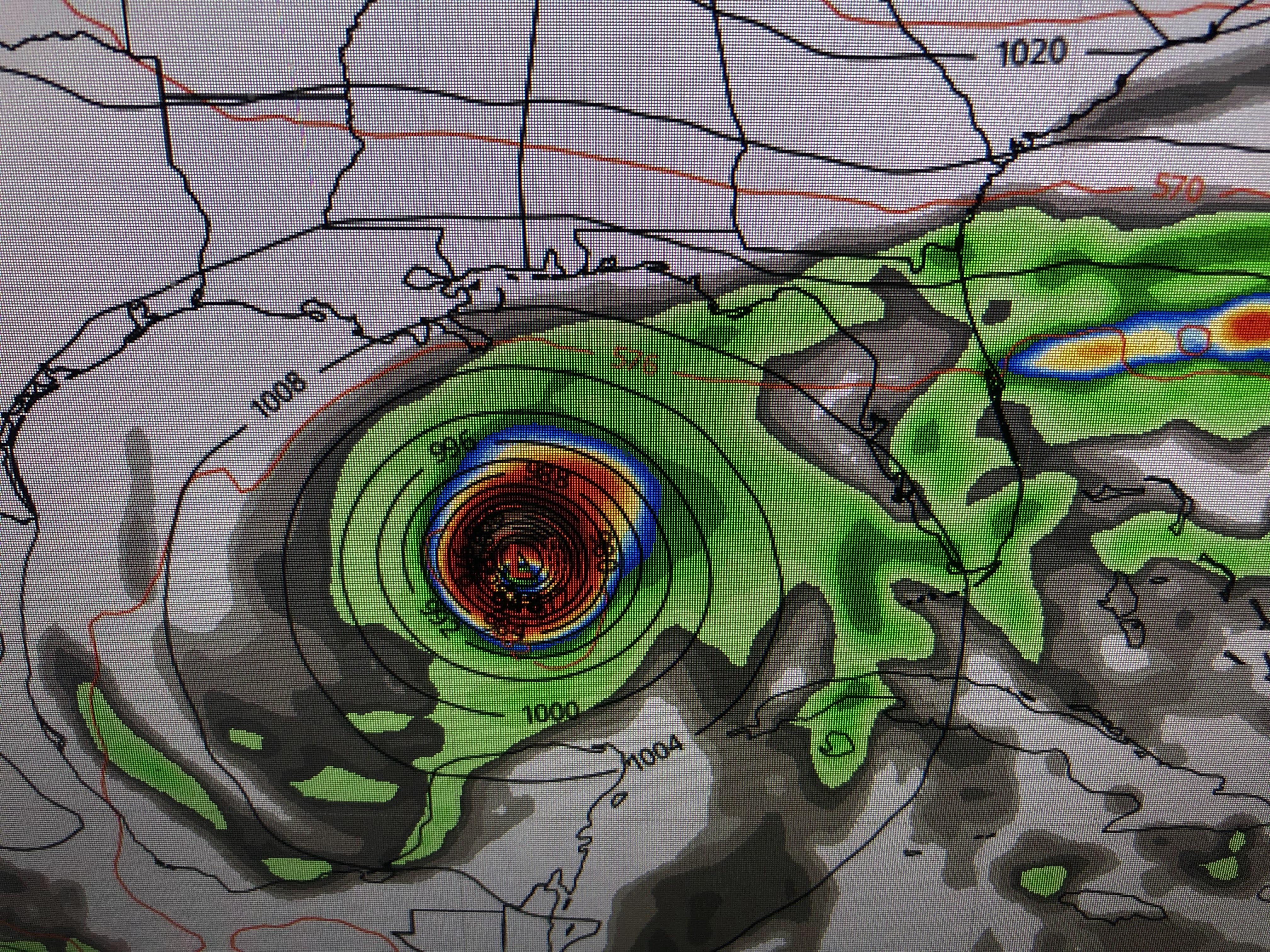

The GFS is much slower & way farther to the west (closer to us) than the Euro. What is concerning is the GFS pretty much sits Invest 98 L (Hermine) down over the Gulf (right over the loop current) for several days. This solution would be terrible for the Florida Panhandle where the brunt of the storm's impacts hit. We would be on the weak side, but it's too close for comfort. Remember, there is NOTHING to track yet. These are only model solutions 7-8 days out. Zack Fradella had these good graphics on his morning program.


The upper heat dome over us now will not be there next week. In fact, an upper trough will bring down a front for Monday & Tuesday. But Invest 98 L (Hermine) is still down in the Caribbean then.


So than cooler airmass will block/protect us early next week. But after that, the upper trough leaves, the surface high shifts off the East coast allowing an avenue for whatever forms to head northward. It's way too soon to know if that means we're in the clear and the storm stays east, or if we need to worry . I'll let you know by Friday, if this is our storm or someone else's. More model runs will likely flip-flop future tracks, but RIGHT NOW, we have nothing to track. A Recon plane is scheduled to investigate this evening.

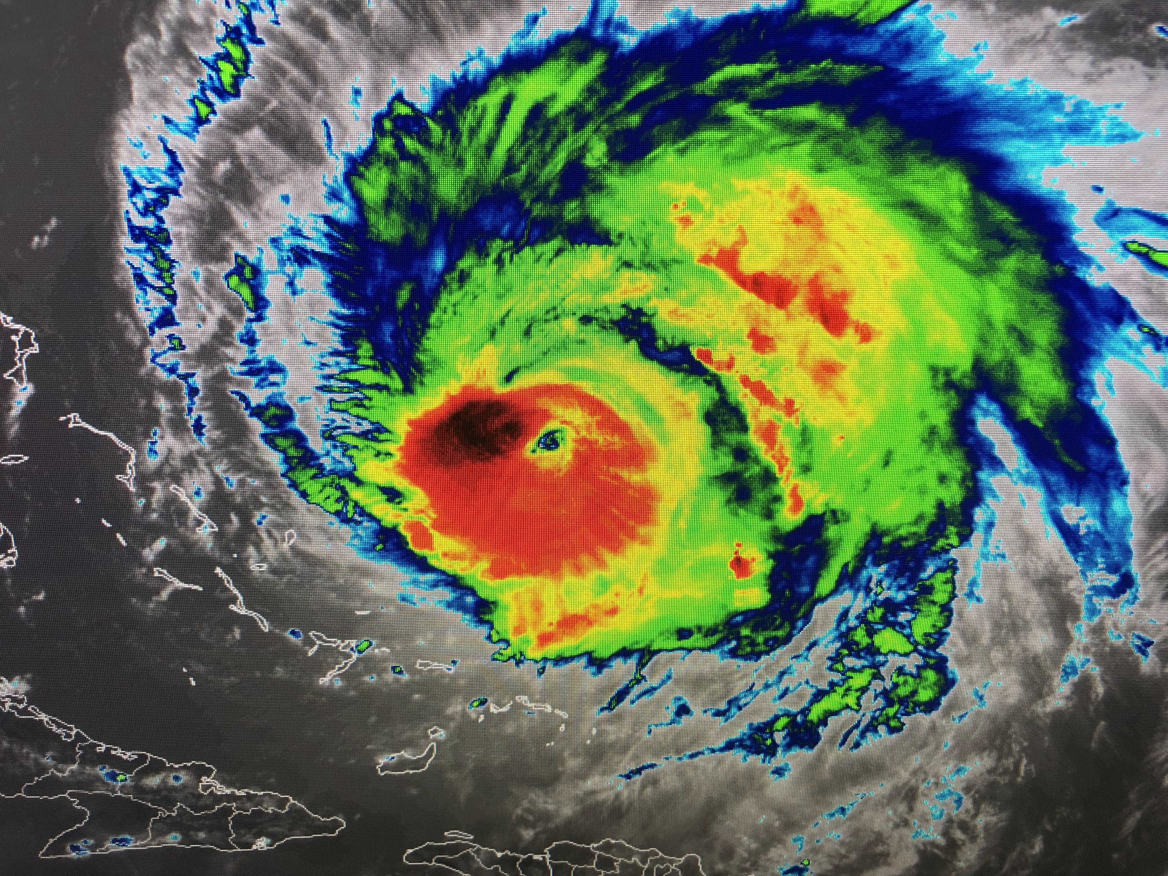

The main tropical story is major Hurricane Fiona, now a Cat. 4 leaving the Bahamas. She will brush by Bermuda tomorrow and head towards Newfoundland well off the East coast. She has that classic donut hole look of a major hurricane.


Back over the U.S., the southern heat dome lingers, but the cold air is coming with 50s & 60 dropping over the central Plains. Note, we still have triple digit heat across Oklahoma , Arkansas into Tennessee.


There is a sharp temperature cooldown behind this next front. It will finally put an end to the heat dome with much cooler air pushing to the Gulf Coast late Sunday.


With no rain around today, we are near a record high. But relief is coming for next week.


Let's hope that front will block any system in the Gulf from coming our way, or delay it down over the Gulf until the next upper trough steers it to our east late next week. Folks having plans for Disney World or the Florida beaches should not cancel yet. Nobody is sure where whatever might form will go. IF it stays weak , it could go into the Yucatan and not get into the Gulf. Or it might not ever organize because of the interaction with South America. IF it gets real organized and strong, it could be picked up and end up east of Florida. So we watch for now. Stay tuned!

1 comment:
Appreciate ya!
Post a Comment