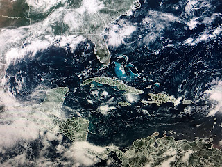
Danielle has weakened slightly and is way out in the Atlantic while the low over the eastern Atlantic is over cooler, stable waters.
So our focus shifts back to the Caribbean & Gulf where there is nothing organizing. What has formed is another boundary over the northern Gulf.
There is no surface front around so I think it;s more a feature in the upper air flow. We have a upper Low over northern Arkansas that is creating a split in the westerly flow coming across Texas. That upper level split creates low level lift triggering numerous clouds and storms.
The benefit is cooler temperatures. Models continue to show deep tropical moisture staying over us so look for more rounds of storms for the next several days. Try to enjoy the holiday weekend despite the wet weather. As I said yesterday, the Tropics are not exploding and no model has any new storms forming for the next 7-10 days. Stay tuned!


No comments:
Post a Comment