

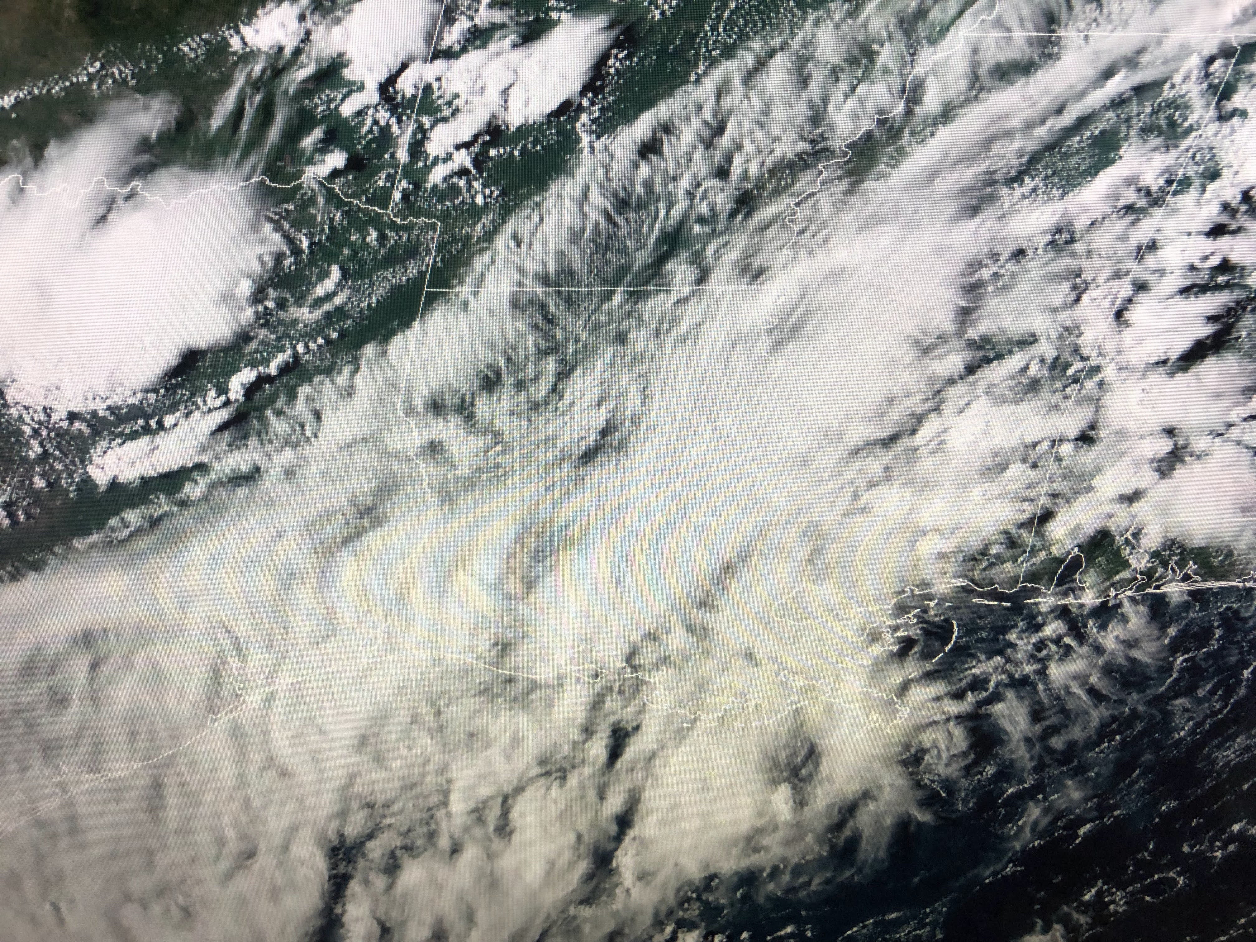


The immediate relief the clouds & rains bring is less hot temperatures. The heaviest rainfall is expected to be just offshore and to our east toward the Florida beaches.

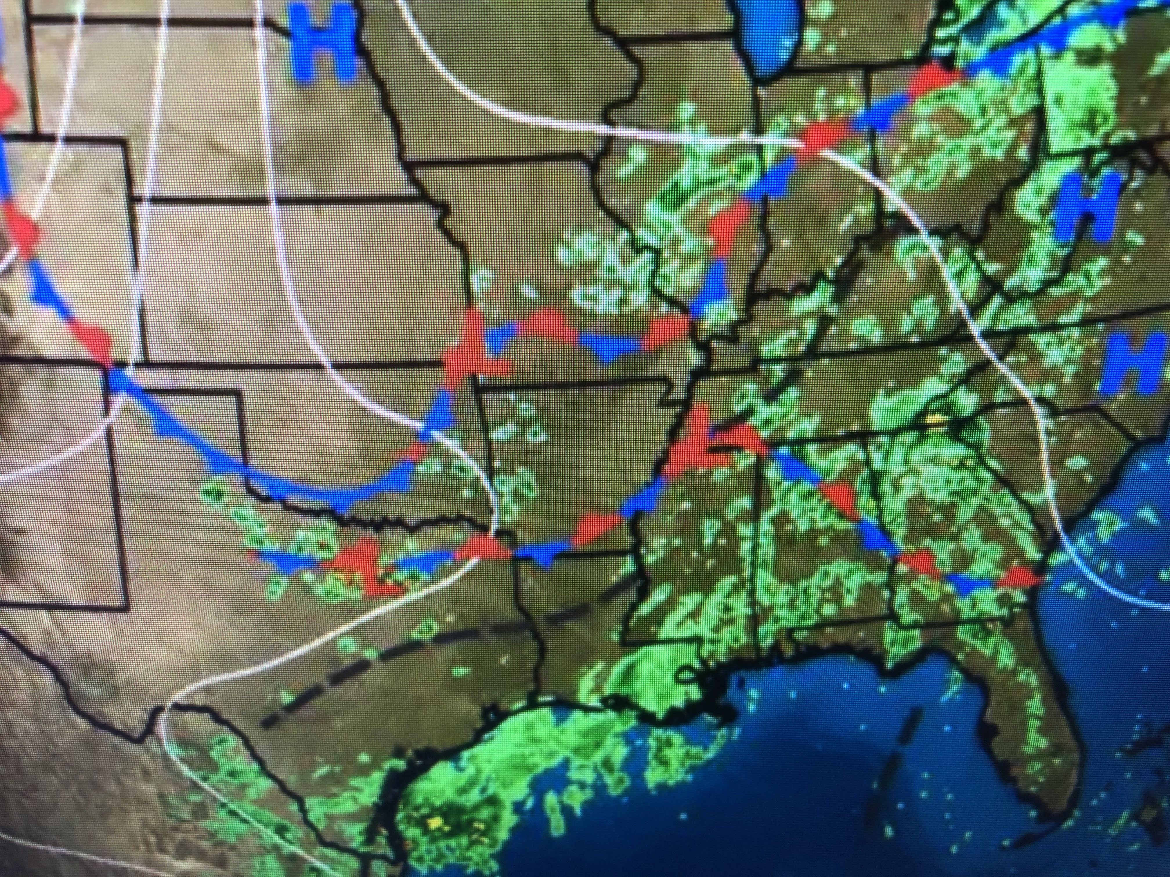


The surface map has no fronts near us so our above normal clouds & showers can be traced to the upper air pattern. Note, dew points(drier air) are lower behind the front to our northwest. It's only a matter of time before those fronts start pushing through us.


Before we can get a real cold front down to us, the upper heat dome over the west has to break down allowing cold air up over northern Canada to come south. Right now, southern Canada is in the mid 80s with the real heat over the desert Southwest.

The Tropics are active, but not exploding as we enter the historically most active week of hurricane season. Hurricane Danielle is heading out into the north Atlantic while another wave moves off of Africa. The main focus is still with Earl north of Puerto Rico.


Tropical Storm Earl is struggling with SW upper wind shear that has exposed the western side of the center. NHC suggests a new center (yellow L) is trying to form farther to the NE. That's partly why they his track well east of Bermuda.

We have another TUTT low south of Cuba that is making for a hostile environment both in the Caribbean and Gulf. Models show no tropical threats for us over the next 7-10 days.

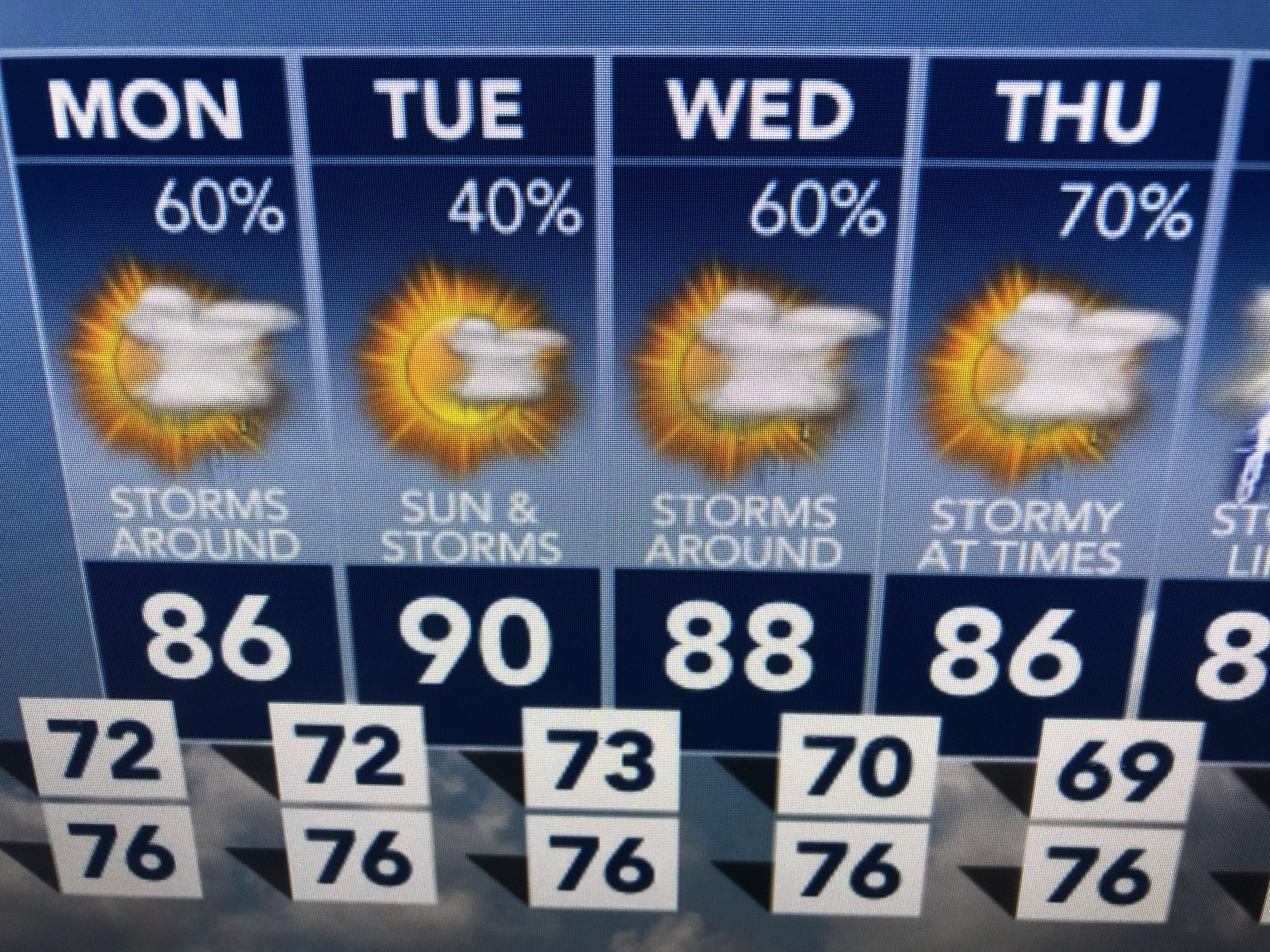
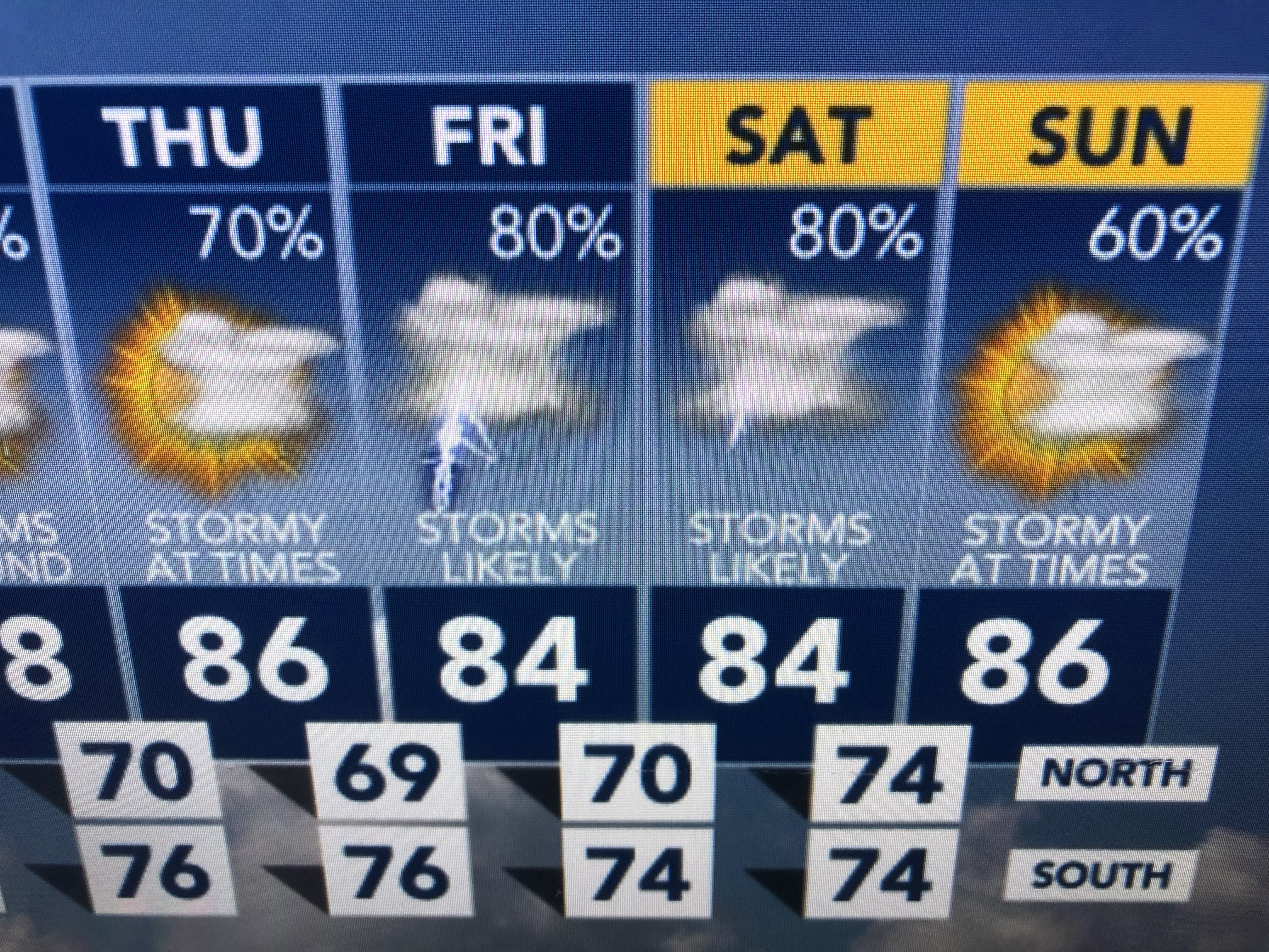
So if you don't mind the wet weather making us less hot, this should be a great week in September. Enjoy Labor Day relaxing with family or friends. Stay tuned!

No comments:
Post a Comment