
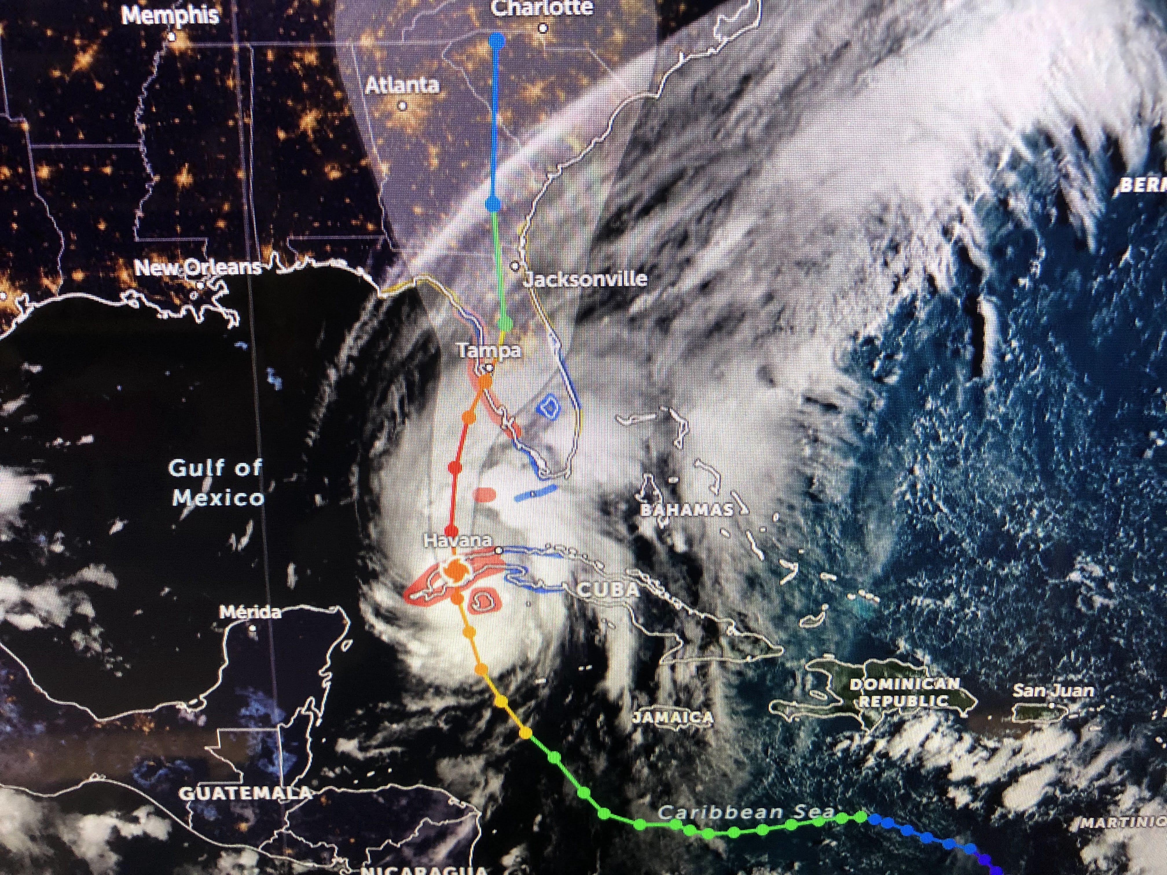


Ian has completed his recurve and is now moving due north. A cold front is pushing off our coast and heading towards Ian. That is our protection as tropical systems do not like cooler & drier air. A bend towards the NE should begin later today. So what does that mean?


The latest NHC track has again shifted slightly to the east and, if that trend continues, Tampa will end up on the weaker side of the storm, meaning less storm surge, but that's all. Unless the eastward trend continues, Tampa will still get into the EYEWALL winds. I grabbed these graphics from Zack Fradella's morning programs on FOX 8.


So the shift to the east means less impacts to St. Pete & Clearwater, but worse impacts to the coast south of Sarasota. Note the gusts to 120+ at Sarasota & Port Charlotte. Even Tampa could see gusts top 100+.

So then the main issue with a slow moving hurricane is drenching rainfall for days. NHC's predicts 15-20"+ (purple shade) with 10-15" amounts around that. Some model have totals approaching 30+" ! The key will be that center line track. What if there's a "wobble" back to the west? How about a wobble to the east. Either way, this will be a serious impact for many and everyone should be fully prepared to endure many days without power.


The cold front is making us feel delightful. Look at the cooler air plunging southward. Birmingham is in the 40s! More importantly, so are the dew points meaning this is very dry air. Our hope is the front reaches Ian and begins the weakening process BEFORE it reach landfall. Right now, NHC believes the turn towards the east brings it to the coast sooner while still a Cat. 3. Time to open those prayer lines for those in Harm's Way. I'll update again after 4. By then we'll have more model runs giving us higher confidence that Ian's greatest impacts will miss Tampa Bay. Unfortunately, those to the south will be hammered. Stay tuned!

No comments:
Post a Comment