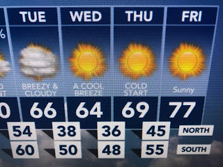
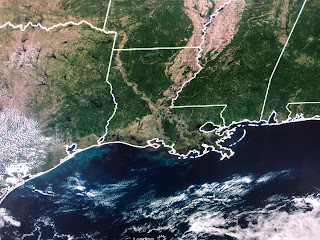
It's not gonna really be THAT chilly, but because this weekend will be so warm, the cool down will be rather extreme. The reason is simple. A deep upper low, with several swirls, is rotating over the Great Lakes. In December we'd call it the "Polar Vortex".
it's even colder farther to the north where for the first time this season, I'm finding below zero in Alaska. Most of Canada is in the 20s & 30s and I grabbed these pics off of Zack Fradella's morning program.
This easily will be the coldest air since last March and the main concern for gardeners will be having their plants deal with the strong, dry north winds. We could have a few showers ahead of the cold front on Monday, but I would make sure you really water all plants BEFORE the front.
But before the front will be some near record warmth. It should be a great weekend for all the Fairs & Festivals around NOLA.
All the clear skies & lack of rain has the River down and the lawns brown. We could use some widespread soaking rains, but I don't see that in sight unless the front triggers some on Monday. Enjoy your weekend outdoors appreciating this kind of weather while our friends up north are shivering and complaining about Winter in mid-October! Stay tuned!


No comments:
Post a Comment