


The Main Development Region (MDR) of the tropical Atlantic still could see a storm or two, but we don't need to worry about any system from out there. If we see anything form in the Caribbean or Gulf, cold fronts and increasing westerly winds will steer any disturbance away from us. Karl is weakening and heading to the south.
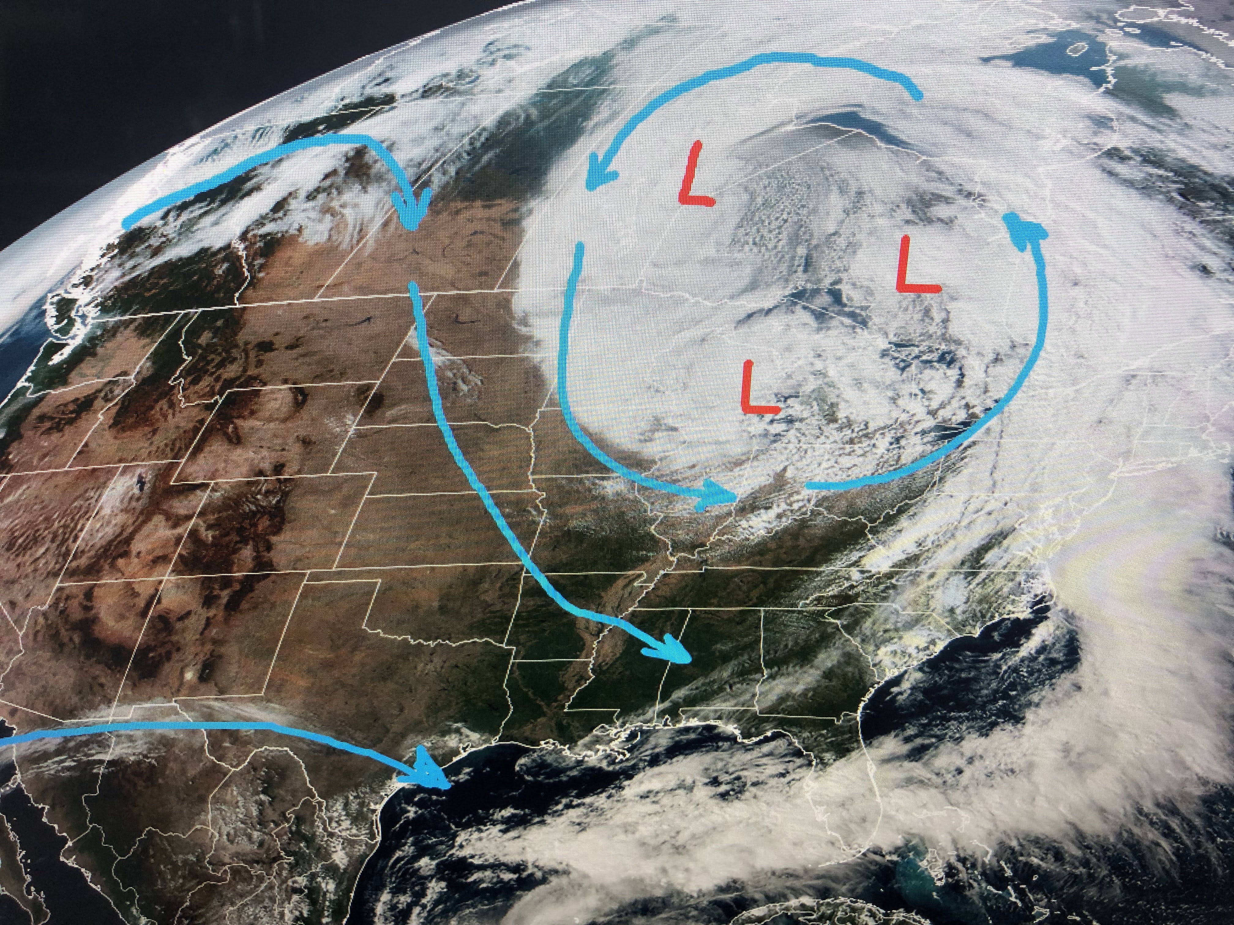


Why, look at the upper winds with a deep low over the Great Lakes. The bottom two graphics are the upper flow with the first being currently and the bottom one for next Tuesday. If that happens next month, look for a major blizzard along the East Coast. With the upper low parked over Buffalo next Tuesday, the flow is straight our of Canada where it's already in the 20s & 30s.


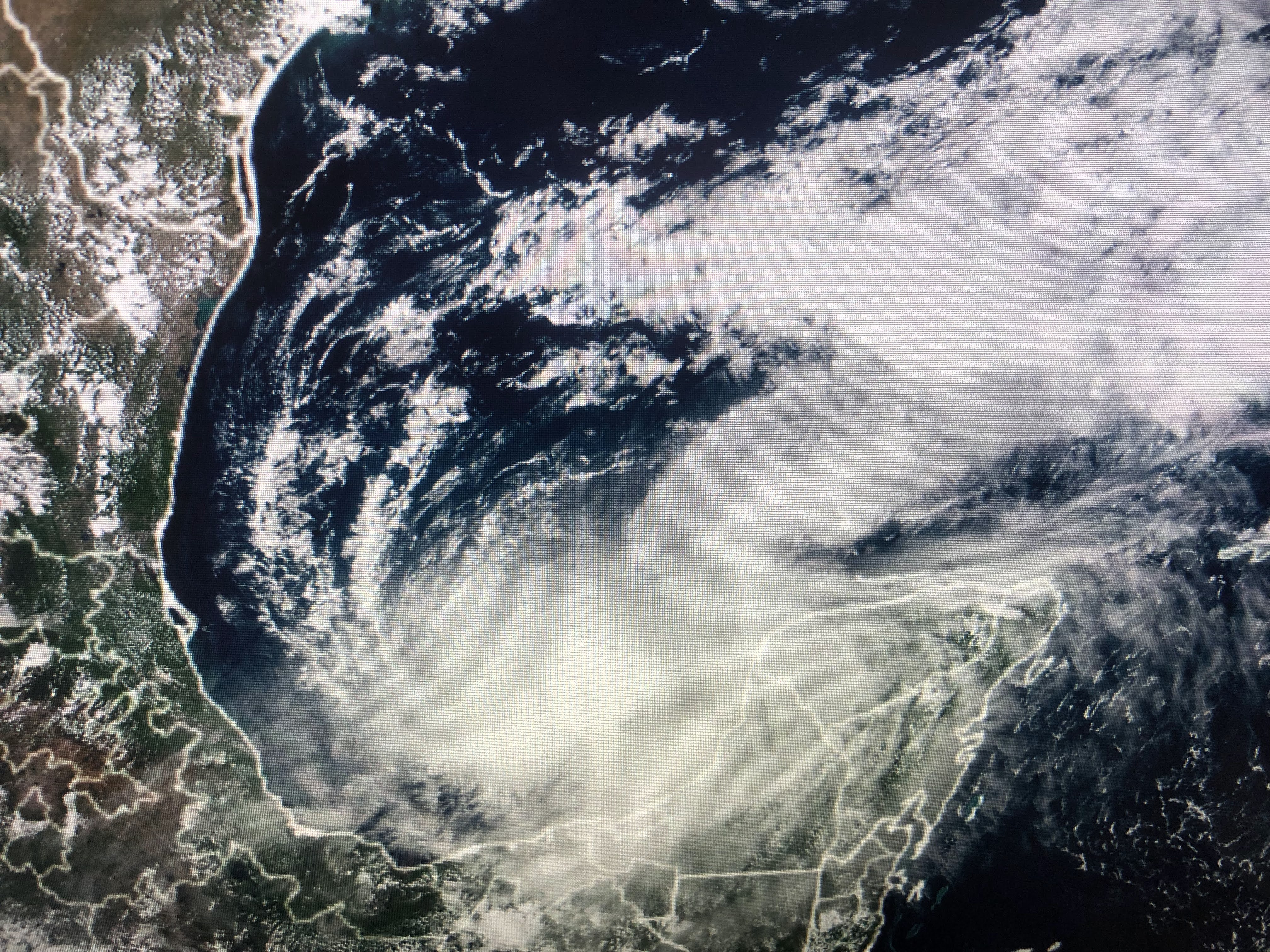
Alaska (top pic) is down into the single digits! It all fits in with Weather Bell Analytics Winter forecast.


That's a general over all forecast, but it might mean we could see several opportunities for the White Stuff here?!!!


The first front came through over night with drier air. The stronger one arrives late next Monday with the REAL chill.
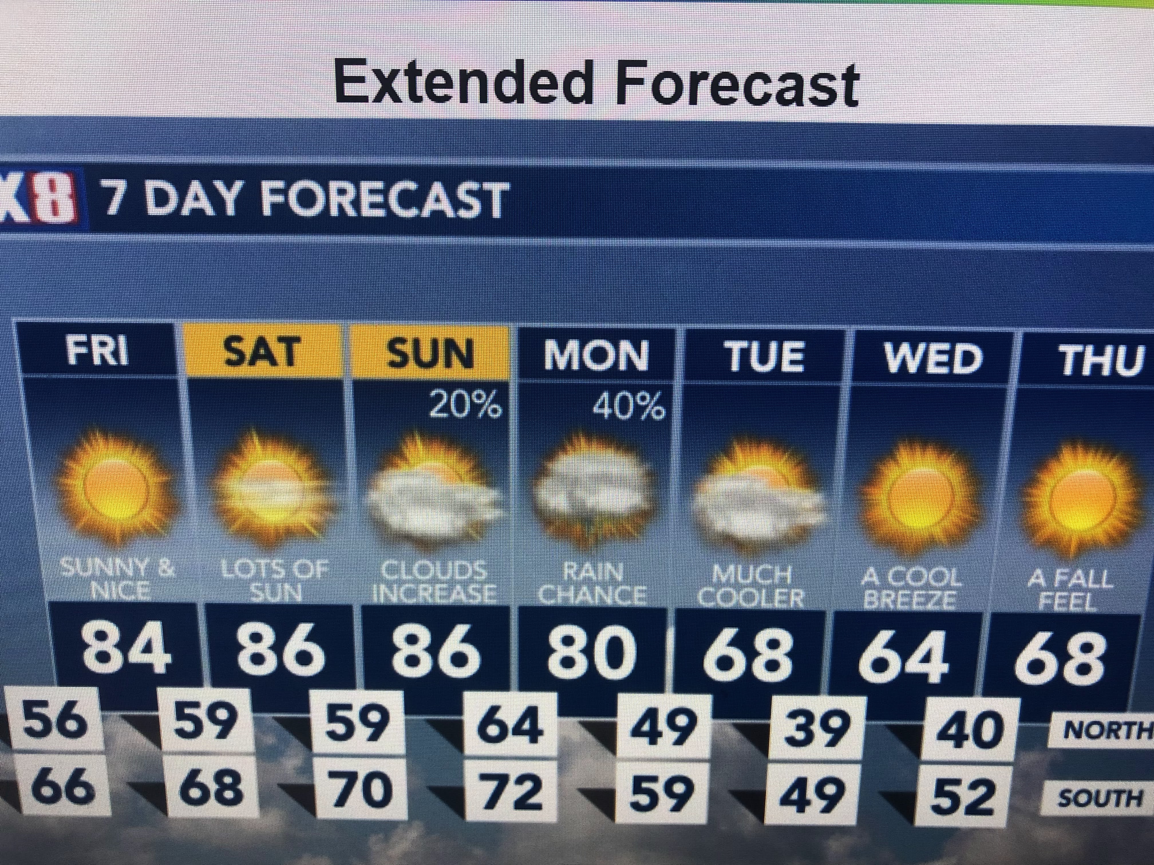

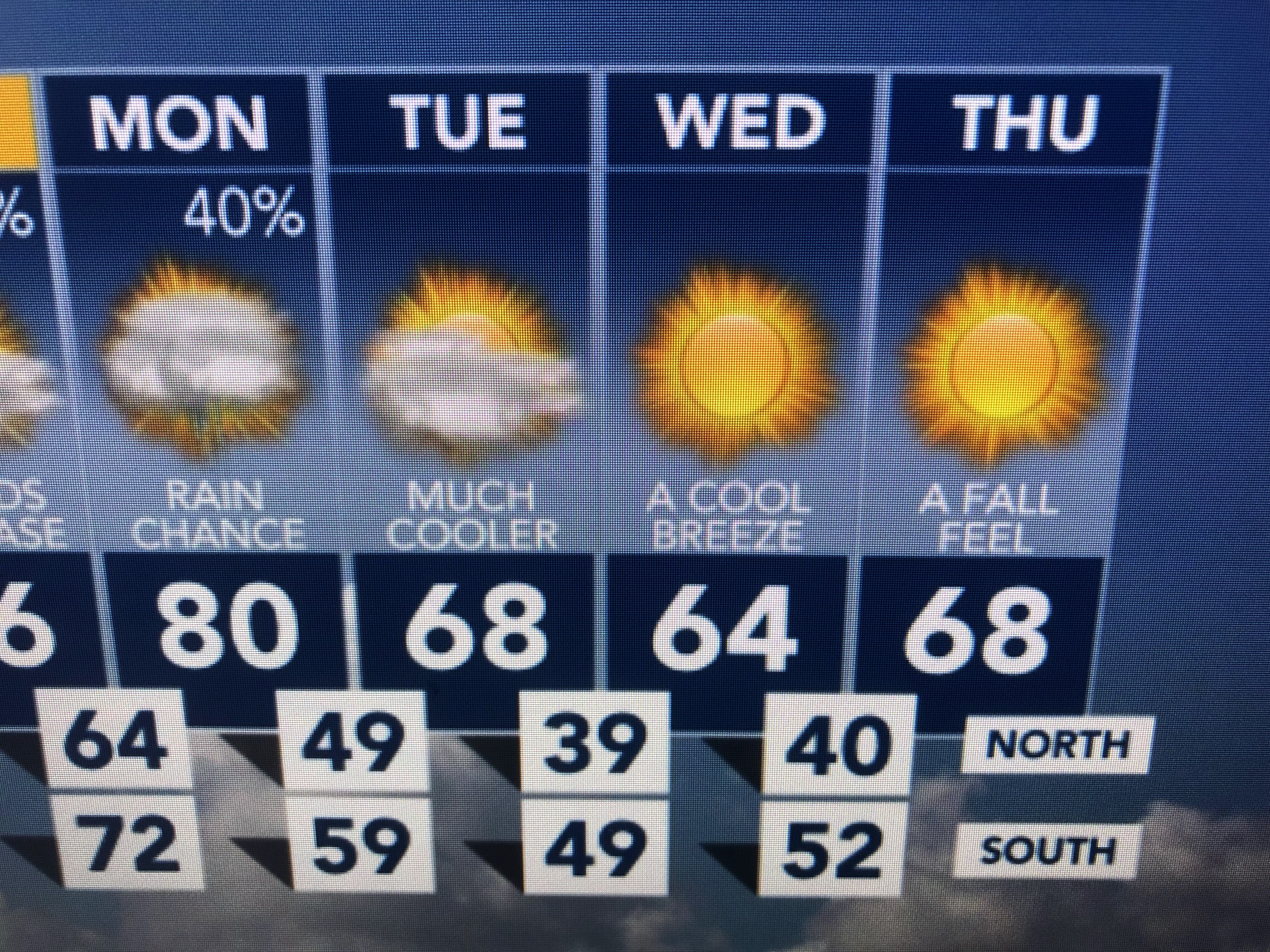
Yep, that's 30s for parts of the far North Shore. Get those coats & jackets ready. Stay tuned!

No comments:
Post a Comment