It's plenty cold over northern Canada & Alaska, but that air can't come southward until there is a dip in the flow.
The widespread cloudiness & showers over the eastern states is due to a slow moving upper system. Note there is no cold air to our west and this week will be another mild to warm one.
This upper low will lift to the NE and the next several days will be rather dull. I think it might be another time to go fishing?!!!
Halloween evening will have no weather problems and this week should see us warm back to 80+.
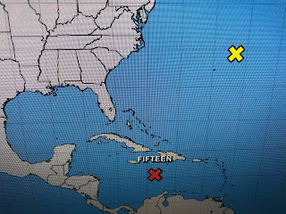
NHC is still watching the Tropics and recon aircraft did find a low level swirl down over the Caribbean. Satellite views indicate there may be several swirls, but NHC has made the northward one PTC # 15. The expect it to become our next named storm (Lisa) and eventually become a hurricane before reaching central America by Wednesday. Enjoy a warm Fall week and I'll post again late Tuesday. Stay tuned!


No comments:
Post a Comment