


Note the difference in appearance between Nicole & Ian (bottom view). NHC still expects Nicole to become a hurricane before landfall, but impacts will be far less than Ian's.


NHC's latest track has changed very little and note how narrow the cone now is. However, look at how wide (orange color) the tropical storm wind field is. So impacts will be felt way away from the center line track. Obviously, those along the coast will receive the greatest impacts with heavy rainfall (4-8") being the greatest threat to inland folks. Power outages will be widespread, but Nicole will not be strong enough to take down the grid and power will be quickly restored once the storm moves northward. Going to WDW this weekend should be OK after tomorrow. Travel will be restricted until the storm passes.


The other big weather news is the train of storms over the Pacific that promises to bring the West Coast some much needed drought relief. The western upper trough has brought them winter-like conditions and that trough will shift eastward for this weekend.. We don't expect the trough to dig/deepen over the eastern states and the core of the cold will stay to our north.


Yesterday I thought the far North Shore might get to freezing this weekend, but today models indicate a Gulf low will form spreading a cold rain back over us for late Monday into Tuesday. Before then, we still have 2 more warm-ish days.


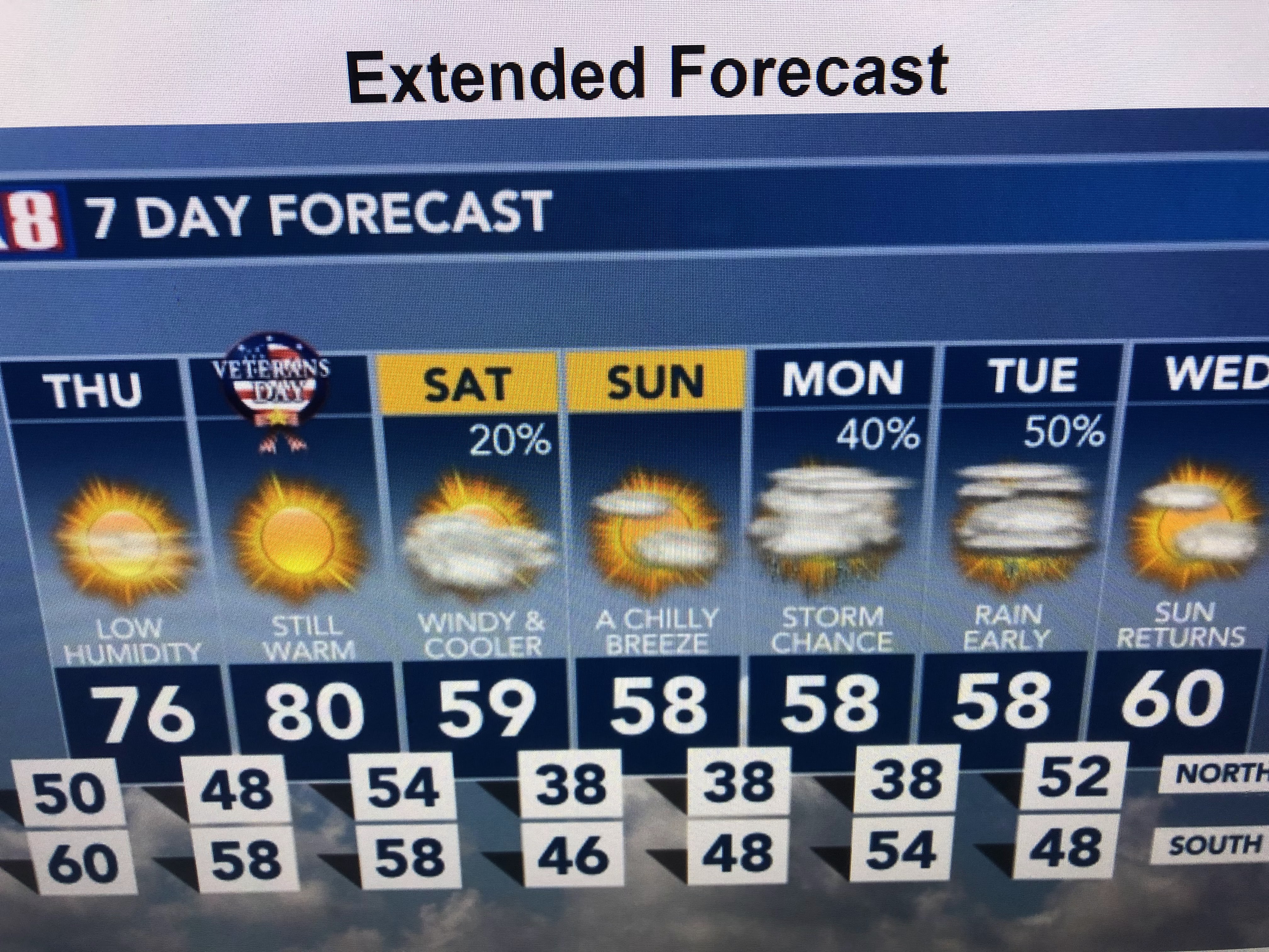
Thursday we're on the dry side of Nicole and Friday's cold front won't arrive until around midnight.


The high thin cirrus we have now are actually the outflow from Nicole. At the surface, dew points have fallen from yesterday's 70+ down into the 40s this afternoon. That is good feeling air and should make for a pleasant Thursday. Get ready for November reality (sweaters/jackets) to return this weekend. Stay tuned!

No comments:
Post a Comment