The bitter cold (30-35 below) air is still up over Canada and I expect it'll move back down into the lower 48 after Jan. 10th. So all of those states severely impacted by last week's cold will get a welcomed reprieve to help melt down some of the deep snow piles.
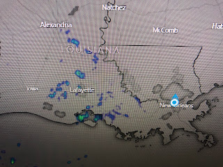
You can clearly see the warm air surging back northward off the Gulf as the center of the cold surface high drifts off the Carolinas.
Our low single digit dew points are gone as low level moisture streams northward. I suspect we'll start seeing some widespread dense fog later tonight, or certainly by Thursday night.
The main rain threat will come Friday morning into the afternoon as an upper disturbance approaches. Since it will stay far to our north, we don't expect severe weather, but we could see 1-2"+ rain totals.
Hannah Gard detailed the timing during her 4 PM broadcast. If all works correctly, New Year's Eve should be dry for fireworks.
Finally, not to make light of the tragic storm of last week, I found these two contrasting pictures.
Note the feet of snow on top of the van while someone who lives way down South also measures in feet, but it's not snow but sunshine. Stay tuned!


No comments:
Post a Comment