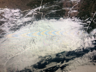
It appears the North Shore will have more rain than south of Lake P. This is all part of a upper pattern shift that could bring down some Arctic air for NEXT weekend.
The change has already happened along the West coast as a ridge has developed turning off for now the Atmospheric rivers than have drenched them for 3 weeks. The upper trough has moved over the Rockies and that means we need to pay attention to see if a trough develops over the eastern states.
Right now the super cold (30-40 below) air is trapped over northern Canada, but look at the upper pattern predicted for next weekend.
The top graphic is for tomorrow morning with the next valid one week later. Wow, not exactly a polar vortex, but certainly a pattern that brings the frigid air over the Great Lakes. If it's a little deeper, we could see another freeze threat here?
in the short term, the upper disturbance coming out of the Rockies will trigger our rain chances here on Saturday with a break coming for Sunday PM into Monday. Another upper disturbance will approach on Tuesday and it could bring us a severe weather threat if we get into the warm air sector.
Tuesday will be the only day above normal as we definitely are trending towards a colder overall pattern. You cold air geeks need to hope the Arctic Blast pushes into the Gulf next weekend and then a Gulf low develops throwing moisture back over us.
Could we make a snowman like my Grandson (Ethan) did 2 years ago in Oklahoma? Nah, but...
Do you remember Jan. 17, 2018? That's the last time Bailey was able to play in the snow. Keep the faith Gang, Winter is far from over. Stay tuned!


No comments:
Post a Comment