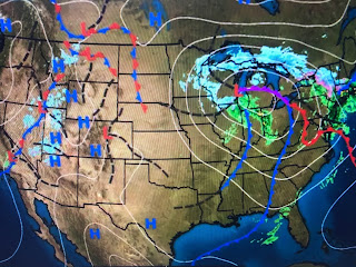
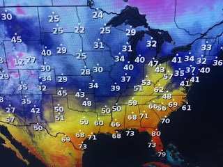
No super cold Arctic air is around, but say goodbye to the 75-80 degree Spring preview for much of this month.
The deep low up near Green Bay doesn't have much cold air with it, consequently the precipitation is falling mainly as rain. Friday may start out with some filtered sunshine, but clouds will be on the increase with a cold rain breaking out after dark.
One low will streak by late Saturday into Sunday with a stronger one arriving on Tuesday. IF we get into the warm air sector, we may have to be on the watch for severe weather. Finally, here's some stuff you won't see on our local channels.
What the heck are those streaks down over the Gulf sthte LA/MS coast? My guess those are airplane contrails (condensation Trails). Notice we don't have any around us as the drier air has moved in.
And what about those Atmospheric Rivers out west? California is getting a break right now, but more rain could be coming. I'll be watching to see if the storms over the Pacific curve northward towards Alaska. That would buckle the Jet Stream and bring Arctic air back our way by the end of next week. However, signs right now indicate the lows will keep moving into the West coast bringing them rain and spreading milder Pacific air over most of the nation. Regardless, look at the drought monitor for the past 3 weeks.
California no longer has any reds (Extreme) and that's if no more rain falls. However, that's the short term drought. Most reservoirs are no where full and could use more rain. We don't need the rain here, but more is coming. Boo
In fact, no area east of the Mississippi River has any reds. It's the central Plains that needs the moisture. Stay tuned!


No comments:
Post a Comment