The top picture is my son's (Rob) house in Longmont before the snow yesterday. The next was this morning after 6-8"+ of the white stuff. Looks nice, except he has to shovel out the drive to get to work.
The top two graphics are where the upper low is today. Look how the models keep those lows coming. The top graphic is valid for Saturday morning with the middle valid for Tuesday. With a front stalled along the northern Gulf coast, those disturbances will trigger a cold overrunning rain shield for us.
The bottom graphic is valid for 10 days from now showing a deep "Polar Vortex" dropping down from Canada. If that proves reality and continues to deepen along the East Coast, we'll have to worry about another hard freeze coming the first week in February. We have many days to watch the situation evolve.
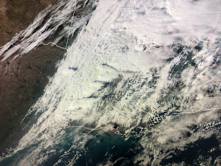
In the short term, a cold front will bring some showers after midnight, but there is very little cold air right behind it. The severe threat appears to be staying well north of us as the SPC's Tornado Watches indicate.
You will notice a different feel to the air tomorrow as dew points fall from the 60s into the 20s & 30s.
As you can see, the highest rain chances occur after midnight and are gone by daybreak.
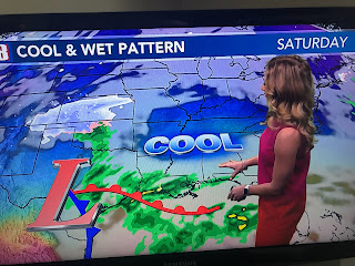
As Hannah Gard showed on her noon program, we'll have several rain opportunities coming into next week. The difference will be the much colder temperatures.
So all you cold air geeks, get those sweaters & heavy coats ready as our Spring preview is ending. No snow yet, but if the model is correct on that Polar Vortex, who knows for later this month! Stay tuned!


No comments:
Post a Comment