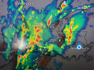
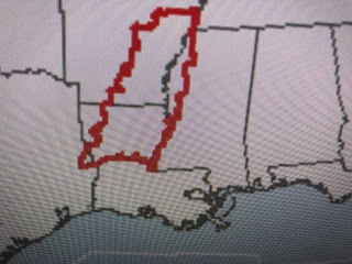
So what is causing this severe potential? There are several factors at work here. We begin at the surface where we see a surge of low level moisture/dew points ahead of the front.
Add in to this mix another upper level disturbance that has dipped into Texas & Oklahoma. This is causing an upper split in the jet streams right where SPC has outlined the highest severe threat (green circle). That split will move across us tonight.
Unfortunately, there will not be any rapid clearing behind this front as another strong upper system now in Montana dives southward. That will keep the surface front stalled just to our east with waves of moisture moving up along it. It will take until Saturday afternoon for that disturbance to get to our east resulting in clearing skies for Sunday.
Note how much colder it is to our west. This will be a return to heavy coats this weekend. In the short term, several lines of heavy storms will move across us this evening. Have your FOX 8 Weather App updated and ready to alert you in case warnings are issues.
There is only one tornado watch for north LA/MS/AR right now but that will be extended eastward shortly. Bruce Katz, assisted by Hannah Gard, will interrupt regular programming if warnings are issued.
This is a drastic weather change coming as we go from our Spring preview back into later Winter cold. The North Shore will see freezes with the South Shore dipping into the 30s. I will let you know what and when I'll be moving my plants back into my He-Shed in future posts. Pay attention tonight for the possible severe weather. Stay tuned!


No comments:
Post a Comment