


Now let's move on to Tropical Storm Bret that has strengthen over the Atlantic. It's about 4 weeks early to be having systems come off of Africa, but satellite views captured three this afternoon.


On the third system coming off the African coast, I zoomed in (bottom view) to see the first signs of the Saharan dust (SAL Layer) heading into the eastern Atlantic. Increasing dust should limit future development of that 3rd system.


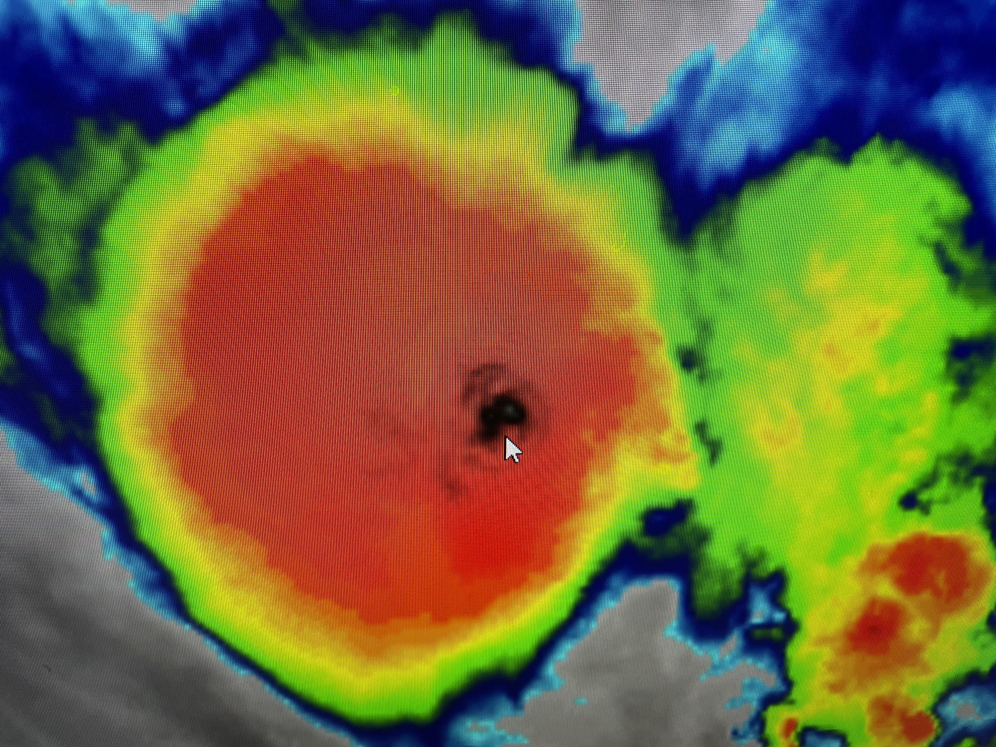
Focusing on Bret reveals a burst of storms right around the center where Recon aircraft found flight level winds greater than hurricane force. NHC has increased surface winds to 65 mph and I would not be surprised to see Bret briefly pop to hurricane strength later tonight. The bottom view (arrow) indicates where a small eye is trying to form. NHC still believes Bret will NOT become a hurricane as it encounters stronger westerly wind shear as it moves farther to the west.


The NHC official forecast takes Bret into the central Caribbean where it is forecasted to dissipate as it moves south of Jamaica. Closer to home, the upper pattern continues stalled around an upper heat dome to our west & an upper cold low to our east.


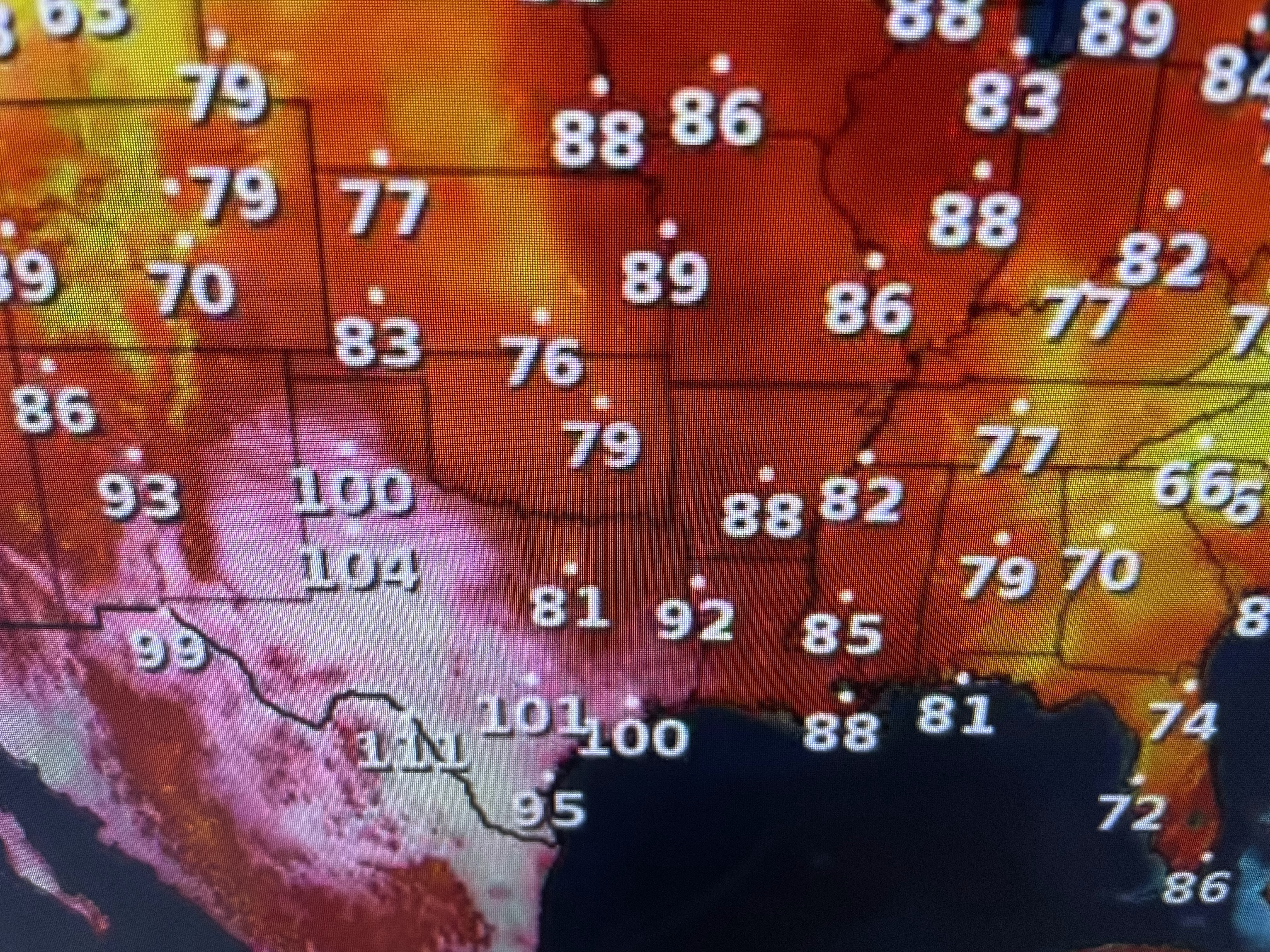

Houston has hit 100+ with the core of the heat over the Rio Grande basin. There is a weak moisture boundary just to our south that shows up on satellite views.


Since most of us are dry, temps are back to 90+, unlikely yesterday afternoon's cooldown with storms.


If you gather anything from the 7 day forecast, it's this. The next 2 days will have higher rain chances with a heat wave returning late this weekend into next week. Boo! Finally,


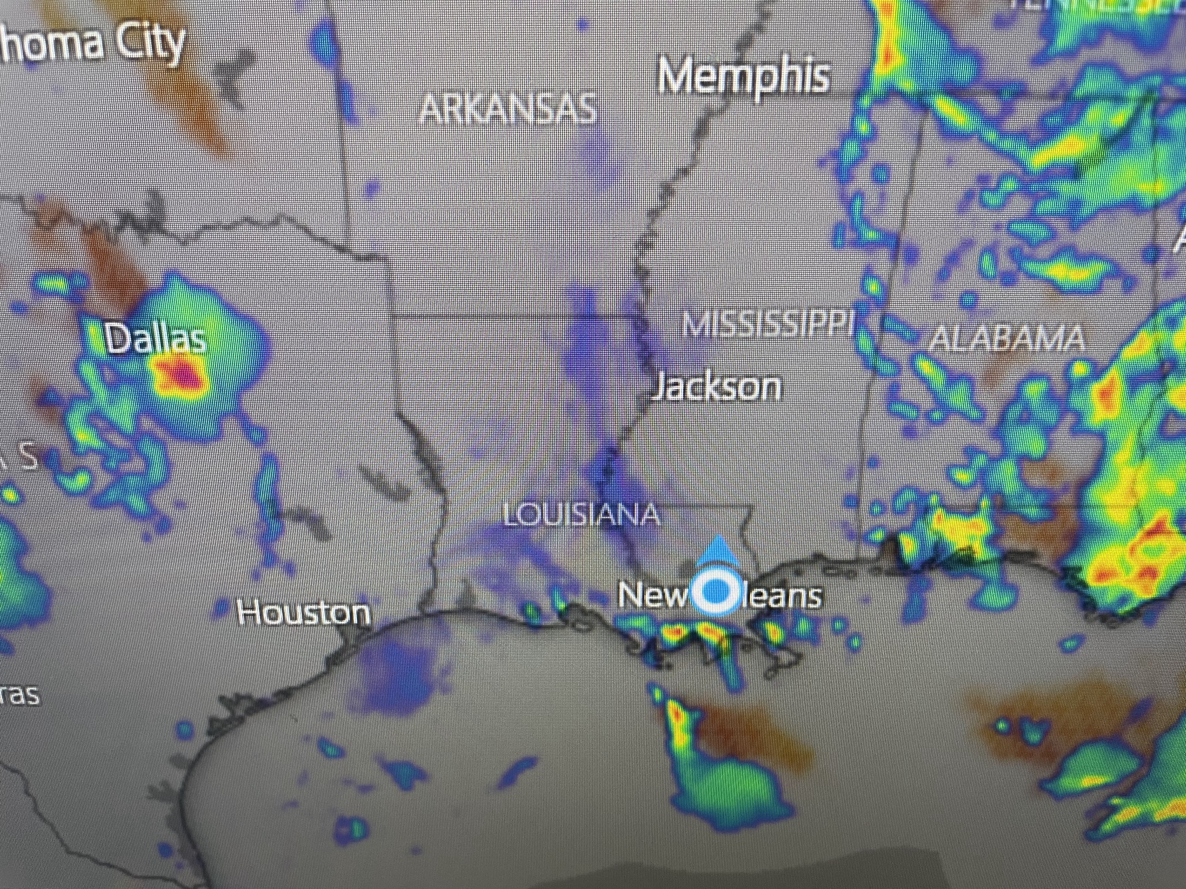
I've mentioned this several posts ago. The lower Mississippi River has dropped drastically as there has been little widespread rainfall to the north. In addition, the many cuts in the Mississippi River levees south of New Orleans has weakened the River's flow allowing a salt water wedge to move up the river. This is affecting the drinking water south of Empire and will likely require the Army Corps of Engineers to construct an under water sill later this summer. Will October arrive soon enough? Stay tuned!

No comments:
Post a Comment