Watching Zack Fradella this morning before I went to play golf, he showed upper air graphics that indicated cooling relief will arrive maybe as soon as Tuesday as the upper high shifts westward and the upper low drifts our way from the NE. That should mean increasing rain chances and less hot temperatures.
As the upper low drifts over us, we could go from being very dry to too wet heading into next weekend. June, historically, is our wettest month, but the first 2 weeks so far have been way below average/normal.
If you really want cooler air, you have to journey north of the cold front in Kentucky where it's much drier/lower dew points.
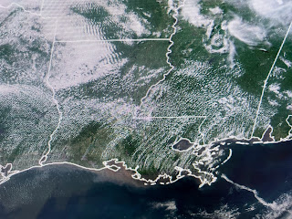
After a cluster of early AM storms raced away, we're seeing lots of sunshine & temps in the low to mid 90s. It's dew points 75-80+ that's making the heat feel much worse.
FYI, the rain chances for late next week could be much higher than 60% coverage if the upper low gets to our west. But some cooling relief is coming. Finally,
NHC has upped the chances for development (based on computer models) of a wave coming off Africa to 60%. Look for our next named storm (Bret) sometime during the week, but as satellite views today indicate nothing is there yet. Enjoy your weekend & Happy Father's Day to all the Dads. Go visit Pops if he's still living. Stay tuned!


No comments:
Post a Comment