


The op satellite view was from after daybreak when you could see the shadows (dark areas) created by the taller T-Storms. The radar views are from 2,3 & 4 PM as those storms marched across Lake P. They quickly dissipated leaving clear skies by 5 PM.


Most of the Great Lakes & Northeast remain well below normal/average as upper low dominate most of the country.


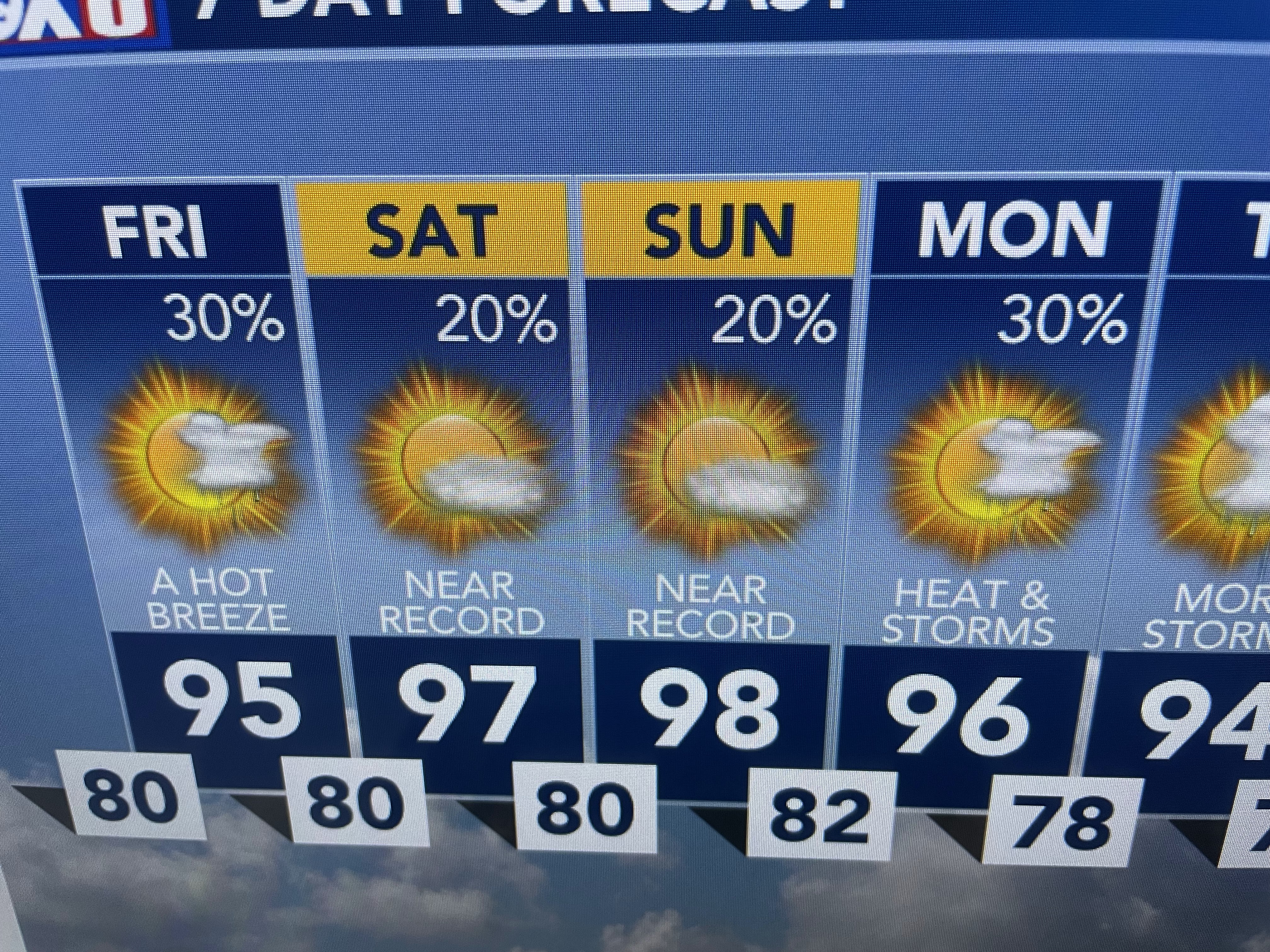
I just don't see the upper high down over the Gulf & Mexico building over us as NWS indicates. In fact, they have issued an Excessive Heat Watch for Friday.


As long as we have such brisk winds, I don't see where this heat feels that bad. Take away the winds & increase the temps to 97-100, sure, but that is not happening the past few days. Remember, that is only my opinion and we all deal with heat differently.


I agree with the less hot temperatures for next week, but that should mean we have higher rain coverage. Again, the 7 day in the summer is almost useless. Finally,


NHC is ignoring the GFS once again developing a system coming out of the Caribbean for late next week. Instead they are focusing on where water temperatures are way above average out in the Tropical Atlantic. Models suggest a wave coming off of Africa will become organized become our next named storms. So far out with nothing there yet? C'mon, don't make us worry. Stay tuned!

No comments:
Post a Comment