


So, from now until the middle of September, unless we have our daily T-Storms, we'll see the heat index flirt with 105. I've mentioned in pasts posts, until or unless the upper high builds right over us, the extreme heat (95+) will stay to our west. Let's look at the current upper air flow.


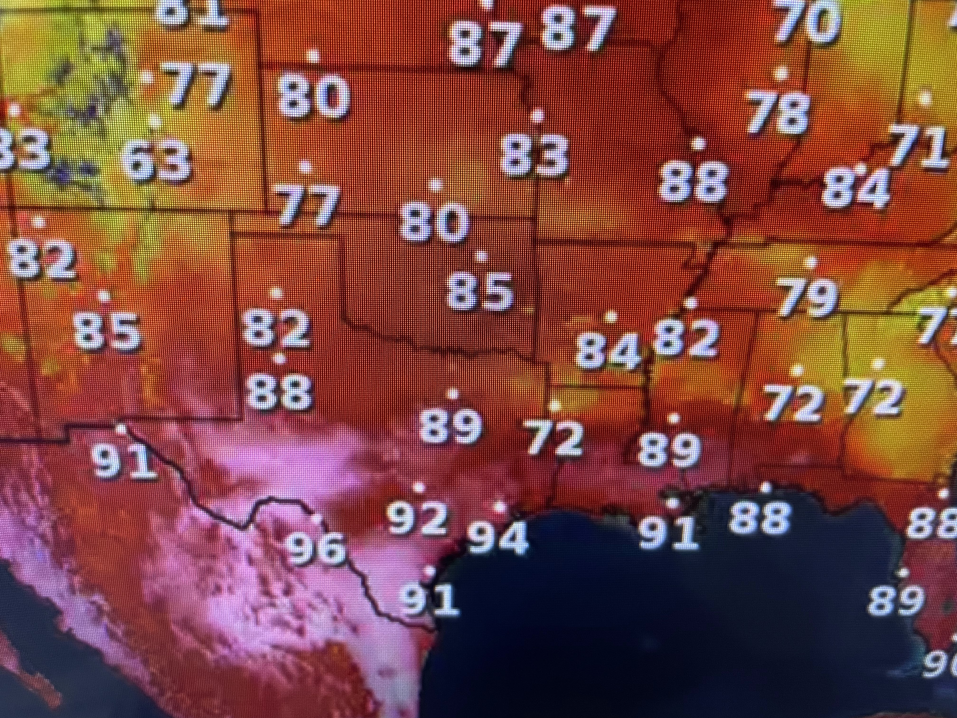
The center of the upper high has shifted slightly eastward, but not northward. Extreme heat means 100+ back over Texas and that is not happening. Computer guidance indicates the east coast trough will again deepen over the weekend with the upper high building northward over Texas & Oklahoma. To me, that means the core of the heat stays to our west. That is not what the FOX 8 Weather Team is calling for.


They have us flirting with 100 for this weekend. Whatever, it will be hot, but it's not like this hasn't happened in past Junes. In fact, Bruce showed us a graphic yesterday that June 2022 was the hottest ever, but then July & August were less hot due to more showers.


The satellite view pretty well defines where that stalled front is located. Several large tornadoes have been sighted across Georgia as other strong storms rumble across north LA/MS.


That boundary should remain well to our north on Thursday before shifting back to the south for Friday & Saturday. So I don't mean to minimize the heat danger, only to point out it will only get worse (hotter) as we get into July & August & the surface winds will not be as strong. Finally,

The fires up in Canada are still going. With the flow around the upper trough over the Great Lakes, that smoke is returning back over the northern states. Bottom line, many places need rain, even here. The lower Mississippi River basin is seeing very low river levels. That will be the next news story (river shipping traffic) coming in the next few weeks. Stay tuned!

No comments:
Post a Comment