


This morning's T-Storms south of the city have pushed farther offshore with the heaviest heading towards Florida. The first cluster of storms in Oklahoma & Texas will move into Louisiana tonight and could bring some early showers on Saturday. The second cluster back over west Texas could trigger some late PM storms here on Saturday. But look what happens after that.


The top graphic has the current set up with the center of the upper high over the Rio Grande and us under a 'ring of fire" pattern with the upper low to the northeast. As Amber Wheeler showed us at 4 PM, the center of the high builds back over us for next week as the upper low (cold pool aloft) leaves. That should result in near zero rain chances and record highs approaching 100 degrees.


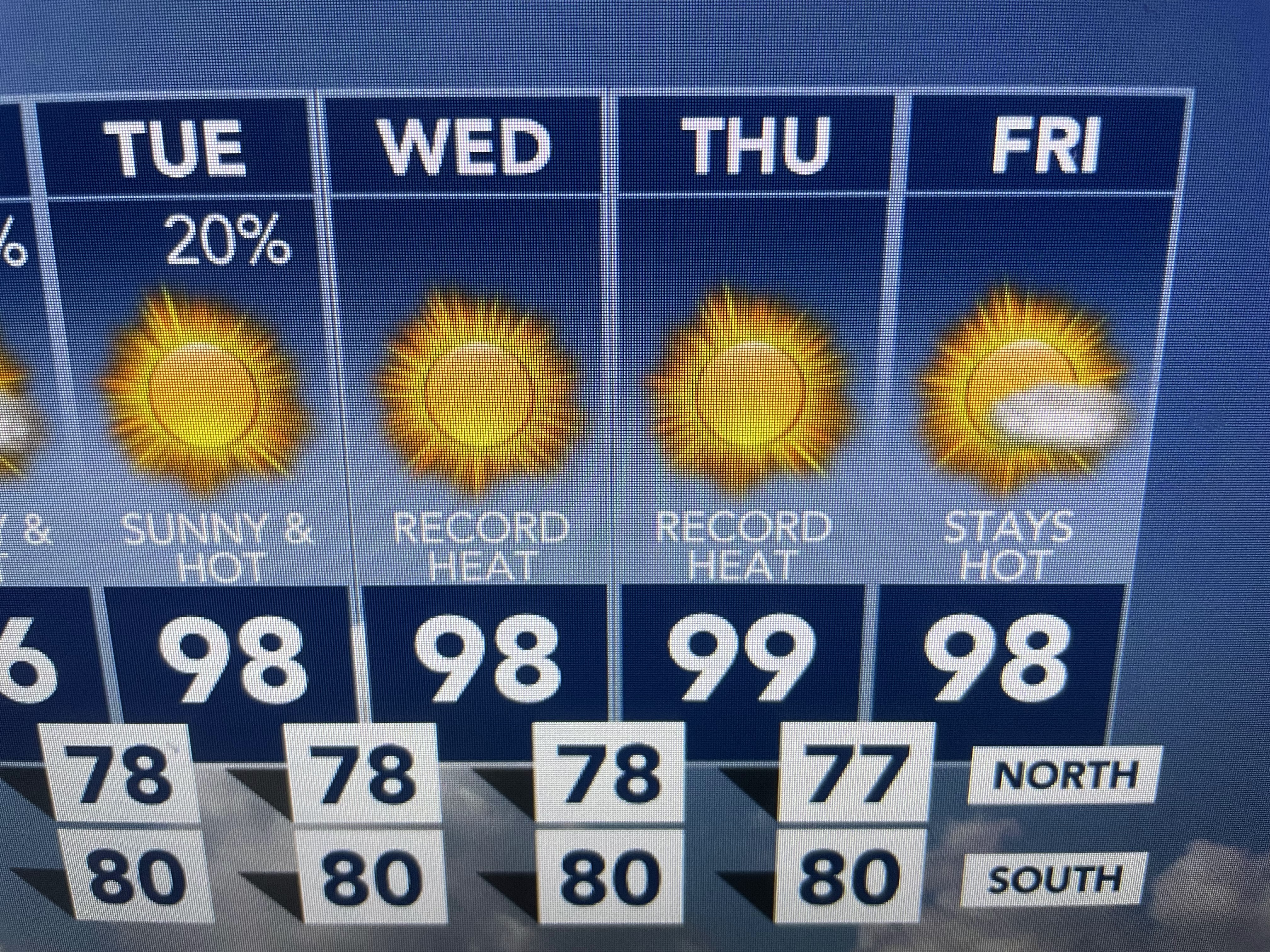
So Gang, get ready for the hottest week of this Summer season with highs approaching or topping 100 late next week. Now to the Tropics.


There remains 2 Tropical Storms, but neither is a threat to land right now. let's begin with Bret.


It follows Bret well east of the islands and the NHC track keeps it that way for the next several days. Cindy also has experienced a burst of storms around her center, but the last advisory indicated no change in intensity. Our problem through this weekend into next week will not be a tropical threat, but the 'extreme heat" coming.


We could talk/complain about the heat for the next 3 months, but we know that's Summer in NOLA. Has it happened before? Absolutely! I'm going to my chardonnay instead of whining! Finally,


Coming off of African is the typical June dust layer. Last year it was earlier & more widespread. If it continues to expand during the next few weeks, it'll shut down any storms our over the MDR (main Development Region) in the tropical Atlantic. Also, I saw where Dr. Knabb on The Weather Channel pointed out the summer of 1968 (before global warming!) had three named storms in June. But the rest of the season only saw 6 more for a total of 9. I kind of think that might happen this year as El Nino gets stronger. Enjoy your weekend & stay tuned!

No comments:
Post a Comment