
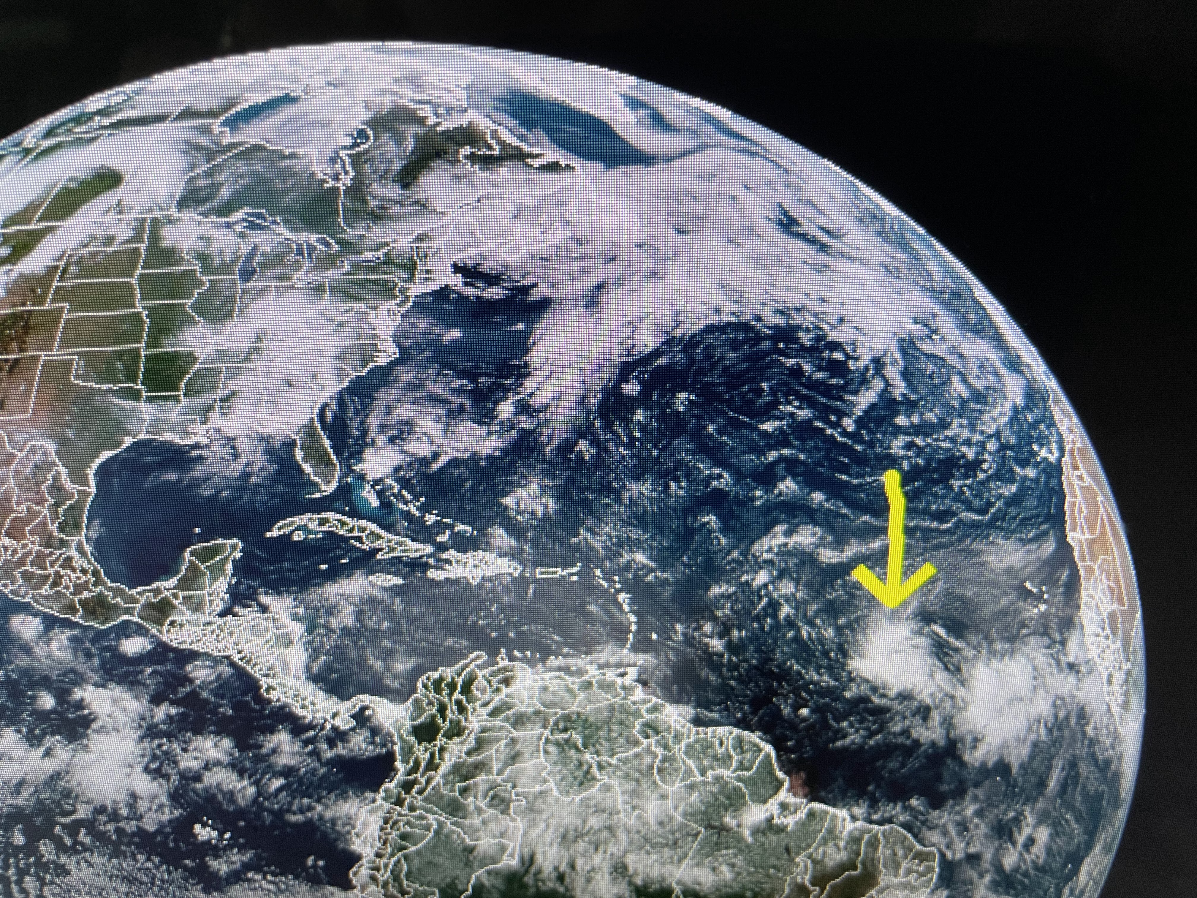


Three reasons I see that happening is 1) TD 3 is over the warmest waters, 2) there is no major dust coming off the Sahara desert yet and 3) there is little winds shear right now.


There actually are two disturbances out in the eastern Atlantic, but I'm just dealing with the western most one. NHC is buying into the computer guidance where most models bring this system to hurricane strength before it reaches the Islands. I have no problem with that. What I wonder is why NHC keeps the track going more towards the west and not curving it back to the north? My experience tells me weaker storms will stay farther to the south, but if a storm gets stronger, it typically begins to recurve more to the north. IF soon to be Bret doesn't recurve and keeps going west through the Caribbean and into the SE Gulf (very unlikely), that won't happen until next Tuesday at the soonest so we have many days to follow Bret,
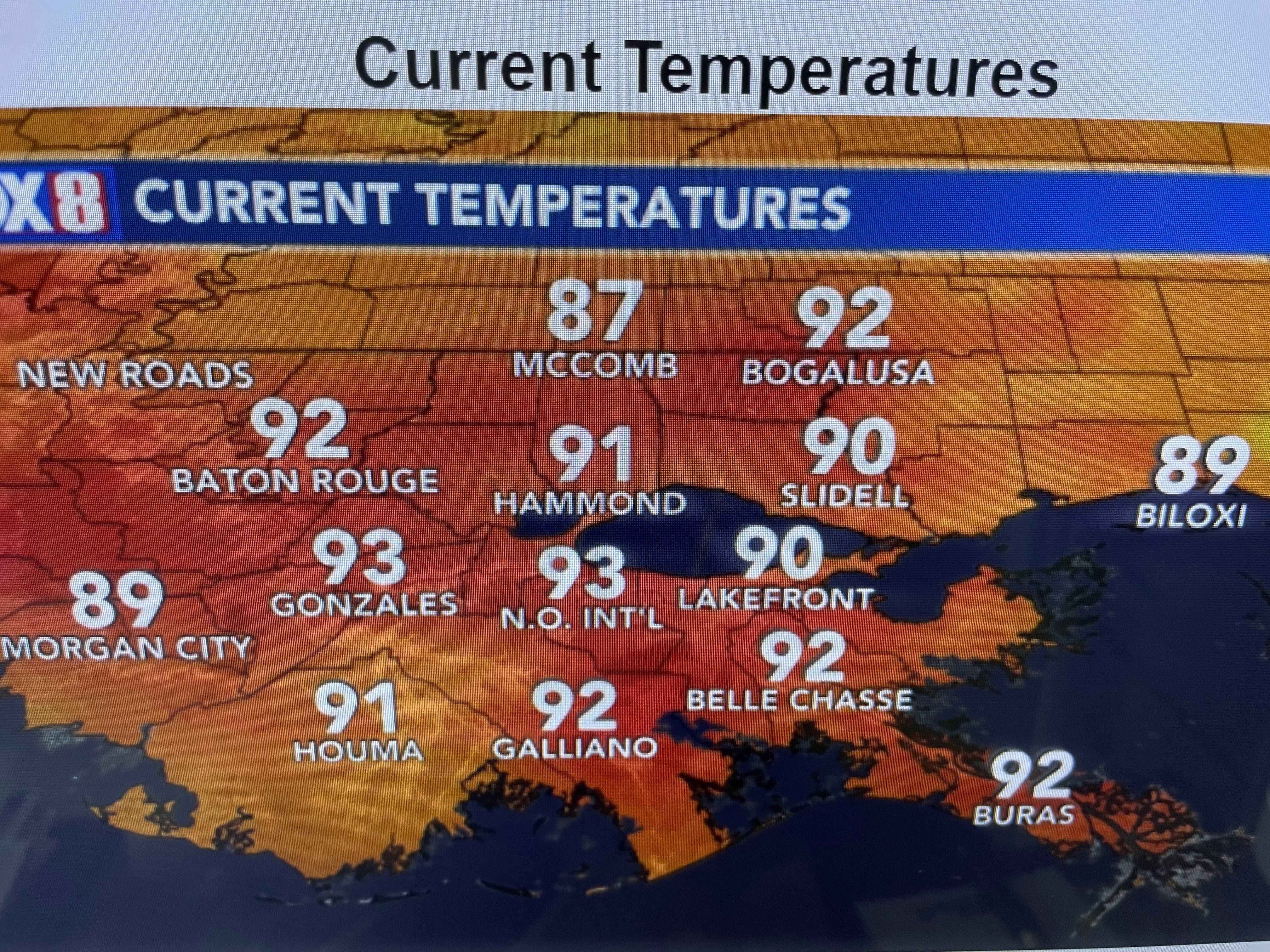


Locally, at 11 AM we're already dealing with extreme heat, but that is firing off some storms that could turn severe later this afternoon. Pay attention & have your FOX 8 Weather App. ready to alert you in case any warnings are issued. Next update after 4 PM Stay tuned!

No comments:
Post a Comment