


This is not a strong cold front, but any relief is accepted after the long heat spell we've endured for the past 10 weeks. The upper heat dome has shrunk and is reforming out to the west.


Monday should see our highest rain chances in weeks. Our stretch of 100+ degree days should be over for this summer. So now let's focus on the Tropics.


NHC upgraded TD # 10 to Tropical Storm Idalia and expect her to become a strong hurricane as it churns northward over the warm waters of the eastern Gulf. There is an upper low over us that is creating westerly wind shear over the northern Gulf and that should keep Idalia away from us. NHC has been very consistent on a track into the Big Bend area across Florida into the Atlantic along the Carolina coasts. As we approach the anniversary of Katrina & Ida, it's nice to know this is not our storm.


For us, the 7 day finally bring us relief.


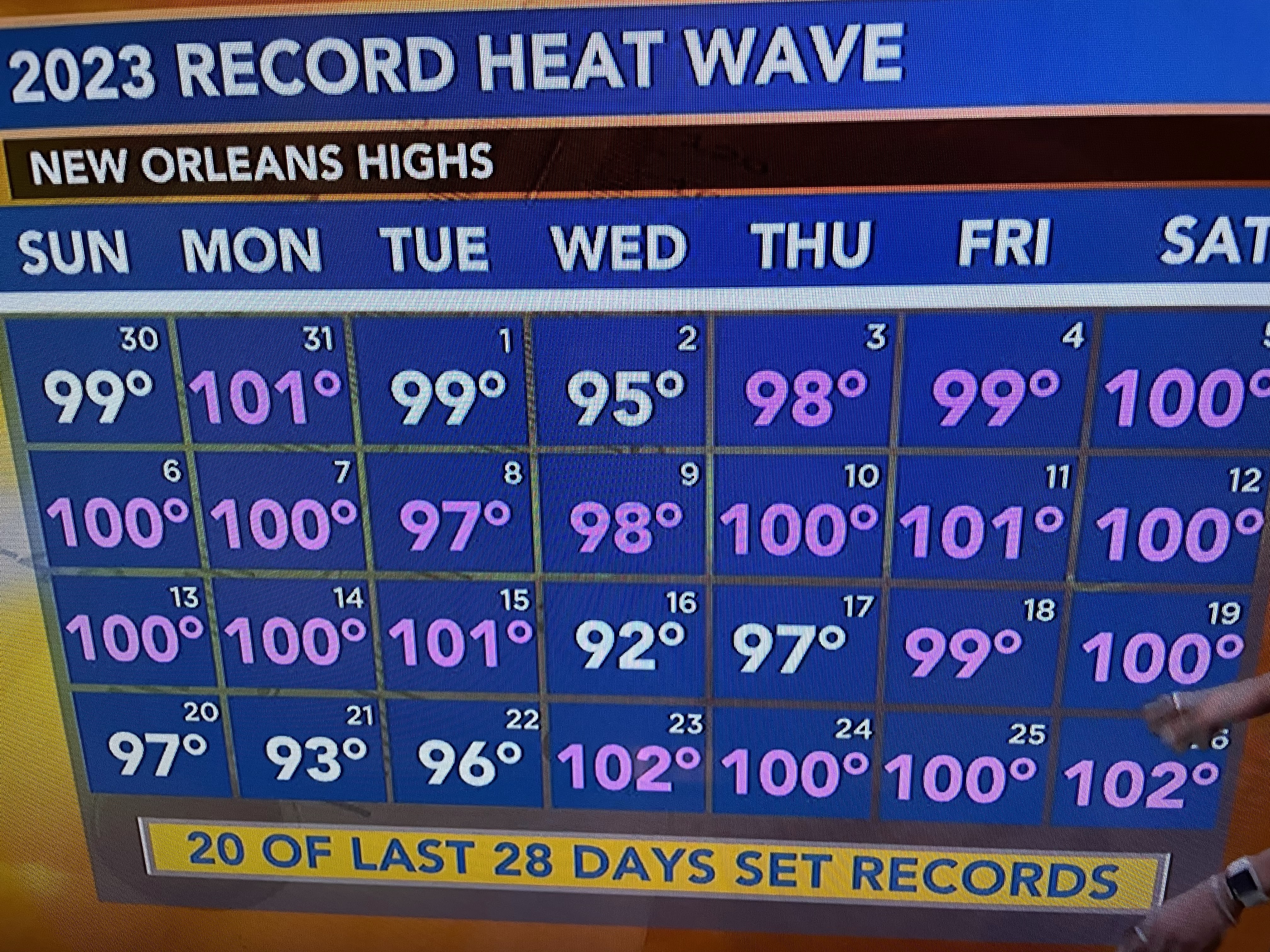
A look back shows 16 days of 100+ in August alone! Let's bring on Fall. Stay tuned!

No comments:
Post a Comment