


Note, the eyewall in a symmetrical hurricane is about 20-30 miles on either side. Impacts extend well beyond that on the right/stronger side, but stay away from the eyewall & your damage should be reduced. We have another such hurricane today with Franklin now a Cat. 4 west of Bermuda.


Note how it looks much like Ida back in 2021. Tropical Storm Idalia is just getting started. You can see the difference in the satellite views & wave heights.


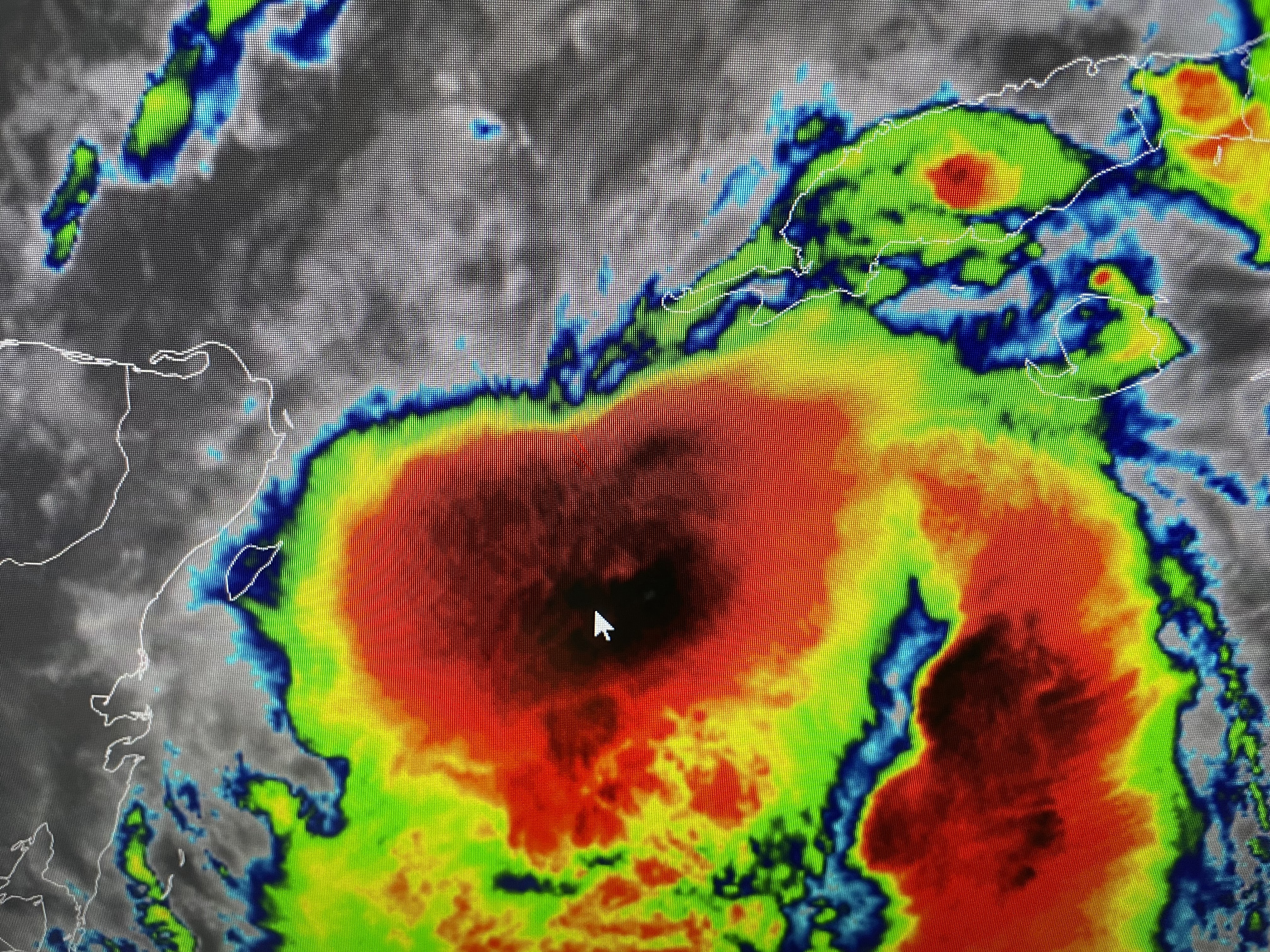

But NHC is predicting Idalia to become at least a Cat. 3 before making landfall. Let's go back to following that centerline track.


It looks the same from the 4 AM advisory, until you zoom in tight. NHC shifted the centerline slightly to the west, but not by much. We can expect this slight shifting to continue and with a major hurricane, a shift of 20-30 miles will make a huge difference in damages. Where it's projected right now has way less people compared to areas farther south towards Clearwater. The stronger Idalia gets, the better computer models are at forecasting the track.

I haven't seen anyone mentioning the upper low over the Gulf southeast of us. To me that's the wild card. My gut tells me the track will start shifting back to the right on future advisories. That would bring the Tampa Bay area under the gun, Remember Charley & Ian turned to the right. IF I live in Tampa, I'd be planning where to go IF that track starts to shift back to the east. Thank God this is not our storm, but let's pray for the folks of central Florida.


Our heat wave appears to be broken. Hopefully we'll see widespread storms form this afternoon. We'll have to wait until Wednesday to see those lower (60s) dew points coming down from the north.


Next update after 4 PM. Stay tuned!

No comments:
Post a Comment