I think we all agree the path of this storm was the best outcome coming ashore where the fewest people & structures were. Listening to the media use words like "monster storm, devastating or incomprehensible" makes one believe they were overhyping the situation. Coming back from golf yesterday, Scoot on WWL radio said that's how he felt. Governor DeSantis told Jim Cantore on The Weather Channel that hurricanes back in the 20s, 30s & 40s were far stronger. What has changed? We now have many more people living in harm's way. This was a bad storm for sure. But it was no where near as destructive as the past Laura, Delta, & Ida were to Louisiana. We're not done with the 2023 season.
NHC is following 3 named storms with more on the way. As Joe Bastardi with Weather Bell Analytics pointed out, most of these systems are above 30 degrees north Latitude out over the Atlantic. Look at how quiet the MDR (Main Development Region) is.
The Caribbean is all quiet, but the Gulf has an interesting feature down off the Yucatan. There is a weak low along the old frontal boundary with a surge of tropical moisture heading our way for this weekend.
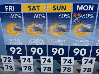
Don't look for it to rain 60% of the time, but these will be tropical downpours that will dump 1-2"+ on some folks. We need it!
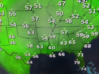
I'm looking for that first real front as we enter September, but based on computer guidance, I don't see it happening until after the 15th. The 70+ dew points will be back for tomorrow his weekend making it feel more uncomfortable.
In the short term, satellite & radar confirm T-Storms are not far away. That should keep us less hot. Keep the umbrellas handy. Hope you remember where you put them! Stay tuned!


No comments:
Post a Comment