


Idalia has increased to a Cat. 2 (winds 100 mph) and is now racing straight northward at 16 mph. Because the turn to the NNE hasn't happened yet, NHC has shifted the centerline track slightly (20-25 miles) farther to the west. As I mentioned in my last post, that should mean lesser impacts to the major population centers along Florida's west coast. The Big Bend communities will receive the main impacts, but they have had plenty of warning to get out.
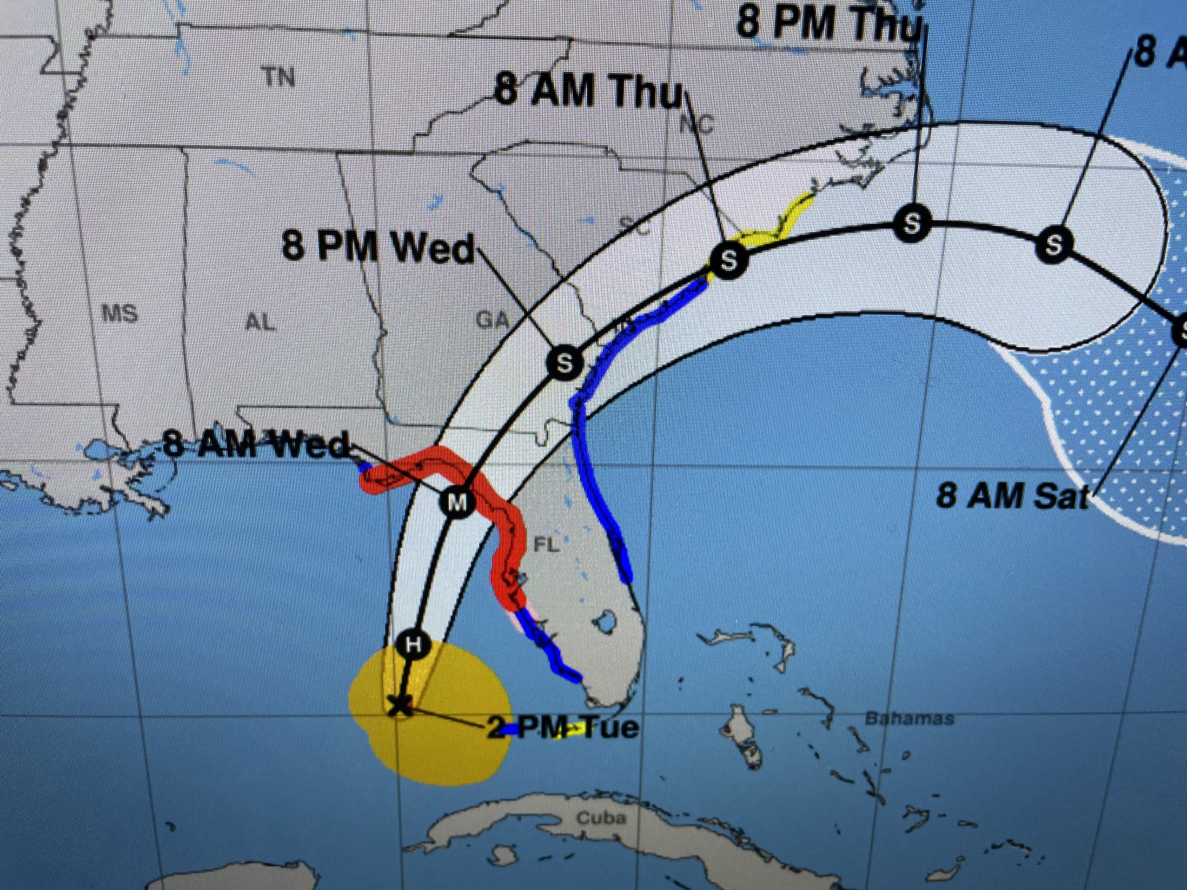


As a result of the westward shift, the heavy rainfall graphic keeps the 6-10"+ totals well off the coast with only 2-4 inches expected over the land areas south of Cedar Key.


A rather deep upper trough over the eastern states will keep Idalia from turning back towards us. Her circulation should help usher in drier air for Wednesday & Thursday. Note the dew point in Houston is 60!


For the second straight day, T-Storms have brought welcome rainfall to many. This has cooled some folks into the 70s.
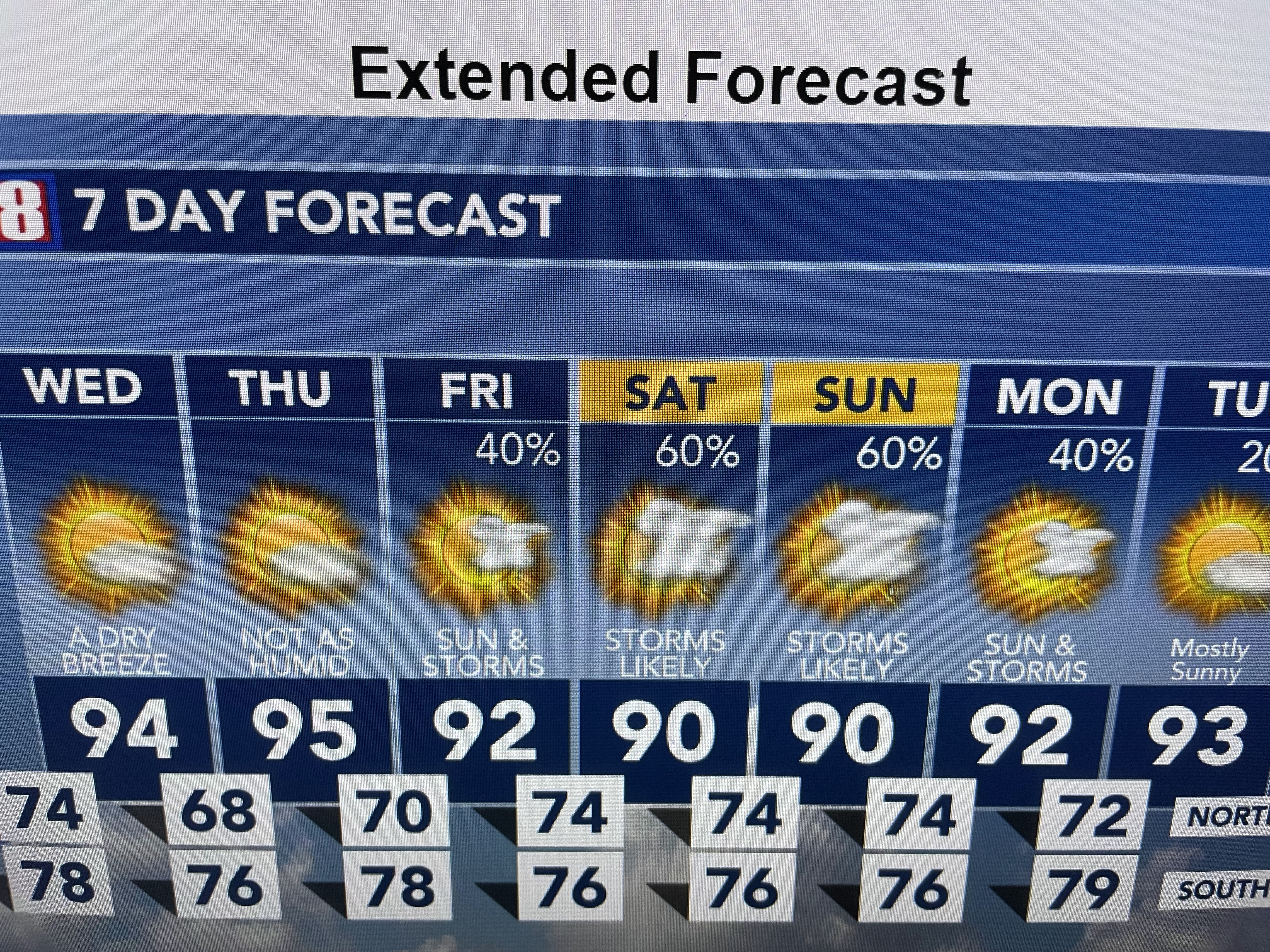


I don't see a real strong cold front coming yet, but it appears we're done with the triple digits.

The rest of the Tropics remains active with Hurricane Franklin still a Cat. 3 and TD # 11 staying way out on the extreme right in the satellite view above. My guess is NHC will briefly make TD 11 our next named storm (Jose). Another wasted name. Stay tuned!

No comments:
Post a Comment