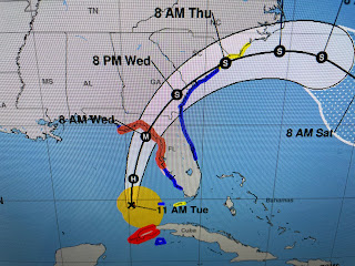
I don't see a well defined eye yet, but that should happen this afternoon. There's lots of squalls on the eastern side so all of Florida's West Coast will get a soaking.
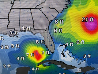
The orange colors represent 6-10"+ rainfall with the yellows 4-6". Note the wave heights with Franklin are much greater compared to Idalia's. NHC has been remarkable on not shifting the track at all.
Bravo NHC for your consistent messaging. Idalia is going over the loop current now, but the surface waters along Florida's west coast are very warm so that's why she should get stronger.
The upper low over the NE Gulf yesterday has been kicked out into Georgia while a deeper trough digs in from the west. That is why the storm can't come to us. Finally,
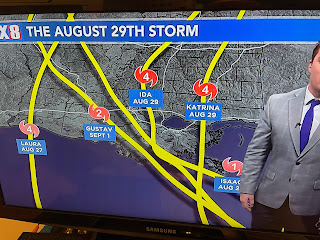
Zack Fradella had an interesting graphic on his morning program. We've seen many storms around August 29th. Fortunately for us, Idalia is not our storm. Next post after 4 PM.


No comments:
Post a Comment