


As we approach the anniversary of Katrina & Ida, let me assure you this is not a Louisiana storm. There is an upper low over the western Gulf that is allowing the tropical moisture down in the Caribbean to flow northward. It appears a weak circulation is trying to form north of Honduras. The reason this system cannot come to Louisiana was explained by Zack Fradella this morning.
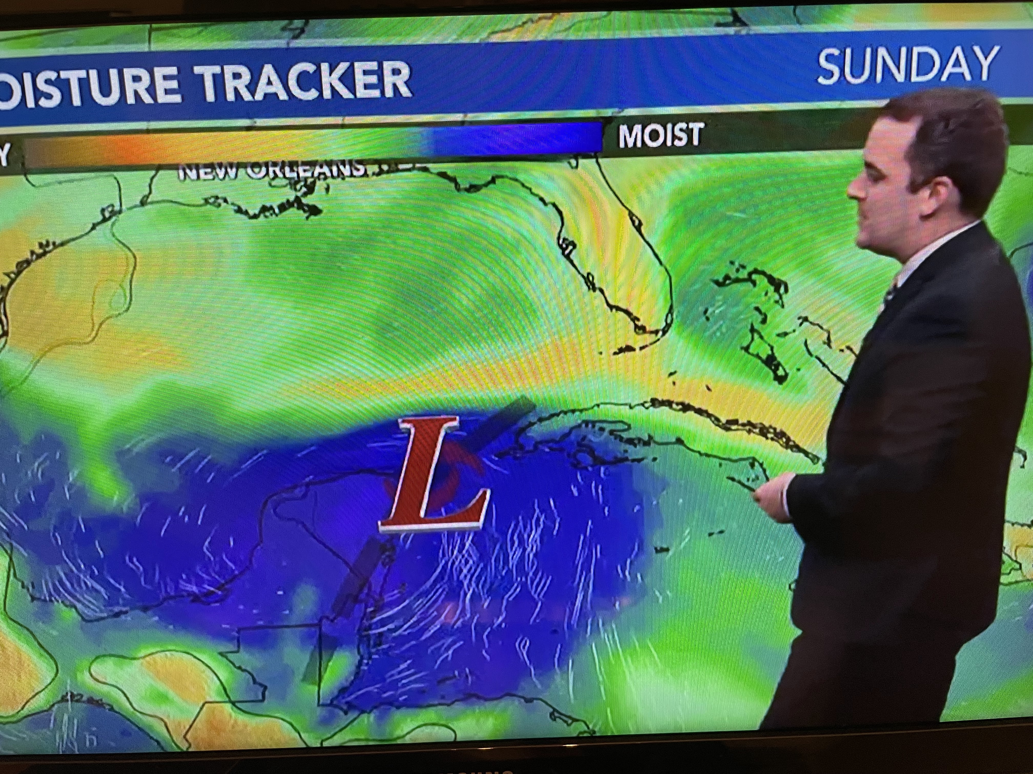
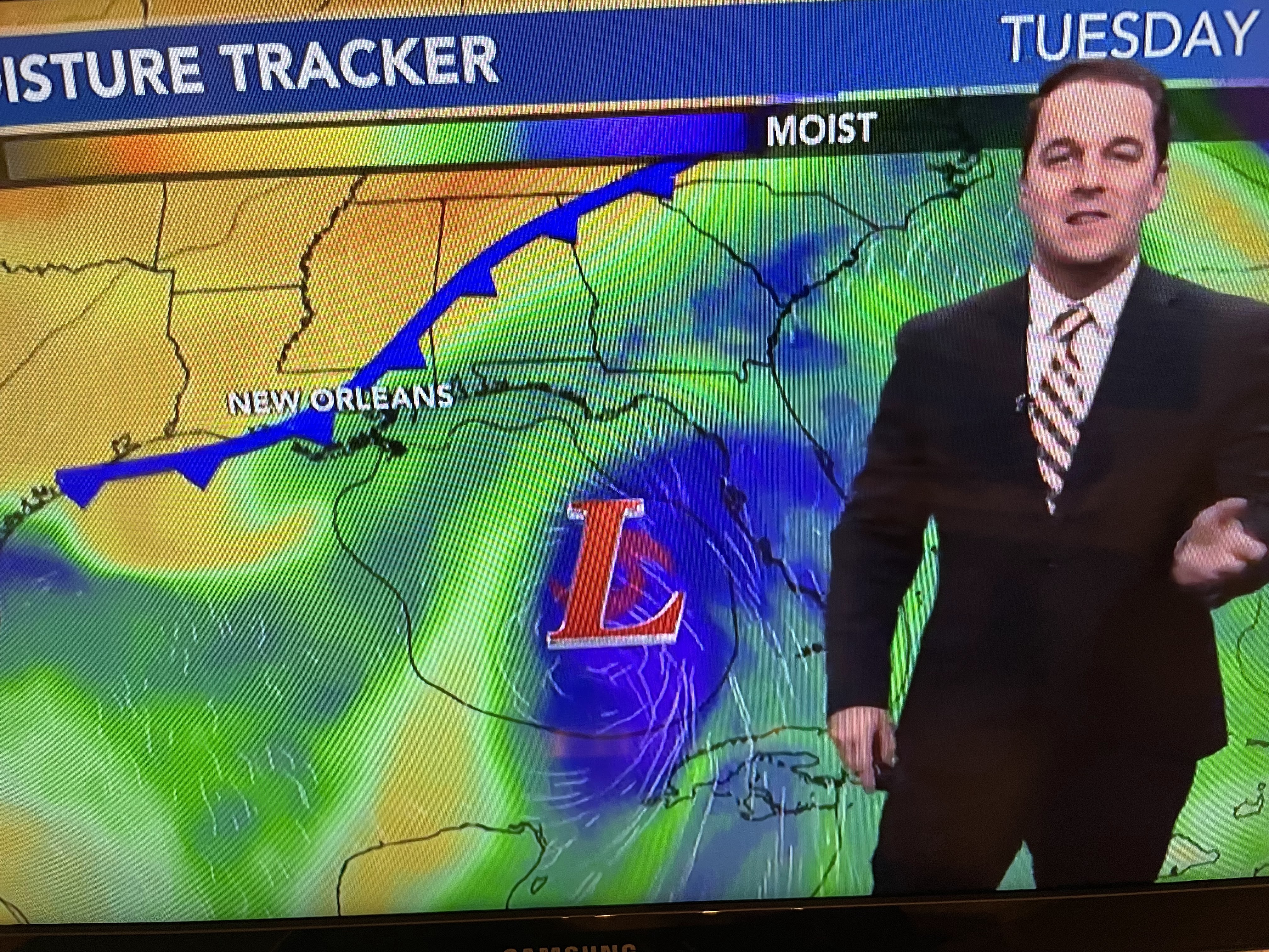


As the blocking upper heat dome finally shifts back to the western states, it allows a deep dip in the upper trough over the Great Lakes and East coast to bring a cold front (no foolin;!) into the deep South. A front is nothing but a weakness in the atmosphere that tropical systems often follow. As the front dips into the Gulf next week, it will steer whatever forms well to our east into Florida, more towards Cedar Key & Clearwater/Tampa Bay. Any trip to the Florida beaches this weekend should be find as most impacts will stay well to the east. However, please pay attention in case the storm tracks farther to the west. I'll update again after 4 PM.

That large wild fire over western Louisiana clearly shows up on satellite views. We need rain !!! Stay tuned!

No comments:
Post a Comment