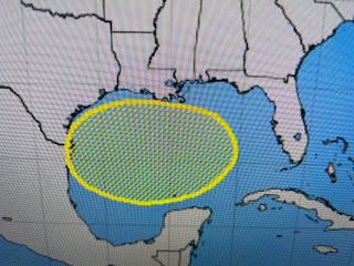
As the satellite view confirms, then is nothing there yet. All the action is over the Pacific where 3 named storms are churning. The latest (Hilary)is expected to take a more northern track and could bring much needed moisture to the desert SW.
With an upper low just west of California, tropical moisture has already spread northward curtailing their heat wave. Unfortunately, with T-Storms comes lightning and that can start wildfires. If it isn't one thing, it's another. But I digress. Back to the Gulf.
The top satellite view has clusters of disorganized storms from the eastern Gulf to off the Carolina coasts. Zack showed us this morning that one computer model does bring a tropical wave of moisture across us early next week. That would be great as 1) we need the rain and 2) it would mean temperatures would be less hot. No model develops this wave. Again, it's mid August and it's pay attention time.
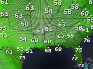
The other two areas NHC is watching are way out in the Atlantic and are likely to curve to the north before threatening land areas. So yesterday's weak cool front did make it through bringing us much lower dew points *drier air). However,, don't get use to it as the muggies will be back by Friday PM and so will the heat for our weekend.
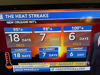
Finally our streak of 100+ heat has ended as today was the "coolest" we've been all month as our high at MSY so far is 92.
Anyway you look at it, this 3-4 week spell of brutal heat has never happened in our lifetime dating back
into the 1890s at Audubon Park. We start a new streak tomorrow. Let's hope it doesn't last as long.
Finally, Hannah Gard had two graphics that were interesting.
The Top graphic you've seen for years indicating the ramp up in storm activity late August through September. The bottom compares last year to this year.. 2022 had early season activity (Alex, Bonnie & Colin) then August went quiet before six storms developed in September. We're seeing a similar pattern this year. However, I'd be very surprised for August to finish with no named storms. Whatever happens, we'll have plenty of time to prepare. Still amazed by the destruction and death total from the Maui firestorm. Stay tuned!


No comments:
Post a Comment