


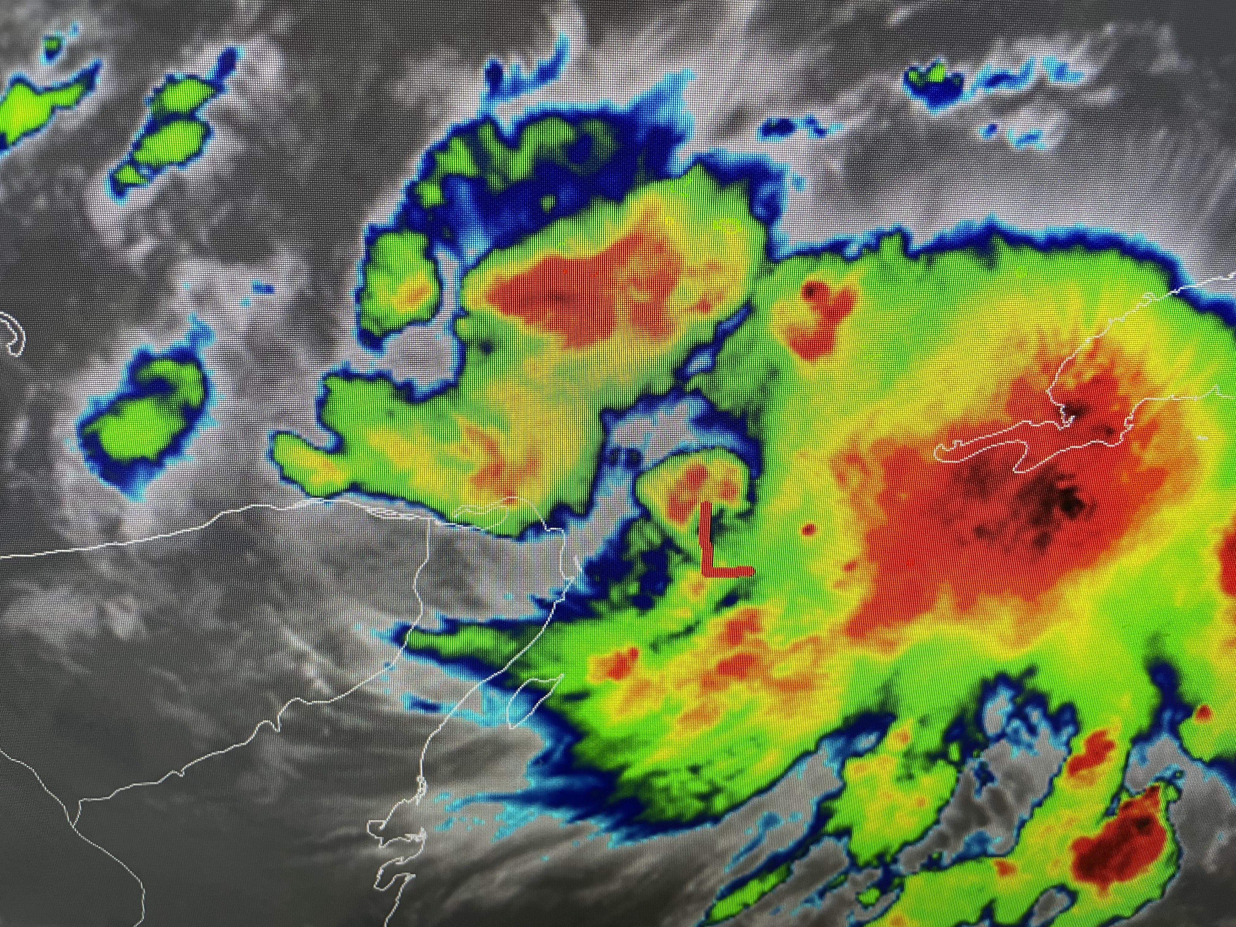
They have labeled this disturbed area Invest 93 L so we have computer models running on where it might go


They have increased to 90% the probability for development and both the GFS & Euro bring the system into the eastern Gulf as a named storm (Idalia). They are in agreement on time but differ on landfall with the Euro following the Spaghetti tracks while the GFS still says Destin - Panama City next Wednesday morning. perhaps the slow expected movement is why NHC hasn't pulled the trigger yet to at least call it a PTC (Potential Tropical Cyclone)?


The top view is the Euro for Tuesday PM while the next two are the GFS for Tuesday PM & then Wednesday AM. Most guidance sides with the Euro.
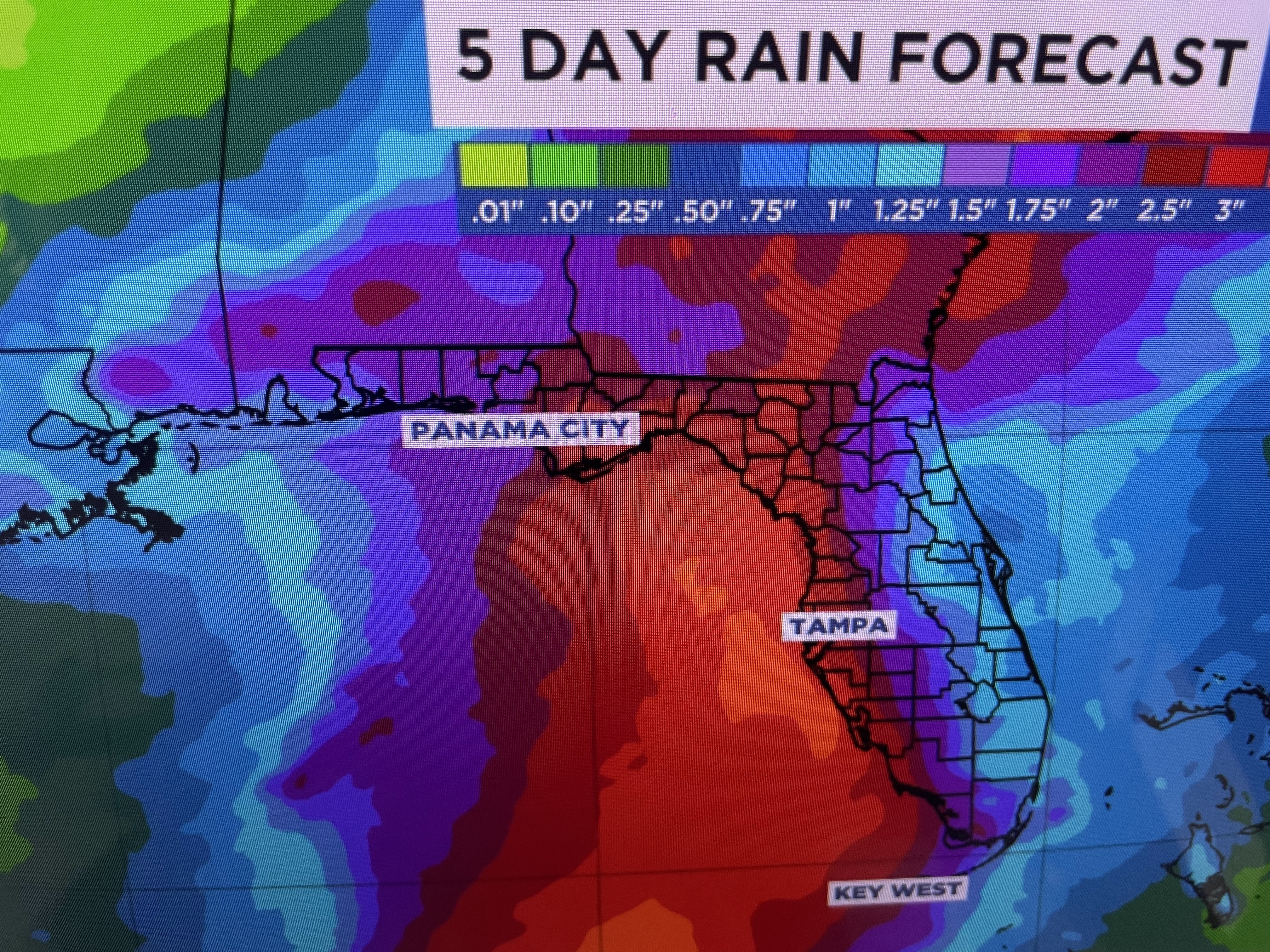


An interesting graphic is the bottom that shows Idalia tracking across Florida and reforming along the Carolina coast next week. I'm sure NHC will come out with an advisory later this afternoon.


The other tropical news is Franklin has strengthened into a hurricane as he churns northward well east of Florida. Bermuda might feel some effects as Franklin motors by later next week.


Otherwise, we're flirting with reaching the all time high of 102 this afternoon. What the heck, let's go for 103! In this summer from hell, why not have the all time hottest next update after 4 PM. Stay tuned!

No comments:
Post a Comment