


probably not, unless we continue to see several model runs paint the same picture. Right now, there is nothing there yet. In fact, an upper low is moving westward across the Yucatan creating strong SW wind shear over the western Caribbean. But looks what the Euro hints.


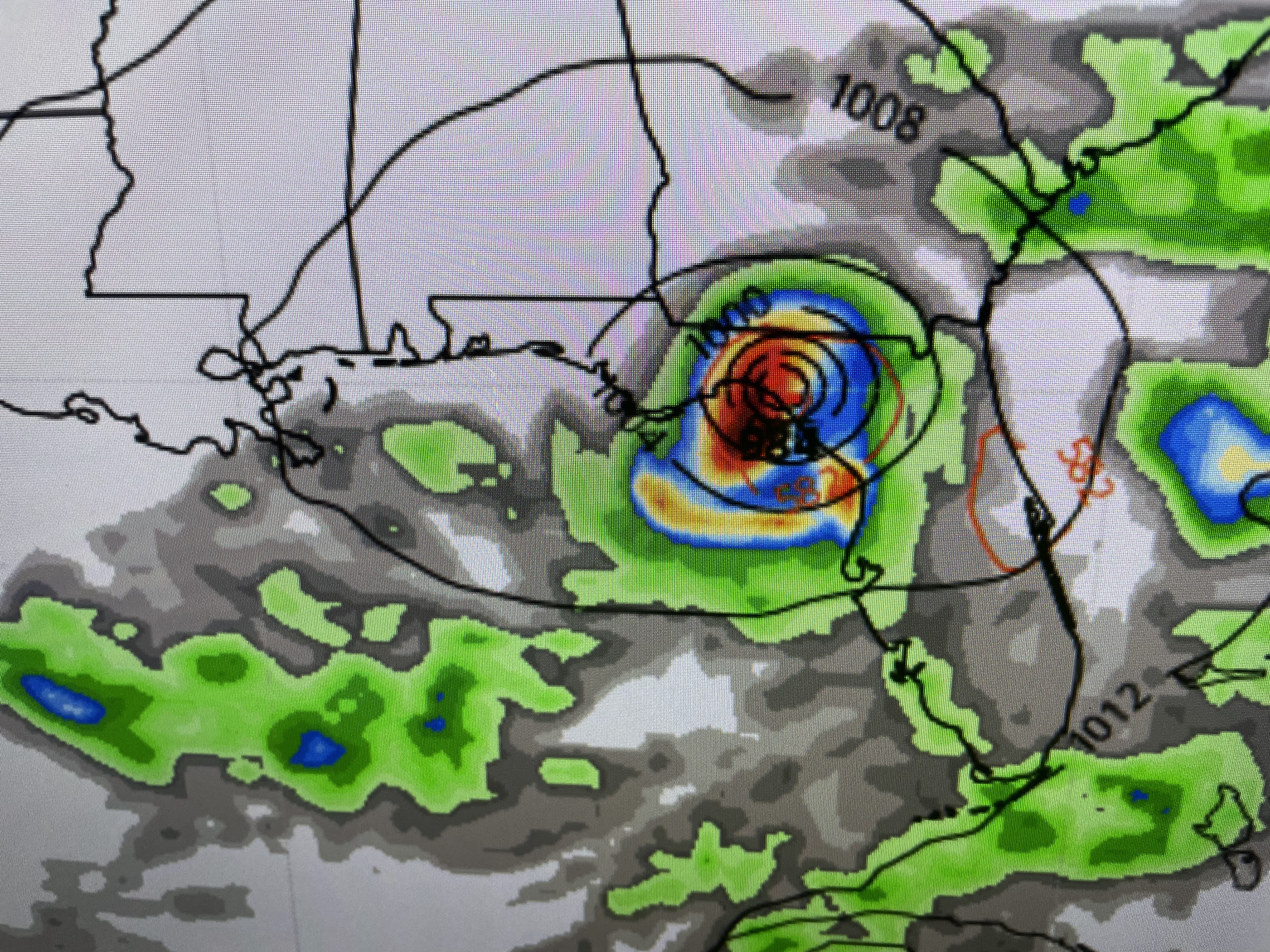
The top view is for late Sunday with Hurricane Franklin churning up well off the East Coast. By Tuesday, a storms is west of Tampa by late Wednesday it looks like a hurricane moves into the Big Bend of Florida. Could happen? Yes. Will happen? Let's watch the model runs for the next couple of days. Regardless, it stays well to our east keeping us on the weak drier side.


The other old story is the heat. When will it leave? Not until the upper heat dome pulls away. Zack gave us some hope this morning.


Hopefully, as the high drifts farther to the west, we'll start to see some spotty PM storms as soon as Sunday.


Both coasts are enjoying nice summer temperatures. but under the heat dome, yikes! Add in the dew points 75-80 and there's a lot of misery around today. It's too hot even for me, but I'm better with too hot than freezing cold. How about a happy medium? (called October!) Stay tuned!

No comments:
Post a Comment