


This morning Hannah Gard showed us that pattern flip that will bring the first real cold front here on Friday. There will be an even stronger front coming for the following week. You can see the colder air with the trough out west.
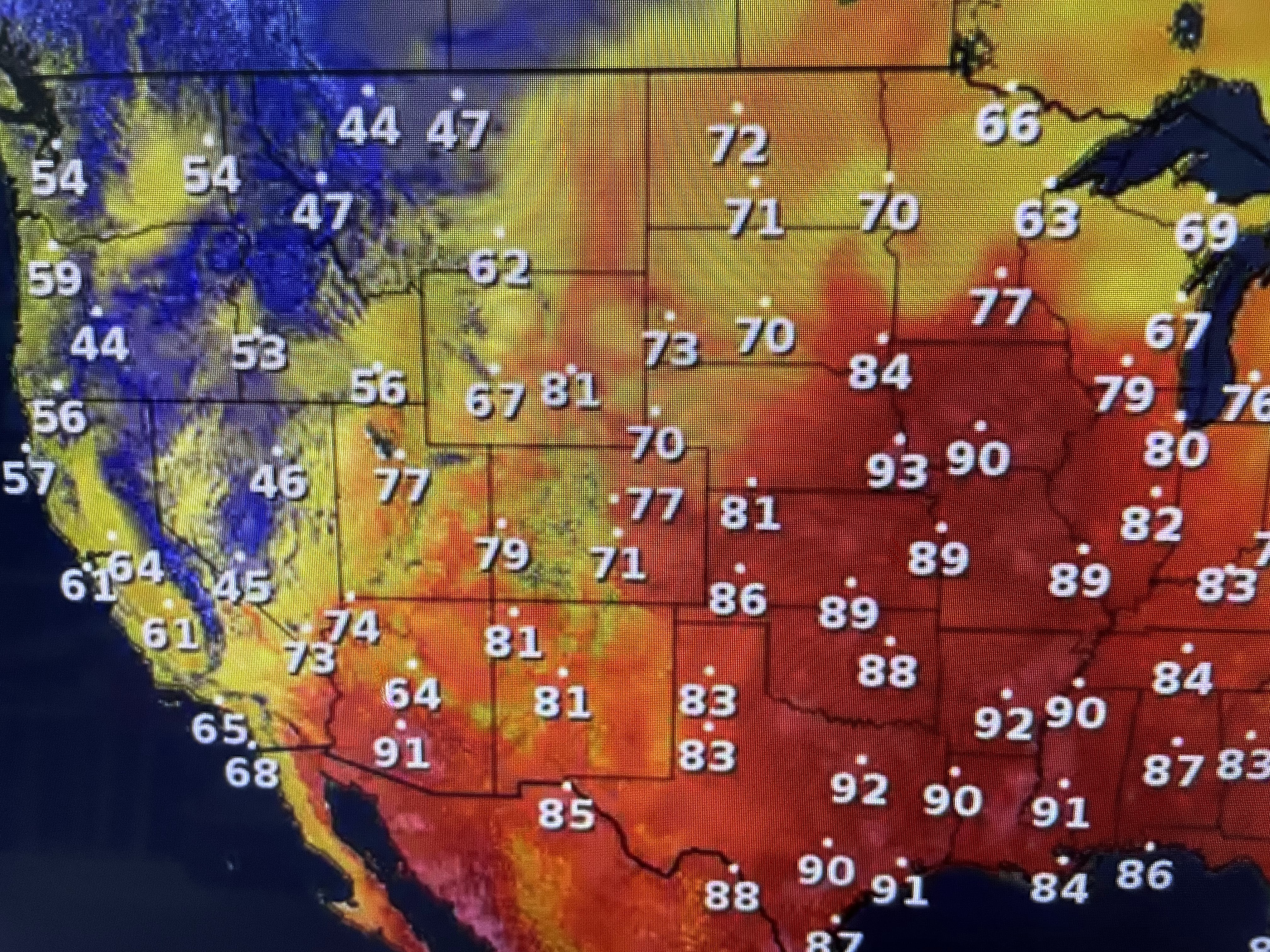

But for the next 5 days, temps will flirt with 90+. It's another day without rain over the entire Miss. River & Ohio River valleys.


Note the lower dew points/drier air that has spread down from the north. Our only rain chances this week will come with the front on Friday.


Today's only negative is the brisk ENE winds that are really kicking up the Gulf. Not that we forget about watching the Tropics as we get into October, it's just way harder for any system coming off of Africa to come across and get into the Gulf.

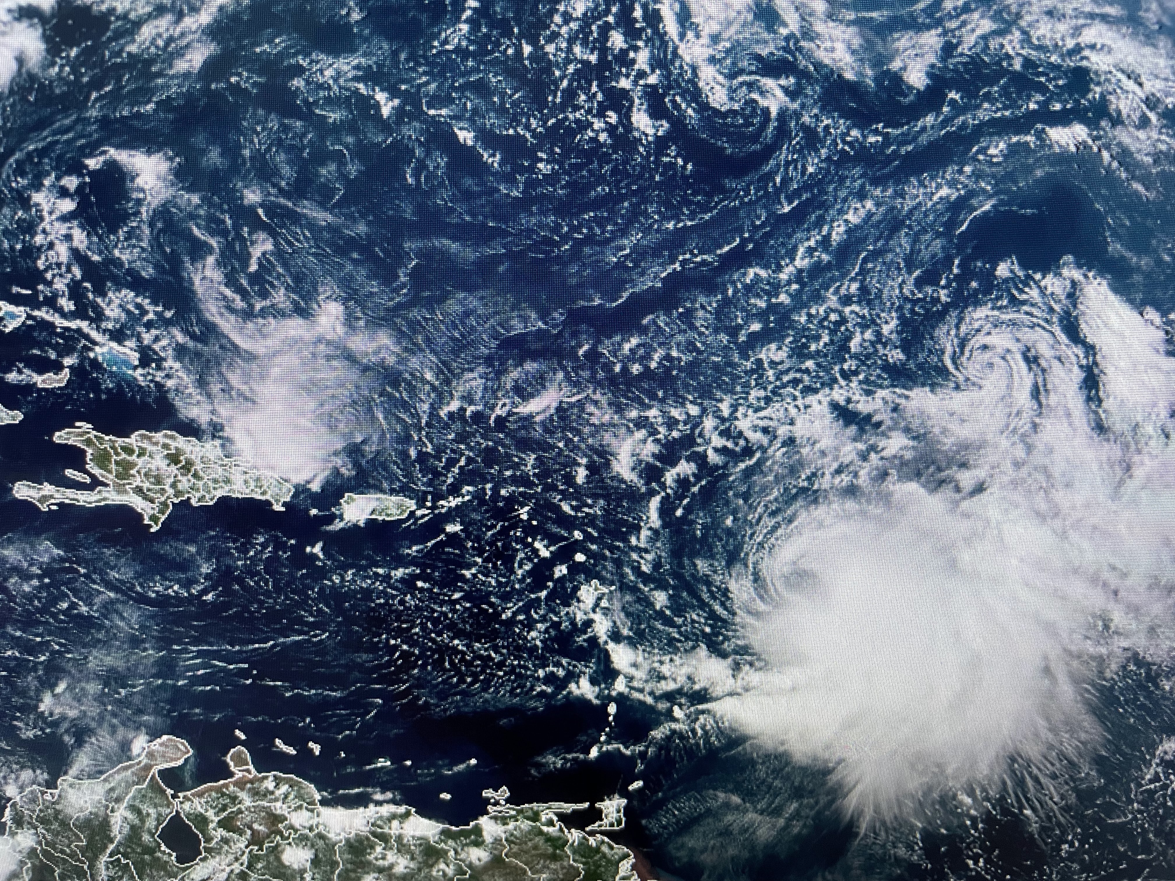


Wind shear has exposed Rina and she will be absorbed by Philippe. He may get stronger again, but he's heading northward out to sea.


The Caribbean & Gulf have no issues as strong westerly upper winds will not allow any development. No model forms anything for the next 10-14 days. NHC still indicates a storm will form next week in the Pacific. However, today's model run keeps whatever forms out to sea and doesn't bring any moisture into the U.S. as the model showed yesterday. The old saying "When in drought, leave it (rain) out" still holds. Stay tuned!

No comments:
Post a Comment