


With few clouds and dry air around, it's been another day without rain.


Fortunately, some storms are drenching parts of the Plains as we need more rainfall up north to flow down river to us. Those storms are not caused by a cold front, but weak upper disturbances.


Computer models take some of the upper energy over Oklahoma and dive it down into Florida by Friday. That should trigger some development along the old frontal boundary that could turn into our next named storm (Ophelia) over this weekend.

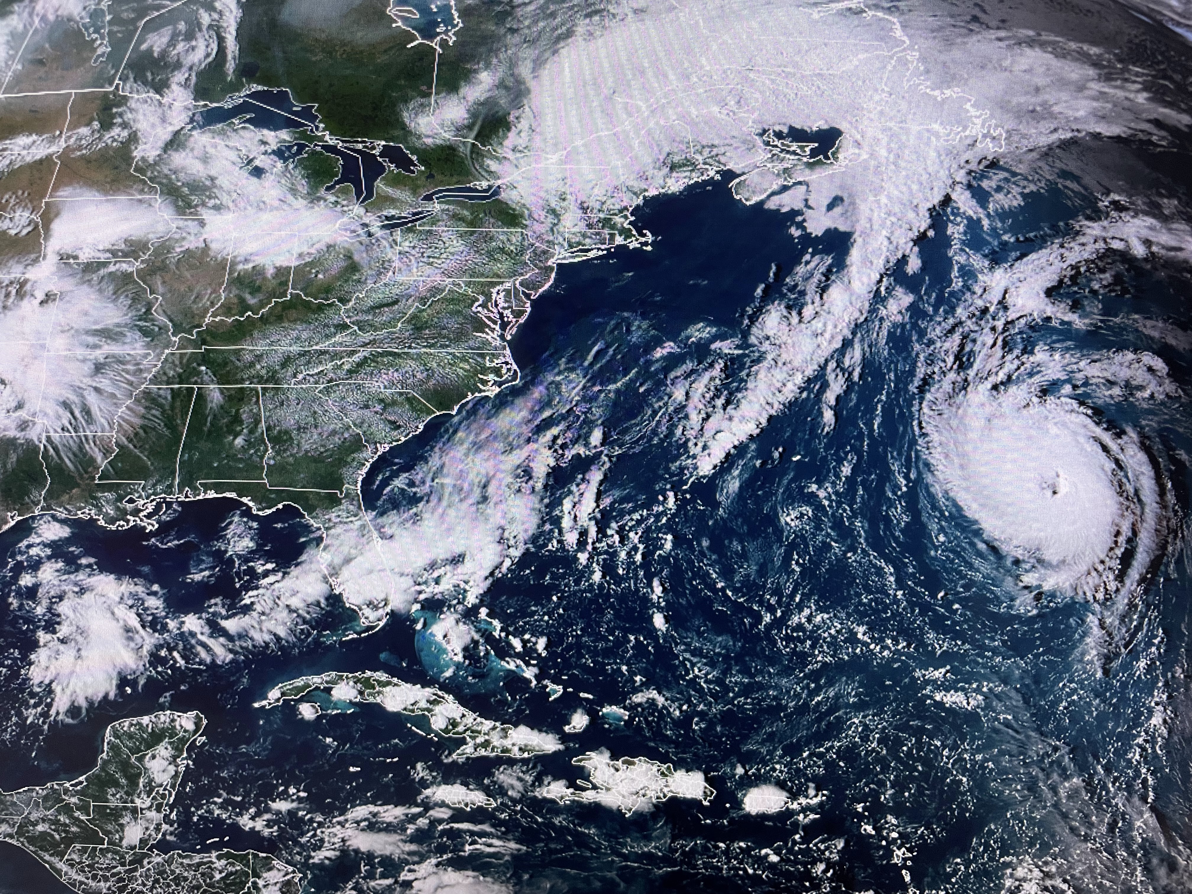


Farther out to the east, Hurricane Nigel has strengthen to a Cat. 2 (100 mph) and could briefly reach Cat. 3 over night. It is so far from land that the only impacts are to the shipping lanes.


Besides Nigel, there are no other tropical systems right now. However, NHC indicates an area coming off of Africa will likely develop later this week. It could take a more southerly track that could impact the Islands for next week. For us, it the lingering heat that will continue into the first week of astronomical Fall.


With the Gulf waters still being in the mid to upper 80s, plus no signs of real cold air coming through the next 10-14 days, I have not placed a call into the "Fat Lady" to sing just yet. I don't think I'll feel really comfortable until we reach mid October. Stay tuned!

No comments:
Post a Comment