


As you can see, they have plenty of water down the "water aisle", but they have pallets of water on other aisles. There is no water shortage. But this is what I want you to know. Unless you live south of Belle Chasse, the amount of salt water reaching your tap will be very small. In fact, I just saw a story on how the Army Corps has started elevating the sill that will stop/limit the wedge from getting too much farther to the north. But my concern is people keeping water in PLASTIC bottles for days & weeks. The chemical reaction of the water & plastic from being kept in heat is far greater than a minor amount of salt content. Stop the hoarding. You only endanger your health. What we need is rain up north.


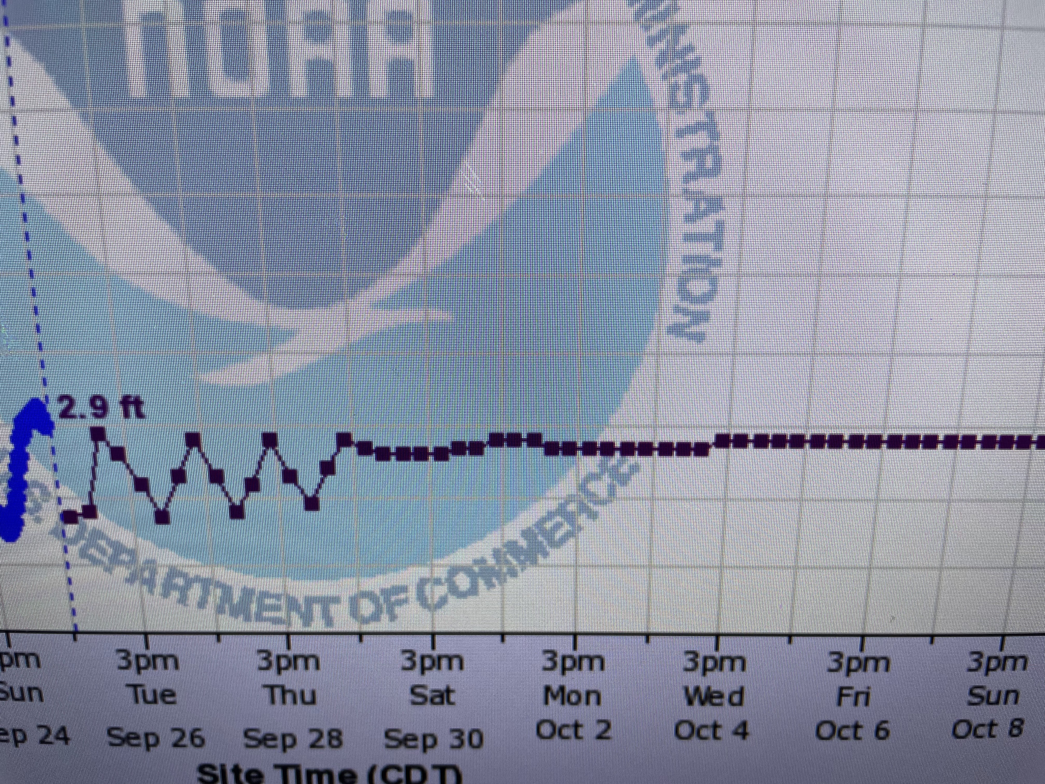
A little is falling way up north, but it's not enough to raise river levels. The latest forecast keeps the Carrollton gauge flatlining well into October. We are seeing some storms locally.


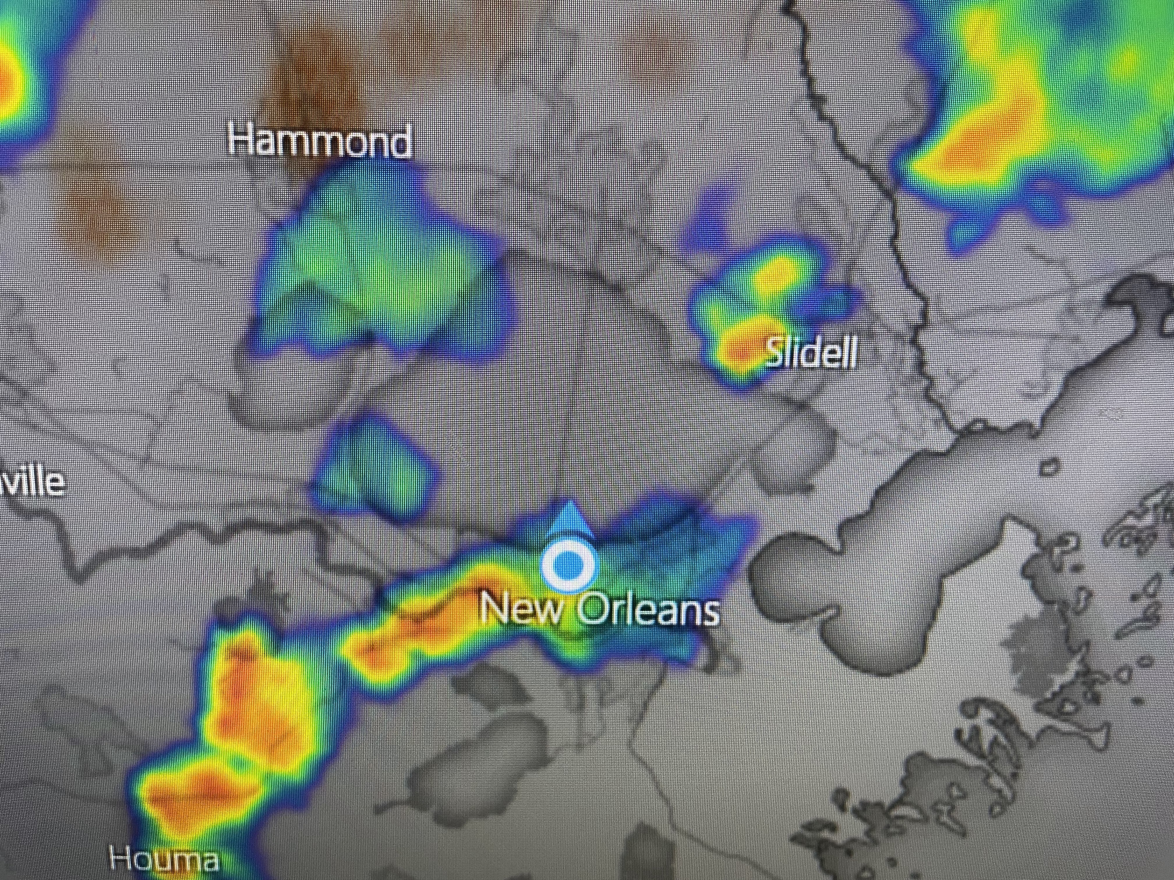

A boundary with a weak low is over south LA/MS triggering numerous showers that have lowered temps a bit.


These boundaries are leftover cold fronts that have stalled near us. You can see there is no real cold air or drier air coming our way. If those boundaries linger, the next day or two could see more storms develop. Just don't see that first real cold front coming until the second week in October at the soonest.


Fortunately, the Tropics are staying fairly quiet around us. There are several systems to watch, but none will threaten us.


All the stuff out in the Atlantic will track/recurve east of Florida. Tropical Storm Philippe is encountering strong wind shear that has exposed his center. (yellow arrow)


The strong wave over the western Caribbean is interacting with an upper low over the Yucatan.


NHC has lowered chances for development to near zero since another trough is dropping down over the Great Lakes and will cause increasing wind shear over the northern Gulf. No model has anything developing in the Gulf during the next 10-14 days.


Another sign that the change in seasons means a change in weather patterns. A huge upper low is off the West Coast bringing an "atmospheric river" to the the Pacific Northwest. It's only a matter of time before we start seeing an end to our summer-like heat. Stay tuned!

No comments:
Post a Comment